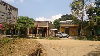
Lira is a city in the Northern Region of Uganda. It is the main municipal, administrative, and commercial centre of Lira District.

Soroti is a town in Eastern Region of Uganda. It is the main municipal, commercial, and administrative centre of Soroti District, one of the nine administrative districts in the Teso sub-region.

Mbale is a city in the Eastern Region of Uganda. It is the main municipal, administrative, and commercial center of Mbale District and the surrounding sub-region.

Iganga is a town in the Eastern Region of Uganda. It is the main municipal, administrative, and commercial center of Iganga District.

Katakwi is a town in the Eastern Region of Uganda. It is the main municipal, administrative, and commercial center of Katakwi District and the site of the district headquarters. It borders Moroto District.

Bugembe is a town in Jinja District in the Eastern Region of Uganda. It is the seat of the Kingdom of Busoga, one of the four constitutional in Uganda, which is coterminous with the Busoga sub-region.

Kumi Town, commonly called Kumi, is a town in the Eastern Region of Uganda. It is the main municipal, administrative, and commercial center in Kumi District and is the site of the district headquarters.

Manafwa is a town in the Eastern Region of Uganda. It is the largest town in Manafwa District and the site of the district headquarters.

Namutumba is a town in the Namutumba District of the Eastern Region of Uganda. It is the main municipal, administrative, and commercial centre of the district.

Busembatya, sometimes spelled Busembatia, is a town in the Eastern Region of Uganda.

Budadiri is a town in the Eastern Region of Uganda. It is one of the urban centers in Sironko District.

Nagongera is a town in Tororo District, in the Eastern Region of Uganda.

Rubirizi, sometimes spelled Rubiriizi, is a town in Rubirizi District, Ankole sub-region, Western Uganda. The town is the main municipal, administrative and commercial center of Rubirizi District. The district is named after the town.

Muyembe is a town in the Eastern Region of Uganda.

Tirinyi is a town in the Kibuku District in the Eastern Region of Uganda.

Kamonkoli is a town in Budaka District, in the Eastern Region of Uganda.
The Iganga–Tirinyi–Kamonkoli–Mbale Road, also known as the Mbale–Kamonkoli–Tirinyi–Mbale Road, is a road in the Eastern Region of Uganda, connecting the towns of Iganga in Iganga District, Namutumba in Namutumba District, Tirinyi in Kibuku District, Kamonkoli in Budaka District, and Mbale in Mbale District.
The Jinja–Iganga–Bugiri–Tororo Road is a road in the Eastern Region of Uganda, connecting the towns of Jinja and Tororo. Sometimes referred to as Tororo–Jinja Road, it is a busy transport corridor, connecting traffic from neighboring Kenya, and northeastern Uganda to Jinja, a major commercial and industrial center, and ultimately to Kampala, the country's capital and points beyond.

Butebo is a town in the Eastern Region of Uganda. It is the chief municipal, administrative and commercial center of Butebo District.

Kigorobya, is a town in the Western Region of Uganda. It is an urban center in the Hoima District Administration. Kigorobya also refers to a sub-county in Uganda, where the town is located.


