
Bajhang District, a part of Sudurpashchim Province, is one of the seventy-seven districts of Nepal. The district, with Chainpur, that is part of Jaya Prithvi Municipality, as its district headquarters, covers an area of 3,422 km2 (1,321 sq mi) and has a population (2011) of 195,159. The headquarter Chainpur is situated at the bank of Seti River and Bauli Khola. Bitthad Bazar is bordered with Baitadi District which is the place of Bitthad Kalika and Kedar. This place was famous for fresh milk and yogurt.

Banke District (Nepali: बाँके जिल्ला[bãke], a part of Lumbini Province, is one of the 77 districts of Nepal. The district, located in midwestern Nepal with Nepalganj as its district headquarters, covers an area of 2,337 km2 and had a population of 385,840 in 2001 and 491,313 in 2011. There are three main cities in the Banke District: Nepalganj, Kohalpur and Khajura Bajaar.
Bara District is one of the seventy–seven districts of Nepal, located in the western part of the Madhesh Province. The district is third richest district in Nepal after Kathmandu and Morang with 3.3% share of total GDP of Nepal and highest per capita income in Madhesh province. Kalaiya serves as the district's headquarter. Bakaiya, Jamuniya, Pasaha, Dudhaura and Bangari are the main rivers of Bara. The main languages spoken in the district are Bhojpuri, Bajjika, Tharu and Nepali.
Dadeldhura, a part of Sudurpashchim Province, is one of the seventy-seven districts of Nepal. The district, with Dadeldhura as its district headquarters, covers an area of 1,538 km2 (594 sq mi) and had a population of 126,162 in 2001 and 142,094 in 2011.
Gorkha District, a part of Gandaki Province, is one of the 77 districts of Nepal, which is the fourth largest district of Nepal and connected historically with the creation of the modern Nepal and the name of the legendary Gorkha soldiers. The district, with Gorkha Municipality as its district headquarters, covers an area of 3,610 km2 (1,390 sq mi) and has a population of 252,201 according to the 2021 Nepal census. Gorkha district is the site of the Manakamana Temple. The temples of Gorakh Nath and Gorakh Kali are found in the district. Several major rivers—the Chepe, Daraudi, Marsyangdi, Budi Gandaki, and Trishuli—run through the district.

Jhapa is a district of Jhapa District in eastern Nepal named after a Rajbanshi |Surjapuri language word "Jhapa" meaning "to cover" (verb). The latest official data, the 2021 Nepal Census, puts the total population of the district at 994,090. The total area of the district is 1,606 square kilometres.
Kailali District, a part of Sudurpashchim Province in Terai plain, is one of the 77 districts of Nepal. The district, with Dhangadhi as its district headquarters, covers an area of 3,235 square kilometres (1,249 sq mi) and has a population 911,155 and, .
Mahottari District, a part of Madhesh Province, is one of the seventy-seven districts of Nepal. The district, with Jaleshwar as its district headquarters, covers an area of 1,002 km2 (387 sq mi) and had a population of 553,481 in 2001, 627,580 in 2011 and 705,838 in 2021 census. Its headquarters is located in Jaleshwar, a neighbouring town of the historical city of Janakpur. The name Jaleshwar means the 'God in Water'. One can find a famous temple of Lord Shiva in Water there. Jaleshwar lies at a few kilometres distance from the Nepal-India border and has a majority Maithili population.

Myagdi District, a part of Gandaki Province, is one of the seventy-seven districts of Nepal. The district, with Beni as its district headquarters, covers an area of 2,297 km2 (887 sq mi), had a population of 114,447 in 2001 and 113,641 in 2011.

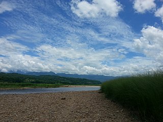
Tanahun District, a part of Gandaki Province, is one of the seventy-seven districts of Nepal. The district, with Damauli as its district headquarters, covers an area of 1,546 km2 (597 sq mi) and has a population (2011) of 323,288. Previously the town of Bandipur was its district headquarter. This district lies in the middlemost of country Nepal. The postal code of Tanahun is 33900.

The administrative divisions of Nepal are subnational administrative units of Nepal. The first level of country subdivision of Nepal are the provinces. Each province is further subdivided into districts, each district into municipalities and rural municipalities, and each of those municipalities into wards. Before 2015, instead of provinces, Nepal was divided into developmental regions and administrative zones.
Bulingtar is a village development committee in Nawalpur District in Gandaki Province, Nepal. Bulingtar is located in the region of Western Region. Western Region's capital Pokhara (Pokhara) is approximately 52 km / 32 mi away from Bulingtar. The distance from Bulingtar to Nepal's capital Kathmandu (Kathmandu) is approximately 113 km / 70 mi. This rural municipality is surrounded by the Gaindakot Gaupalika in the East, Baudhikali Gaunpalika in the west. Similarly, Rishing Gaunpalika lies on the Northern side whereas Devachuli Nagarpalika in the Southern side.
Rish Vand is a village in Itivand-e Jonubi Rural District, Kakavand District, Delfan County, Lorestan Province, Iran. At the 2006 census, its population was 30, in 5 families.
Khomsianeh-ye Rish Sefid is a village in Beyranvand-e Jonubi Rural District, Bayravand District, Khorramabad County, Lorestan Province, Iran. At the 2006 census, its population was 33, in 10 families.
Rud Rish is a village in Ajam Rural District, Dishmok District, Kohgiluyeh County, Kohgiluyeh and Boyer-Ahmad Province, Iran. At the 2006 census, its population was 290, in 52 families.
Aghcheh Rish is a village in Charuymaq-e Sharqi Rural District, Shadian District, Charuymaq County, East Azerbaijan Province, Iran. At the 2006 census, its population was 389, in 59 families.
Aghcheh Rish is a village in Nazarkahrizi Rural District, Nazarkahrizi District, Hashtrud County, East Azerbaijan Province, Iran. At the 2006 census, its population was 39, in 8 families.
Asb Rish is a village in Masal Rural District, in the Central District of Masal County, Gilan Province, Iran. At the 2006 census, its population was 113, in 23 families.
Rishing Rural Municipality (Rishing Gaupalika) (Nepali: ऋषिङ्ग गाउँपालिका) is a Gaunpalika in Tanahaun District in Gandaki Province of Nepal. On 12 March 2017, the government of Nepal implemented a new local administrative structure, in which VDCs have been replaced with municipal and Village Councils. Rishing is one of these 753 local units.


