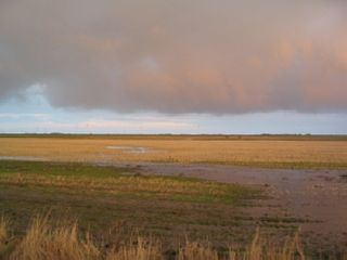
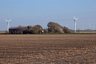
A koog or groden is a type of polder found on the North Sea coast of Germany that is established by the construction of dykes enclosing the land which is then drained to form marshland. This type of land reclamation is also used along rivers. In general, a koog is protected by embankments known as dykes (Deiche).
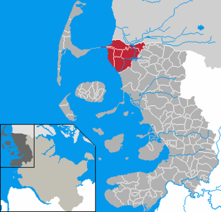
is a peninsula and former island in North Frisia on the North Sea coast of Germany. It is part of the Nordfriesland district in the federal state of Schleswig-Holstein. Its area is 50 km² and its population is 2,300. Nordstrand has two municipalities, Nordstrand and smaller Elisabeth-Sophien-Koog, which are part of the Amt Nordsee-Treene.

Dagebüll is a municipality located at the west coast of Schleswig-Holstein in the Nordfriesland district, Germany. Today's Dagebüll was created in 1978 as a merger of the municipalities of Fahretoft, Juliane-Marien-Koog and Waygaard. Dagebüll used to be a Hallig, the oldest houses were built on artificial dwelling hills which in parts can still be seen today. In 1704 the area was secured by sea dikes.
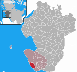
Friedrichskoog is a municipality in the district of Dithmarschen, in Schleswig-Holstein, Germany. It is situated near the outflow of the Elbe into the North Sea, approximately 25 km southwest of Heide, and 25 km northeast of Cuxhaven.

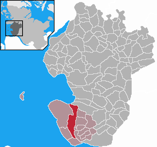
Reußenköge is a sparsely populated municipality in the district of Nordfriesland, in Schleswig-Holstein, Germany. It is situated directly adjacent the shoreline of the North Sea coast, in a driving distance of in between 15 up to 29 km northwest of the county-capital city of Husum.
Wiedingharde was an amt in the district of Nordfriesland, in Schleswig-Holstein, Germany. It was situated on the North Sea coast and on the border with Denmark. Its seat was in Neukirchen (Naisjösbel).

Hedwigenkoog is a municipality belonging to the Amt Büsum-Wesselburen in the district Dithmarschen in Schleswig-Holstein, Germany.

Karolinenkoog is a municipality in the district of Dithmarschen, in Schleswig-Holstein, Germany.
Kronprinzenkoog is a municipality in the district of Dithmarschen, in Schleswig-Holstein, Germany.
Elisabeth-Sophien-Koog is a municipality in the district of Nordfriesland, in Schleswig-Holstein, Germany. It occupies a small part in the northwest of Nordstrand peninsula.

Friedrich-Wilhelm-Lübke-Koog is a municipality in the district of Nordfriesland, in Schleswig-Holstein, Germany.

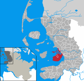
Tümlauer-Koog is a municipality in the district of Nordfriesland, in Schleswig-Holstein, Germany.
Nordstrand was an Amt in the district of Nordfriesland, in Schleswig-Holstein, Germany. Its seat was in Nordstrand. In January 2008, it was merged with the Ämter Friedrichstadt, Hattstedt and Treene to form the Amt Nordsee-Treene.
Marne-Nordsee is an Amt in the district of Dithmarschen, in Schleswig-Holstein, Germany. Its seat is in Marne. It was formed on 1 January 2008 from the former Amt Kirchspielslandgemeinde Marne-Land, the town Marne and the municipality Friedrichskoog.

Südtondern is an Amt in the district of Nordfriesland, in Schleswig-Holstein, Germany.

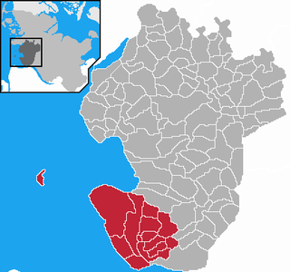
Eiderstedt is an Amt in the district of Nordfriesland, in Schleswig-Holstein, Germany. The Amt covers the peninsula of Eiderstedt, excepted for the town of Tönning.

Nordstrandischmoor is a Hallig off the North Frisian coast in Germany and lies within the Schleswig-Holstein Wadden Sea National Park.

The Arlau is a 37-kilometre-long river in the county of Nordfriesland in Schleswig-Holstein, Germany. It flows into the North Sea near Nordstrand and is part of the Eider catchment.

Hamburger Hallig is an area on the westcoast of Nordfriesland district in Schleswig-Holstein, Germany, that is not protected by sea dikes. It is therefore counted among the Halligen islands.

The Delver Koog is a koog, about 1,200 hectares in area, that is dominated by agricultural grassland and through which one of the large bends of the River Eider meanders. It contains one of the 10 nature reserves in the Eider-Treene Depression in the western part of the German state of Schleswig-Holstein. Since 1976, an area of 190.1 hectares has been protected as a nature reserve. The koog is part of the municipality of Delve in the county of Dithmarschen.