Kakonko District

Last updated
Kakonko District
Kakonko District in Kigoma 2022.svg
Kakonko District of Kigoma Region
Coordinates: 03°16′48″S30°57′58″E / 3.28000°S 30.96611°E / -3.28000; 30.96611
CountryFlag of Tanzania.svg  Tanzania
Region Kigoma
Area
  Total
2,209 km2 (853 sq mi)
Population
 (2022)
  Total
178,419
  Density81/km2 (210/sq mi)

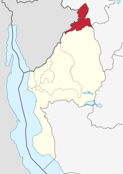
Kakonko District is one of the eight districts of the Kigoma Region of Tanzania. It is one of the 20 new districts that were formed in Tanzania since 2010; it was split off from Kibondo District. [1] Kakonko District is bordered to the north by Kagera Region, to the east by Geita Region, to the south by Kibondo District, and to the west by Burundi. Its administrative seat is the town of Kakonko.

Contents

According to the 2022 Tanzania National Census, the population of Kakonko District was 178,419. [2] [3]


Transport

Unpaved trunk road T9 from Kigoma Region to the Kagera Region border passes through the district. [4]

Administrative subdivisions

As of 2012, Kakonko District was administratively divided into 11 wards. [3]

Wards

References

  1. "New constituencies up for grabs as CUF cries foul". The Citizen. Archived from the original on 20 April 2019. Retrieved 17 February 2016.
  2. "Tanzania: Administrative Division (Regions and Districts) - Population Statistics, Charts and Map". www.citypopulation.de. Retrieved 2024-02-10.
  3. 1 2 "Census 2012". National Bureau of Statistics. Archived from the original on 5 March 2016. Retrieved 16 February 2016.
  4. "Kigoma Roads Network" (PDF). Tanroads. Archived from the original (PDF) on 3 April 2016. Retrieved 22 March 2016.