Kasulu

Last updated
Kasulu Town
Kasulu Mjini
District & City
Nickname: 
Igasulo
Kasulu Town in Kigoma 2022.svg
Kasulu Town District of Kigoma Region
Tanzania location map.svg
Red pog.svg
Kasulu Town
Coordinates: 04°34′48″S30°06′00″E / 4.58000°S 30.10000°E / -4.58000; 30.10000
CountryFlag of Tanzania.svg  Tanzania
Region Kigoma
District Kasulu
Settled, Urban-ward, Township and Town-council1500s, 1972, 2009 and 2011
Government
  Chairman and DirectorTwallib S.Mangu Fatina H.Laay
Area
   District & City911.8 km2 (352.0 sq mi)
Elevation
1,316 m (4,318 ft)
Population
 (2022 census) [1]
   District & City238,321
  Density260/km2 (680/sq mi)
   Urban
238,321
Time zone UTC+3 (EAT)
Climate Aw
Website Town website

Kasulu Town is the largest city in Kigoma Region, and the fourteenth most populous city in Tanzania with a population of 238,321 as of 2022. [1]

Contents

Location

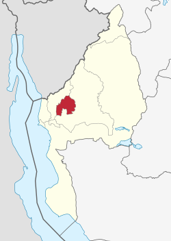
Kasulu is located in northwestern Tanzania, near the international border with the Republic of Burundi. The town lies at the centre of Kasulu District, Kigoma Region. It is located approximately 78 kilometres (48 mi), by road, northeast of Kigoma, the location of the regional headquarters. [2] Kasulu lies approximately 800 kilometres (500 mi), by road, northwest of Dodoma, the capital of Tanzania. [3] The coordinates of the town of Kasulu are:4° 34' 48.00"S, 30° 6' 0.00"E (Latitude:4.5800; Longitude:30.1000).

Population

As of 1988, the population of the town was estimated at 19,324. [4] as per 2012 national census, the population of Kasulu Town counted at 208,244, also in 2015 the population were counted at 224,880, while National Bureau of Statistics (NBS) estimated at 229,218 and 234,783 in 2016 and 2017 respectively. Spoken languages are Kiswahili and Ha.

Economy

The town is the location of the headquarters of Kasulu District Administration. Agriculture is the main income-generating activity in the Council. Over 85% of inhabitants depend on crop and animal husbandry, while the remaining percentage depends on other economic activities such as Small and medium enterprise businesses (SMEs). The main food crops are maize, beans, cassava, sweet potatoes and banana. The main cash crops include coffee, tobacco and sugar cane. The per capita income of each individual in the council is estimated at Tshs. 685, 000/= per annum. Industrial contribution to the GDP of Kasulu Town is very minimal due to very little investment.

Government

In 2011 Kasulu township became a town council. The highest decision body in Kasulu town is the Town Council under the leadership of the council chairman and town council director.

Administrative divisions

Kasulu Town is administratively equal to a district and is divided into 2 divisions, 15 urban-level wards and 108 sub-ward (mitaa). Even though approximately every ward has its own centre, the real central business district (CBD) lies between Kumsenga and Murubona urban wards.

Wards

The 15 Wards and their population in 2016. [5] :123

  • Heru Juu (16,982)
  • Kigondo (18,150)
  • Kimobwa (3,744)
  • Kumnyika (12,429)
  • Kumsenga (14,811)
  • Msambara (24,646)
  • Muganza (16,003)
  • Muhunga (19,160)
  • Murubona (23,522)
  • Murufiti (10,451)
  • Murusi (17,510)
  • Mwilamvya (6,250)
  • Nyansha (14,756)
  • Nyumbigwa (12,811)
  • Ruhita (17,991)

Related Research Articles

<span class="mw-page-title-main">Dodoma Region</span> Region of Tanzania

Dodoma Region is one of Tanzania's 31 administrative regions. The regional capital is the city of Dodoma. The region is located in central Tanzania, it is bordered by Singida Region to the west; Manyara Region to the north; Iringa Region to the south; and Morogoro Region to the east. Dodoma Region hosts the nation's capital city with where the legislative assembly or Bunge is based. Dodoma Region also hosts one of the largest University in Tanzania, University of Dodoma. The region is sole home of the Tanzanian wine industry, which is the second largest wine industry on the continent after South Africa. According to the 2022 national census, the region had a population of 3,085,625. 2012 national census, where by, 2012 had 2,083,588.

<span class="mw-page-title-main">Shinyanga</span> City in Shinyanga Region, Tanzania

Shinyanga, also known as Mji wa Shinyanga in the national language, is a city in northern Tanzania. The city is the location of the regional headquarters of Shinyanga Region as well as the district headquarters of Shinyanga Urban District. The region and district are named after the town.

<span class="mw-page-title-main">Kigoma Region</span> Region of Tanzania

Kigoma Region is one of Tanzania's 31 administrative regions. The regional capital is the city of Kigoma. Kigoma Region borders Kagera Region, Geita Region, Katavi Region, Tabora Region, DRC and Burundi According to the 2012 national census, the region had a population of 2,127,930, which was higher than the pre-census projection of 1,971,332. For 2002-2012, the region's 2.4 percent average annual population growth rate was tied for the fourteenth highest in the country. It was also the sixteenth most densely populated region with 57 people per square kilometer. With a size of 45,066 square kilometres (17,400 sq mi), the region is slightly smaller than Estonia.

<span class="mw-page-title-main">Biharamulo District</span> District in Kagera Region, Tanzania

Biharamulo District is one of the eight districts of the Kagera Region of Tanzania. It is bordered to the north by Karagwe District and Muleba District, to the east and south by Geita Region, to the west by Ngara District, and to the southwest by the Kigoma Region. Its administrative seat is Biharamulo town. Biharamulo Game Reserve is located within the borders of the district.

<span class="mw-page-title-main">Ngara District</span> District of Kagera Region, Tanzania

Ngara District is one of the eight districts of the Kagera Region of Tanzania. It is bordered to the north by Karagwe District, to the east by Biharamulo District, to the south by the Kigoma Region, to the northeast by Muleba District and to the west by the countries of Rwanda and Burundi.

<span class="mw-page-title-main">Kibondo District</span> District of Kigoma Region, Tanzania

Kibondo District is one of the six districts of Kigoma Region, Tanzania. It is bordered to the north by the Kakonko District, to the east by the Tabora Region, to the south by the Uvinza District, to the west by the Kasulu District and to the northwest by Burundi.

<span class="mw-page-title-main">Kasulu District</span> District of Kigoma Region, Tanzania

Kasulu District is one of the 8 districts of Kigoma Region, Tanzania. The Kasulu District is the rural district council to the Kasulu Town Council which separated from the Kasulu District Council in 2011. It is bordered to the north by Burundi, to the east by Kibondo District, to the south by Uvinza District, to the west by Kigoma District and to the northwest by Buhigwe District. The district consists of lowland forest, and highland grasslands.

<span class="mw-page-title-main">Uvinza</span> District of Kigoma Region, Tanzania

Uvinza is one of the eight administrative districts of Kigoma Region in Tanzania. Uvinza is bordered to the northwest by Kigoma District and Kigoma-Ujiji District. North of the district is bordered by Kasulu District. Lake Tanganyika borders the district on the west. Mpanda District in Katavi Region boders the district to the south and Kaliua District in Tabora Region borders the district to the east. The district is named in honor of the Vinza people whom the western part of district was their historic kingdom. Southern Uvinza District is home to the Mahale Mountains National Park. A unique park that is home to both Chimpanzees and lions in the same habitat.

Hazina is an administrative ward in the Dodoma Urban district of the Dodoma Region of Tanzania. The ward covers an area of 8.584 square kilometres (3.314 sq mi).

Mtumba is an administrative ward in the Dodoma Urban district of the Dodoma Region of Tanzania. The ward is along the main road to Dar es salaam. Residence in this ward depended btradionally much on Agricultural activities as well as Animal keeping. Since 2016 the new "Government City" housing the headquarters of ministries and government institutions has become functional in Mtumba.

<span class="mw-page-title-main">Buhigwe District</span> District of Kigoma Region, Tanzania

Buhigwe District is one of the eight districts of the Kigoma Region of Tanzania. It is one of the 20 new districts that were formed in Tanzania since 2010; it was split off from Kasulu Rural District. Buhigwe District is bordered to the north by Burundi, to the east by Kasulu Rural District and Kasulu Urban District, and to the west by Kigoma Rural District. Its administrative seat is the town of Buhigwe.

<span class="mw-page-title-main">Kigoma Rural District</span> District of Kigoma Region, Tanzania

Kigoma District is one of the eight administrative districts of Kigoma Region in Tanzania. The district lies north of the city of Kigoma-Ujiji. Uvinza District, to the west and south of Ujiji, was split off from the Kigoma District in 1 July, 2013.

<span class="mw-page-title-main">Kasingirima</span> Ward in Kigoma-Ujiji District, Kigoma Region

Kasingirima is an administrative ward in Kigoma-Ujiji District of Kigoma Region in Tanzania. The ward covers an area of 0.2 km2 (0.077 sq mi), and has an average elevation of 799 m (2,621 ft). In 2016 the Tanzania National Bureau of Statistics report there were 3,156 people in the ward, from 2,867 in 2012.

<span class="mw-page-title-main">Kigoma Ward</span> Ward in Kigoma-Ujiji District, Kigoma Region

Kigoma is an administrative ward in Kigoma-Ujiji District of Kigoma Region in Tanzania. The ward covers an area of 4 km2 (1.5 sq mi), and has an average elevation of 789 m (2,589 ft). In 2016 the Tanzania National Bureau of Statistics report there were 7,604 people in the ward, from 6,908 in 2012.

Businde is an administrative ward in Kigoma-Ujiji District of Kigoma Region in Tanzania. The ward covers an area of 7.8 km2 (3.0 sq mi), and has an average elevation of 808 m (2,651 ft). In 2016 the Tanzania National Bureau of Statistics report there were 2,681 people in the ward, from 2,436 in 2012.

Katubuka is an administrative ward in Kigoma-Ujiji District of Kigoma Region in Tanzania. The ward covers an area of 3 km2 (1.2 sq mi), and has an average elevation of 814 m (2,671 ft). In 2016 the Tanzania National Bureau of Statistics report there were 27,287 people in the ward, from 24,790 in 2012.

Kipampa is an administrative ward in Kigoma-Ujiji District of Kigoma Region in Tanzania. The ward covers an area of 1.8 km2 (0.69 sq mi), and has an average elevation of 777 m (2,549 ft). In 2016 the Tanzania National Bureau of Statistics report there were 8,714 people in the ward, from 7,917 in 2012.

<span class="mw-page-title-main">Simbo, Kigoma</span> Ward in Kigoma District, Kigoma Region

Simbo is an administrative ward in Kigoma Rural District of Kigoma Region in Tanzania. Prior to 2014 the ward was in the Uvinza District before moving to the Kigoma District.

<span class="mw-page-title-main">Uvinza Ward</span> Ward in Uvinza District, Kigoma Region

Uvinza is an administrative ward and town in Uvinza District of Kigoma Region in Tanzania. The town is the district capital of Uvinza District. The ward covers an area of 1,502 km2 (580 sq mi), and has an average elevation of 1,073 m (3,520 ft). The town is home to salt mining industry in Kigoma region. Uvinza town is situated between where the Ruchugi River and Malagarasi Rivers merge. In 2016 the Tanzania National Bureau of Statistics report there were 24,122 people in the ward, from 35,231 in 2012. Prior to 2014 the Basanza was a village in the Uvinza Ward before splitting off to form its own ward.

<span class="mw-page-title-main">Matendo</span> Ward of Kigoma District, Kigoma Region

Matendo is an administrative ward in Kigoma District of Kigoma Region in Tanzania. The ward covers an area of 175.4 km2 (67.7 sq mi), and has an average elevation of 969 m (3,179 ft). In 2016 the Tanzania National Bureau of Statistics report there were 14,306 people in the ward, from 22,458 in 2012. Prior to 2014 Kidahwe Ward was a village in the Matendo Ward before splitting off to form its won new ward.

References

  1. 1 2 Citypopulation.de Population of Kasulu Town
  2. Map Showing Kigoma And Kasulu With Distance Marker
  3. Estimated Travel Distance Between Dodoma And Kasulu With Map
  4. Estimated Human Population In 1988
  5. 2016 Makadirio ya Idadi ya Watu katika Majimbo ya Uchaguzi kwa Mwaka 2016, Tanzania Bara [Population Estimates in Administrative Areas for the Year 2016, Mainland Tanzania](PDF) (Report) (in Swahili). Dar es Salaam, Tanzania: National Bureau of Statistics. 2016-04-01. Archived (PDF) from the original on 2021-12-27. Retrieved 2022-07-03.