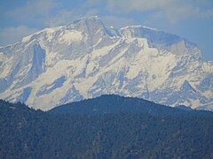
Kumaon is a revenue and administrative division in the Indian State of Uttarakhand. It spans over the eastern half of the state and is bounded on the north by Tibet, on the east by Nepal, on the south by the state of Uttar Pradesh, and on the west by Garhwal. Kumaon comprises six districts of the state: Almora, Bageshwar, Champawat, Nainital, Pithoragarh and Udham Singh Nagar.

Almora is a district in the Kumaon Division of Uttarakhand state, India. The headquarters is at Almora. It is 1,638 meters above sea level. The neighbouring regions are Pithoragarh district to the east, Chamoli district to the west, Bageshwar district to the north and Nainital district to the south.

The three-week-long Nanda Devi Raj Jat is a pilgrimage and festival of Uttarakhand. India. The Raj-Jaat is celebrated in Chamoli Garhwal district, and traditionally only the deities of Garhwal Division took part in it. Sometimes, during the peaceful periods between the Kingdoms of Garhwal and Kumaun, the Goddess "Nanda of Almora" was invited and took part in the Raj-Jaat, while mostly there were separate Nanda-Sunanda fairs in Kumaun. Off late, after the formation of Uttarakhand, the state Government has been trying bring the people from Garhwal and Kumaun together for celebrations and fairs. Hence, in the Nanda Devi Raj Jaat held in the year 2000, the goddess "Almora ki Nanda" took part after 90 years and a number of other deities from Kumaun accompanied her. To facilitate this change, even the traditional route of the Yatra was tweaked and an additional stop with a detour was added, i.e. Nanadakesri. It is at this point, that the deities and devotees from Kumaon assimilate with the main Jaat. Now people from the entire Garhwal division-Kumaon division, as well as other parts of India and the world participate in Nanda Devi Raj Jat yatra

Ranikhet is a hill station and cantonment town, near Almora Town in Almora district in the Indian state of Uttarakhand. It is the home of the Military Hospital, Kumaon Regiment (KRC) and Naga Regiment and is maintained by the Indian Army.

Gangolihat is a town in the Pithoragarh district of Uttarakhand, India. It is the headquarters of an eponymous tehsil ~ one of the 12 revenue subdivisions of the Pithorarh district.

The Chand Dynasty, sometimes Chandel of Kumaon or Chand Kingdom, was a Hindu dynasty of Kumaon, which was established by displacing the Katyuri kings. The Chands ruled over the Kumaon and parts of the Farwestern Nepal called Doti. They belonged to the Somvanshi Chandel Yadava dynasty of Rajputs.
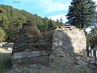
Pauri Garhwal is a district in the Indian state of Uttarakhand. Its headquarters is in the town of Pauri. It is sometimes referred to simply as Garhwal district, though it should not be confused with the larger Garhwal region of which it is only a part of.

Almora is a municipal board and a cantonment town in the state of Uttarakhand, India. It is the administrative headquarters of Almora district. Almora is located on a ridge at the southern edge of the Kumaon Hills of the Himalaya range. The Koshi (Kaushiki) and Suyal (Salmale) rivers flow along the city and snow-capped Himalayas can be seen in the background.

Srinagar is a city and municipal corporation in Pauri Garhwal district in the Indian state of Uttarakhand. It is located about 33 km from Pauri town, the administrative headquarters of Pauri Garhwal district, Uttarakhand, India.
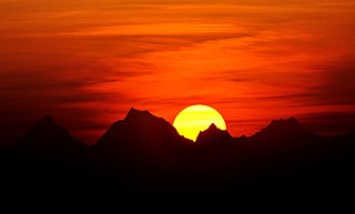
Kausani is a hill station and Village situated in Bageshwar district in the state of Uttarakhand, India. It is famous for its scenic splendour and its spectacular 300 km-wide panoramic view of Himalayan peaks like Trisul, Nanda Devi and Panchchuli. Mahatma Gandhi called this place the 'Switzerland of India', due to similarity in landscapes.

Baijnath is a small town on the banks of the Gomati river in the Bageshwar district in Kumaon division of Uttarakhand, India. The place is most noted for its ancient temples, which have been recognized as Monuments of National Importance by the Archaeological Survey of India in Uttarakhand. Baijnath has been selected as one of the four places to be connected by the 'Shiva Heritage Circuit' in Kumaon, under the Swadesh Darshan Scheme of the Government of India.

Gwaldam is a hill station in India, situated between the Garhwal and Kumaon, 39 km (24 mi) from Kausani.
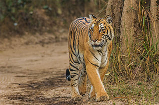
Uttarakhand is a state in North India. Its name, which means "northern land" or "section" or "northern part" in Sanskrit, is mentioned in early Hindu texts as the combined region of Kedarkhand and Manaskhand.
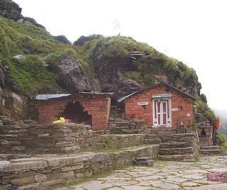
Rudranath is a Hindu temple dedicated to God Shiva, located in the Garhwal Himalayan mountains in Uttarakhand, India. Located at 3,600 metres (11,800 ft) above sea level, this natural rock temple is situated within a dense forest of rhododendron dwarfs and Alpine pastures. The temple is the second temple to be visited in the Panch Kedar pilgrimage circuit, comprising five Shiva temples in the Garhwal region to be visited in a strict pecking order starting with Kedarnath at an altitude of 3,583 m, the Tungnath (तुंगनाथ)(3,680 m or 12,070 ft), Rudranath (रुद्रनाथ), Madhyamaheshwar (मध्यमहेश्वर) and Kalpeshwar (कल्पेश्वर).

Kumaon Kingdom was an independent Himalayan kingdom in Kumaon, a region located in the eastern part of the present-day Uttarakhand state of India. It was established around 7th century and remained an independent and sovereign kingdom until 1791.
Thalisain is a town and tehsil of Pauri Garhwal district in the North Indian state of Uttarakhand. At an elevation of 1690 metres from sea level, it is situated on a gentle slope above the right bank of Nayaar (East) river. It is in the southwestern foothills of Dudhatoli Range and at a distance of 83 kilometers from Pauri town and 95 kilometers from Gairsain, the future capital of Uttarakhand.
Gujrugarhi is a place of historical importance located in Patti Gujdu of Nainidanda region in Pauri Garhwal district, Uttarakhand. The whole complex of temple and historical caves is situated on a hilltop in Deeba range at an average altitude of 2400 metres (7880 ft). The co-ordinates are 29°46'52.77"N 79° 5'18.68"E.

Diba Danda is a peak in the Patti Khatli region of Pauri Garhwal district, Uttarakhand, India. It is 2,670 metres (8,760 ft) high and is a part of the Diba Range, which forms the southern boundary of the Nayar Valley.

Dudhatoli is a middle Himalayan mountain range/forest running approximately 25 km in a north–south direction, starting near Thalisain tehsil of Pauri Garhwal district in Uttarakhand, with Gairsain in Chamoli district being its western limit and Syoli-Khand region in Pauri its northernmost spur.

Badhangarhi temple is an ancient Hindu temple dedicated to Kali, worshipped as Maa Dakshineshwar kaali or Bhagwati. People living in Tharali, Naranbagar, Dewal block of Chamoli and garur, kapkot block of Bageshwar have a great faith in Badhangarhi, a popular deity in this region. It is situated in Tharali tehsil of Chamoli Garhwal district of Uttarakhand. The nearest town to Badhangarhi is Gwaldam which is 8 km from the main Badhangarhi temple. The temple is situated at the elevation of about 2260 m.