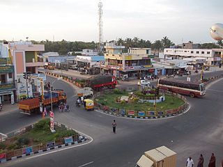
Perundurai is a Special Grade Town Panchayat in Erode district in the Indian state of Tamil Nadu. Perundurai is the only special grade town panchayat among 42 in the district. Perundurai has developed as the industrial center with SIPCOT Industrial Estate and SEZ Complex. It is the Asia's Second largest SIPCOT.

Dharapuram is a town situated along the banks of Amaravati River in Tiruppur district in the Indian state of Tamil Nadu. Dharapuram is one of the oldest towns in South India and was the capital of Kongu Nadu under the Cheras, Western Ganga Dynasty and later Kongu Cholas, at which time it was known as Viradapuram. Amaravathi River flows through the town. As of 2011, the town had a population of 67,007. The city houses famous temples including Agatheeswarar Temple, Kaadu Hanumanthasamy temple and many others.
Karumathampatti is a Municipality in the Coimbatore district in the state of Tamil Nadu, India. It is one of the most developing suburb in Coimbatore about 25 km away from the city centre. It is situated in between NH544 which connects the city of Coimbatore with Salem – Erode – Tirupur and also in between the State Highway 165 connects Annur – Kamanaikenpalayam. Nearby places are Somanur-3 km, Avinashi-10 km, Tirupur-20 km, Sulur-15 km, Annur-16 km. Coimbatore -27,Mettupalayam-38,Palladam-19. Karumathampatti lies near the junction of two major roads, NH544(Coimbatore – Salem) and Karumathampatti – Annur road.

Muthur is a panchayat town in Kangeyam taluk in Tirupur district, Tamil Nadu, India.

Palladam is a town and First Grade Municipality in Tirupur district in the state of Tamil Nadu, India. It is the headquarters of Palladam Taluk of Tirupur district. Palladam is located on National Highway NH 81. Palladam is a major Town with large source of income collected from the business community which includes Textile industries, Poultry farms and Agriculture. Palladam High-tech weaving park is a milestone of the town. It is a part of the Coimbatore MP Constituency. Palladam is well known for production of Broiler chicken production and head office of Broiler coordination committee (BCC) situated here.
Periya Negamam is a panchayat town in Coimbatore district in the southern Indian State of Tamil Nadu. It comes under Pollachi Taluk and pollachi Assembly constituency. Negamam used to be a popular small town serving the commercial and transport needs of many small villages around it until 1980s. With the arrival of frequent city buses to Pollachi and Udumalpet as transportation mode, growth of Negamam remained stunted. Weekly market on Tuesday used to be a big crowd puller.

Sulur is a town located in the Coimbatore district of Tamil Nadu, India. It is a suburb of Coimbatore. It is the headquarters of Sulur Taluk of Coimbatore district. There are many market places and many big retail and wholesale shops are available and also taluk office, police station, and a famous RVS institutions consisting of medical college, arts college is there in Sulur. And also two big famous temples are there. It is also a taluk and legislative constituency which comes under the Coimbatore parliamentary constituency.

Udumalai, also known as Udumalaipettai and Udumalpet, is a town in Tiruppur district in the Indian state of Tamil Nadu. Udumalaipettai is located 535 km south west from the state capital, Chennai and 72 km away from Coimbatore, the second largest city in the state.

Avinashi is a Special Grade Town Panchayat in Tiruppur district in the Indian state of Tamil Nadu. Avinashi is one among the nine taluks of the district. It is one of the popular pilgrim destinations in Western Tamilnadu region. It is located on National Highway NH544, which bypasses the town. The history of the town is centered around the Avinasilingeswarar temple. The town was previously a part of the Coimbatore district until Tirupur was carved out as a separate district from the erstwhile districts of Coimbatore and Erode. It is a stopping place for vehicles travelling from the western part of Tamil Nadu to Chennai and Cochin.
Perumanallur is a textile Industrial city situated near Tirupur, Tamil Nadu, India. Coimbatore city on the National Highway which now bypasses outside the town. It is a cross junction in NH-47 connecting Cochin/Coimbatore with Erode/Salem and Tirupur with Gobichettipalayam.
Moongiltholuvu is a village and Village Panchayat in Udumalpet Taluk, Tirupur District, Tamil Nadu, India.

Tiruppur District is one of the 38 districts of the Indian state of Tamil Nadu, formed in 22 February 2009. Dharapuram was the largest taluk by area in the district. The district is well-developed and industrialized. The Tiruppur banian industry, the cotton market, Kangeyam bull and Uthukkuli butter, among other things, provide for a vibrant economy. The city of Tiruppur is the administrative headquarters for the district. As of 2011, the district had a population of 2,479,052 with a sex-ratio of 989 females for every 1,000 males.
Anikkadavu is a small village formerly a part of Coimbatore Rural District, India, but now in Tiruppur District which belongs to Udumalpet taluk. The name Anikkadavu derived from the ancient word Anai Kadavu which means that it was the path of elephants used to cross this region long long ago.
Thirumandagoundanpalayam is a small village in Puliyampatti Panchayat, in Kamanaicken Palayam rural area in Coimbatore district of the Indian state of Tamil Nadu. Situated on the state highway-87 (SH-87) which connects the towns of Pollachi and Sathyamanglam, Thirumandagoundanpalayam is situated in 35 km southeast of Coimbatore city and 25 km west from Tirupur
Chinnamanaickenpalayam is a village in the Sulur Taluk of Coimbatore district, Tamil Nadu, India.

Tiruppur or Tirupur is a city in the Indian state of Tamil Nadu. Tiruppur is the administrative headquarters of Tiruppur district and the fifth largest city as well as an urban agglomeration in Tamil Nadu. Located on the banks of Noyyal River, it has been ruled at different times, by the Early Pandyas, Medieval Cholas, Later Cholas, Mysore Kingdom and the British. It is about 450 kilometres (280 mi) southwest of the state capital Chennai about 50 kilometres (31 mi) east of Coimbatore 50 kilometres (31 mi) south of Erode and 50 kilometres (31 mi) north of Dharapuram.
Pongalur is a small town located in Palladam Taluk of Tiruppur district in Tamil Nadu, India. It is located along the Coimbatore - Trichy National highway and headquarters the Pongalur block. It is located 10 km from Palladam, 22 km from Kangeyam, 35 km from Dharapuram and 20 km from district headquarter Tiruppur and 50 km from Coimbatore. It is known for its famous Varadharaja perumal Temple.

Uthiyur is a small town in Kangeyam taluk of Tiruppur district in south Indian state of Tamil Nadu.
Karanampettai is a town located in the Tiruppur district of Tamil Nadu, India. It is a suburb of Coimbatore.It lies on the National Highway 81. It is a part of Palladam taluk and Palladam which comes under the Coimbatore Parliament Constituency.

Kundadam is a small town located in Dharapuram taluk of Tiruppur district in Indian state of Tamil Nadu. It is the headquarters of the Kundadam Panchayat Union in Tiruppur district. It is located 16Km away from Dharapuram in Coimbatore-Dharapuram highway. In the classical Tamil texts, this town is named as Kundrai, Kundrapuram, Kundrai Managar and Kundridam. The town houses famous temples including Varatharājaperumāl Temple, Kala Bairavar Temple, Kongu Vatuganādha Swāmy Temple, Koṅgar Chinnamman Temple and Vadivudaimangai Udanurai Konguvidangkisuvarar Temple.


