Kamela, Poland

Last updated
Kamela
Village
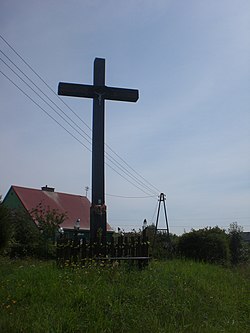
Kamela - krzyz przydrozny.jpg
Wayside cross in Kamela
Poland adm location map.svg
Red pog.svg
Kamela
Coordinates: 54°13′45″N18°14′3″E / 54.22917°N 18.23417°E / 54.22917; 18.23417
Country Flag of Poland.svg  Poland
Voivodeship Pomeranian
County Kartuzy
Gmina Somonino
Population
272
Time zone UTC+1 (CET)
  Summer (DST) UTC+2 (CEST)
Vehicle registration GKA

Kamela is a village in the administrative district of Gmina Somonino, within Kartuzy County, Pomeranian Voivodeship, in northern Poland. [1] It is located in the ethnocultural region of Kashubia in the historic region of Pomerania.

History

The village was founded after 1600. [2]

During the German occupation of Poland (World War II), in 1939, some Poles from Kamela were among the victims of a massacre committed by the Germans in nearby Kaliska as part of the genocidal Intelligenzaktion campaign. [3]

References

  1. "Główny Urząd Statystyczny" [Central Statistical Office] (in Polish). To search: Select "Miejscowości (SIMC)" tab, select "fragment (min. 3 znaki)" (minimum 3 characters), enter town name in the field below, click "WYSZUKAJ" (Search).
  2. Słownik geograficzny Królestwa Polskiego i innych krajów słowiańskich, Tom III (in Polish). Warsaw. 1882. p. 729.{{cite book}}: CS1 maint: location missing publisher (link)
  3. Wardzyńska, Maria (2009). Był rok 1939. Operacja niemieckiej policji bezpieczeństwa w Polsce. Intelligenzaktion (in Polish). Warsaw: IPN. p. 154.