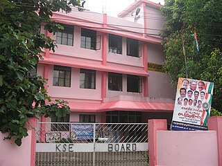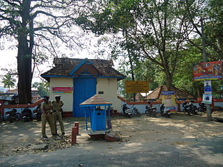
Kottayam, is one of fourteen districts in the Indian state of Kerala. Kottayam district comprises six municipal towns: Kottayam, Changanassery, Pala, Erattupetta, Ettumanoor, and Vaikom. It is the only district in Kerala that neither border the Arabian Sea nor any other states.

Ernakulam, IPA: [erɐɳɐːguɭɐm]; ISO: Eṟaṇākuḷaṁ, in Malayalam: എറണാകുളം), is one of the 14 districts in the Indian state of Kerala, that takes its name from the eponymous city division in Kochi. It is situated in the central part of the state, spans an area of about 3,000 square kilometres (1,200 sq mi), and is home to over 9% of Kerala's population. Its headquarters are located at Kakkanad. The district includes Kochi, also known as the commercial capital of Kerala, which is famous for its ancient Churches, Hindu temples, synagogues and mosques. The district includes the largest metropolitan region of the state: Greater Cochin. Ernakulam is the district that yields the most revenue and the largest number of industries in the state. Ernakulam is the third most populous district in Kerala, after Malappuram and Thiruvananthapuram. The district also hosts the highest number of international and domestic tourists in Kerala state.

Muvattupuzha is a town in the midlands directly to the east of Kochi in Ernakulam district, Kerala, India. It is located about 36 km (22 mi) from downtown Kochi, and is a growing urban centre in central Kerala. The town is also the starting point of the Muvattupuzhayar, which is a confluence formed by three rivers: the Thodupuzhayar, Kaliyar, and Kothayar.
Mundakayam, is a town in Kanjirappally Taluk in the Kottayam District of Kerala. It is the doorway to the high ranges of southern Kerala, and is at the border of Kottayam and Idukki districts. The next nearest town, Kanjirappally, is 14 km (8.7 mi) & Erumely is 12 km from Mundakayam. Mundakayam has rubber plantations, and greenery. The Manimala River runs through Mundakayam. It is located 48 km east of the district headquarters at Kottayam and 148 km from the state capital, Thiruvananthapuram. The name Mundakayam is said to be derived from the Mundi cranes that used to be seen along the Manimala River banks.

Punalur is a Municipality in Kollam district of Kerala State in India. It is the headquarter of the Punalur Taluk and Punalur Revenue Division. It's situated in the eastern part of Kollam district of Kerala, on the banks of the Kallada River and foothills of the western ghats. It is about 45 kilometres (28 mi) north-east of Kollam and 68 kilometres (42 mi) north of Thiruvananthapuram.Punalur is also Known as Mini Pamba, Lap of the Western Ghat, and Gateway of Sabarimala.
Koottickal is a town at the base of Western Ghats mountain ranges in the Kottayam district, Kerala. It is 2,000 feet (610 m) above sea level and is situated on the eastern border of Kottayam District, 55 km from Kottayam, and around 5 km away from Mundakayam on the NH 220. There are streams and waterfalls in the surrounding places. The Muthukora Hills are nearby. Urban centres in Kottayam and Ernakulam districts can be viewed from the top of Muthukora Hills.

Aluva is a region in the city of Ernakulan in Kerala, India. It is not part of the Kochi metropolitan area and is situated around 15 km (9.3 mi) from the city center on the banks of Periyar River. A major transportation hub, with easy access to all major forms of transportation, Aluva acts as a corridor which links the highland districts to the rest of Kerala. Cochin International Airport at Nedumbassery is 11.7 km from Aluva. Aluva is accessible through rail, air, metro along with major highways and roadlines. Aluva KSRTC bus station is an important transport hub in Kerala and one of the busiest stations in central part of the state.

Perumbavoor is a historic place located at Bank of Periyar in Ernakulam District in the Indian state of Kerala. It lies in the north-eastern tip of the Greater Cochin area and is also the headquarters of Kunnathunad Taluk. Perumbavoor is famed in the state for wood industries and small-scale industries. Ernakulam lies 30 km southwest of Perumbavoor. The town lies between Angamaly and Muvattupuzha on the Main Central Road (MC), which connects Thiruvananthapuram to Angamaly through the old Travancore part of Kerala. Perumbavoor lies in the banks of river Periyar.

Pampady is a fastest growing town in Kottayam district of Kerala, Southern India. It lies midway between the backwaters of Western Kerala and the mountains of the Western Ghats.

Uzhavoor is an expanding town in Kottayam district, Kerala in India. It is just 32 km away from the administrative capital Kottayam District. Most of its residents are either wealthy farmers or businessmen. Many of the houses belong to NRIs. The tenth President of India, K. R. Narayanan, was born and brought up in this village. The newly expanded road which connects the city of Pala and other destinations such as Sabarimala to the city of Muvattupuzha passes through Uzhavoor. The town is 177 km from the state capital Thiruvananthapuram.
Piravom is a Municipality in Ernakulam district and a suburb of Kochi in the Indian state of Kerala. It is located with in 31 km southeast of Kochi city center, at the boundary of the Ernakulam and Kottayam districts. Piravom is famous for its Hindu temples and Christian churches. Piravom has a river-front, verdant hills, and paddy fields.

Ponkunnam (പൊൻകുന്നം) is a census town in Kerala, India, part of Kottayam district under Kanjirappally taluk. Ponkunnam literally means golden mountain (ponn = gold, kunn = mountain). Nearby towns are Kanjirappalli, Manimala and Pala. This part of Kerala is famous for its fertile land and rubber plantations. It is at an altitude of 495 ft (151 m) above mean sea level. The town is at the junction of two major roads in Kerala: NH220 and Main Eastern Highway. The climate is moderate with timely cold breezes and the town is the gateway to the Western Ghats. The town is famous for its volleyball traditions and customs. Almost every year there is an ever-rolling volleyball tournament happening in Ponkunnam Mahatma Gandhi Mini Stadium.
Elanji is a village in Ernakulam district, Indian state of Kerala.
Maneed is a village/ rurban area in Ernakulam district in the Indian state of Kerala.
Onakkoor is a village in Ernakulam district in the Indian state of Kerala. The main attractions in the village are Onakkoor River and Onakkoor Temple. Other attractions include Edayan Lake and Onakkoor check dam (chera). Famous writer George Onakkoor is associated with this village. The SH-42 Highway passes through Onakkoor. Piravom is the nearest town with markets and hospitals. The dominant religions are Hinduism and Christianity.

Vechoor is a village in Vaikom taluk, Kottayam district in the state of Kerala, India. Vechoor is a short drive away from one of Kerala's tourist destinations, Kumarakom. The Vechur Cow breed of cattle is named after this village.
Vattappara is a village in Thiruvananthapuram district in the state of Kerala, India. , well known for its geographical peculiarities with quarries that are generally used for extracting building materials (rock).This town is by the side of MC Road connecting Trivandrum and Kottayam and 14 km away from Trivandrum City. The nearest township is Nedumangad.There is no recorded history on the origin of this place. The major occupation in Vattappara is farming(Rubber, Coconut).

Elappally is a village in Thodupuzha Taluk, Idukki district in Kerala, India. It is located 26 km from Thodupuzha town, 85 km from Kochi city, and 70 km from Kottayam town.

Vyttila, IPA: [ʋɐjt̺ːilɐ], is an intersection as well as the name of a region in the city of Kochi, in the state of Kerala, India. It is the busiest as well as one of the largest intersections in Kerala. This node intersects the main north–south artery of the state of Kerala, namely, the Kochi Bypass, with three city roads of Kochi viz, the S. A. Road, the Vyttila-Petta Road, and the Thammanam Road.

Kaloor is a downtown region in the city of Kochi, in the state of Kerala, India. It is two kilometres (1.2 mi) from the Ernakulam North Railway Station. Kaloor Junction is also the name of a major intersection in this part of the city, intersecting the two major arteries of downtown Kochi, namely Banerji Road and the Kaloor-Kadavanthra Road. The nearest major intersections are Palarivattom to the east and Lissie Junction to the west.


