
Hailakandi (pron:ˈhaɪləˌkʌndi) is a town and the district headquarters of Hailakandi district in the Indian state of Assam. Hailakandi is located at 24.68°N 92.57°E.

Karimganj is a city in the Karimganj District of the Indian state of Assam. It is the administrative headquarters of the district.

Lumding is a town with a municipal board in Hojai District in of Assam state in India. It is notable as the location of Lumding Junction railway station, a major hub for India's Northeast Frontier Railway network.
Ambikapur Part-X is a census town in Cachar district in the state of Assam, India.
Badarpur is a town and a town area committee in Karimganj district in the state of Assam, India. Badarpur. Together with adjacent Badarpur Railway Town, it forms the Badarpur Urban Area, one of two notified urban areas in the district. The area is also popularly known as "Gateway to the Barak Valley" of Assam. Badarpur was a part of Karimganj district till 31st December 2022.
Badarpur Railway Town is a census town in Cachar district in the state of Assam, India. Together with adjacent Badarpur Town, it forms the Badarpur Urban Area, one of two notified urban areas in the district.
Durga Nagar Part-V is a census town in Cachar district in the state of Assam, India.
Hindustan Paper Corporation Limited Township, Panchgram is an industrial township in Panchgram under Cachar district, state of Assam. It is the finest township of the Barak Valley Under Hindustan Paper Corporation Limited.
Lakhipur, is a town and a Municipal Board in Cachar district in the Indian state of Assam.
Silchar Part-X is a census town in Cachar district in the Indian state of Assam.
Uttar Krishnapur Part-I is a census town in Cachar district in the Indian state of Assam.
Lala is a town and a town area committee in Hailakandi district in the Indian state of Assam.
Singerband or Singerbond is a village under Singerband Gaon Panchayat in the district of Cachar (Assam), India under Lakhipur sub division.
Dabaka, also called Doboka or Dobaka, is a town in Hojai district of Assam state in India. It is a commercial place situated in the central part of Assam.
Jirighat is a block headquarters in Cachar district, Assam, India. Jirighat is a tea estate.
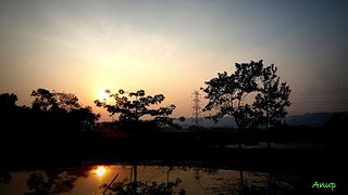
Channighat is a village panchayat in Narsingpur Tehsil in Cachar district of Assam State, India. It is located 39 km (24 mi) south of Silchar, 31 km (19 mi) from Narsingpur and 245 km (152 mi) from the state capital at Dispur.
Dholai is a village in Narsingpur Tehsil in Cachar District of Assam State, India. It is located 30 km towards South from District headquarters Silchar. 22 km from Narsingpur
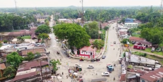
Sonai is a town in the Cachar district in the Indian state of Assam. It is also the name of a circle and block in the town. Government of Assam declared it as a municipal area on 2016 with 11 wards. The River Sonai flows through the town of Sonai joining with Barak River near Dungripar Village of Sonai. The Chandragiri Park and an Archeological site, a temple of Kachari Kingdom at Shivtilla (Changutilla) near Madhab Chandra Das College is a famous place to visit.
Sonabarighat is a town in Sonai, Cachar district, in Assam, India. The birthplace of the late Moinul Hoque Choudhury is situated at the tri-junction of the Aizawl-Sonai-Silchar road.

Rongpur is a village in Katlicherra subdivision of Hailakandi district, Assam India. It is located 25 km south of Hailakandi town and 3 km from Katlicherra..The village falls in Hailakandi district with a population 2068. The male and female populations are 1093 and 975 as of census 2011. The size of the area is about 3.17 square kilometer.



 India
India 