Kanawinka Geopark

Last updated

Kanawinka Geopark
Australia
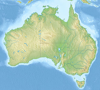
Australia relief map.jpg
Red pog.svg
Kanawinka Geopark
Coordinates 37°59′31.04″S142°0′51″E / 37.9919556°S 142.01417°E / -37.9919556; 142.01417 Coordinates: 37°59′31.04″S142°0′51″E / 37.9919556°S 142.01417°E / -37.9919556; 142.01417
EstablishedJune 2008 [1]
Abolished2012[ citation needed ]
Area26,910 km2 (10,390.0 sq mi)[ citation needed ]

The former Kanawinka Geopark is situated along a structurally controlling geological fault of the same name that extends from the Naracoorte Caves in South Australia into Western Victoria, before disappearing offshore at Portland.

Contents

Description

Kanawinka was declared Australia's First National Geopark in June 2008. [1] It occupies a significant portion of a geological feature known as the Otway Basin (Douglas et al. 1988). Kanawinka Geopark has an area of about 26,910 square kilometres (10,390 sq mi) across two States and nine local government areas, with some 374 volcanic sites and many other significant geological sites and formations. It was deregistered from Geopark status in 2012.

The term kanawinka is taken from the language of the Buandik aboriginal peoples, the traditional owners of the land and means "Land of Tomorrow". Buandik lands stretched along the coast in the far south of modern day South Australia and across to the Victorian border regions. The geological fault line which runs from the Naracoorte area down and across into Victoria is known as the Kanawinka Fault Line and the name was also given to a parish in the Casterton/Coleraine area. As it is important in the UNESCO assessment of granting Goepark status to link geology to culture and society the name Kanawinka was chosen to represent the connection of ancient culture, European settlement and the desire to educate through the Geopark status.

The Otway Basin that hosts Kanawinka occupies the southern margin of South Australia and Victoria, and also has a significant portion located offshore. This basin formed when Australia rifted away from Gondwana (the southern supercontinent), which occurred about 95 million years ago (Drexel et al. 1993) . The sequence of sediments in the basin was deposited from Jurassic through to recent times.

The South Australian portion of the Geopark lies in the Limestone Coast of the state, and adjoins the World Heritage area of Naracoorte Caves. The Victorian part lies in the Western Districts region of that state. Both areas are famous for their cheese, wine, forestry and rural industries.

The eastern extremity of the Geopark in Victoria is located only about one hour's drive from the state capital city, Melbourne. At the Victorian/ South Australian Border the distance is about four and a half to five hours drive from Melbourne. In the South Australian section it is located four to five hours' drive from that state’s capital of Adelaide.

Volcanic activity in Victoria younger than 7 million years is known as the Newer Volcanics Province or Newer basalts. The activity in Kanawinka Geopark falls into this category. Most of the volcanism is estimated to have taken place from about 5 million years before present (B.P.) to around 5,000 years ago.

Included are 6 sites of International Significance, 14 of National significance along with many of state, regional and local significance. (Geological Survey of Australia Victorian Division and the Standing Committee on Geoheritage, National Estate listings 1980). The region varies from volcanic basalt plains dotted with eruption points through to limestone caves and crater lakes to the ‘Terra Rosa’ of the Coonawarra, with its wonderful wines.

The basalt plains of Western Victoria are listed in the top 6 in the World for extent and complexity, and the Blue Lake of Mount Gambier is of International significance with its unique colour change each year. (Sheard, M. 1978)

The Kanawinka Geopark Board was a community-based organization funded by seven of the nine local government areas and was the driving factor in the Geopark proposal. It held support of Tourism Victoria, South Australian Tourism Commission, The National Trust and the Geological Society of Australia along with the Management bodies of the Sites of Significance of the region, but failed to obtain the approval of the Victorian and South Australian Governments as well as the Australian Government. However the group has now disbanded.

See also

Related Research Articles

<span class="mw-page-title-main">Geology of Victoria</span>

Victoria is an Australian state, situated at the southern end of the Great Dividing Range. The Great Dividing Range stretches along the east coast of the continent and terminates near the Victorian city of Ballarat west of the capital Melbourne, though the nearby Grampians may be considered to be the final part of the range. The highest mountains in Victoria are the Victorian Alps, located in the northeast of the state.

<span class="mw-page-title-main">Naracoorte Caves National Park</span> Protected area in South Australia

Naracoorte Caves National Park is a national park near Naracoorte in the Limestone Coast tourism region in the south-east of South Australia (Australia). It was officially recognised in 1994 for its extensive fossil record when the site was inscribed on the World Heritage List, along with Riversleigh. The park preserves 6 km2 of remnant vegetation, with 26 caves contained within the 3.05 km2 World Heritage Area. Out of the 28 known caves in the park, only four are open to the public. Other caves are kept away from the public eye as they are important for scientific research and also for the protection of the caves and their contents. Many of the caves contain spectacular stalactites and stalagmites.

<span class="mw-page-title-main">Lushan Quaternary Glaciation National Geopark</span> Park in Jiangxi Province, China

Lushan Geopark, is located in the region around Mount Lu, Jiujiang. The protected area of 500 square kilometres (190 sq mi) extends from the Yangtze River to the Poyang Lake basin.

<span class="mw-page-title-main">Limestone Coast</span> Region in South Australia

The Limestone Coast is a name used since the early twenty-first century for a South Australian government region located in the south east of South Australia which immediately adjoins the continental coastline and the Victorian border. The name is also used for a tourist region and a wine zone both located in the same part of South Australia.

<span class="mw-page-title-main">Geology of Australia</span> Overview of the geology of Australia

The geology of Australia includes virtually all known rock types, spanning a geological time period of over 3.8 billion years, including some of the oldest rocks on earth. Australia is a continent situated on the Indo-Australian Plate.

The Hunter-Bowen Orogeny was a significant arc accretion event in the Permian and Triassic periods affecting approximately 2,500 km of the Australian continental margin.

<span class="mw-page-title-main">Mount Schank</span> Mountain in South Australia

Mount Schank is a 100 m (330 ft) high dormant volcano in the southeast corner of South Australia, near Mount Gambier. It was sighted by James Grant on 3 December 1800 and named after Admiral John Schank, designer of Grant's ship, HMS Lady Nelson.

<span class="mw-page-title-main">Northern Cordilleran Volcanic Province</span> Geologic province in the Pacific Northwest of North America

The Northern Cordilleran Volcanic Province (NCVP), formerly known as the Stikine Volcanic Belt, is a geologic province defined by the occurrence of Miocene to Holocene volcanoes in the Pacific Northwest of North America. This belt of volcanoes extends roughly north-northwest from northwestern British Columbia and the Alaska Panhandle through Yukon to the Southeast Fairbanks Census Area of far eastern Alaska, in a corridor hundreds of kilometres wide. It is the most recently defined volcanic province in the Western Cordillera. It has formed due to extensional cracking of the North American continent—similar to other on-land extensional volcanic zones, including the Basin and Range Province and the East African Rift. Although taking its name from the Western Cordillera, this term is a geologic grouping rather than a geographic one. The southmost part of the NCVP has more, and larger, volcanoes than does the rest of the NCVP; further north it is less clearly delineated, describing a large arch that sways westward through central Yukon.

<span class="mw-page-title-main">Kula (volcano)</span> Volcanic field in Turkey

Kula is a volcanic field located in western Turkey. Kula field consists of a broad area of cinder cones and maars. It is the westernmost volcano of Turkey. The volcanic character of the area was recognized in antiquity, when it was named Katakekaumene from the appearance of the environment, which was mostly suited for viticulture. Volcanism began in the Miocene and over three stages continued in the Holocene. It is associated with the presence of two neighboring active graben structures. Footprints of prehistoric humans have been found in the area. The area is a geopark recognized by UNESCO given the universal and scientific value.

<span class="mw-page-title-main">Mount Gambier (volcano)</span> Maar in South Australia

Mount Gambier, also known as Berrin, is a maar complex in South Australia associated with the Newer Volcanics Province. The complex contains four maars, the most well-known one of which is Blue Lake / Warwar. The others are Valley Lake / Ketla Malpi, Leg of Mutton Lake / Yatton Loo and Brownes Lake / Kroweratwari. The complex is partially surrounded by the city of Mount Gambier.

<span class="mw-page-title-main">Geology of Tasmania</span> Overview of the geology of Tasmania

The geology of Tasmania is complex, with the world's biggest exposure of diabase, or dolerite. The rock record contains representatives of each period of the Neoproterozoic, Paleozoic, Mesozoic and Cenozoic eras. It is one of the few southern hemisphere areas that were glaciated during the Pleistocene with glacial landforms in the higher parts. The west coast region hosts significant mineralisation and numerous active and historic mines.

<span class="mw-page-title-main">Hong Kong UNESCO Global Geopark</span>

Hong Kong UNESCO Global Geopark, formerly Hong Kong National Geopark (香港國家地質公園), was inaugurated on 3 November 2009. It is a single entity of land area over 150 km2 across parts of the eastern and northeastern New Territories. On 18 September 2011, UNESCO listed the geopark as part of its Global Geoparks Network.

<span class="mw-page-title-main">San'in Kaigan Geopark</span>

The San'in Kaigan Geopark (山陰海岸ジオパーク) is a geopark in Japan. The area was declared a Japanese Geopark in 2008, and a UNESCO Global Geopark in 2010. The underlying themes of the geopark are "geological features, the natural environment, people's lives, and the formation of the Sea of Japan". This geologically diverse area contains records of the process from when Japan was part of the Asian continent to its present-day formation of the Sea of Japan. People's lives are also diverse in this area because of its geodiversity.

The Halibut Field is an oil field, within the Gippsland Basin offshore of the Australian state of Victoria. The oil field is located approximately 64 km offshore of southeastern Australia. The total area of this field is 26.9 km2 and is composed of 10 mappable units.

Kula-Salihli Geopark, also known as Kula Volcanic Geopark and Kula Geopark, is a geopark, a protected area of geological heritage, located in Kula and Salihli districts of Manisa Province, western Turkey. It was recognized by UNESCO as a UNESCO Global Geopark in 2013, and is the country's only geopark.

The geology of Alaska includes Precambrian igneous and metamorphic rocks formed in offshore terranes and added to the western margin of North America from the Paleozoic through modern times. The region was submerged for much of the Paleozoic and Mesozoic and formed extensive oil and gas reserves due to tectonic activity in the Arctic Ocean. Alaska was largely ice free during the Pleistocene, allowing humans to migrate into the Americas.

Waarre is a locality in the Shire of Corangamite of the Australian state of Victoria. It is about nine kilometres northeast of Port Campbell.

The Otway Basin is a northwest trending sedimentary basin located along the southern coast of Australia. The basin covers an area of 150,000 square kilometers and spans from southeastern South Australia to southwestern Victoria, with 80% lying offshore in water depths ranging from 50-3,000 meters. Otway represents a passive margin rift basin and is one of a series of basins located along the Australian Southern Rift System. The basin dates from the late Jurassic to late Cretaceous periods and formed by multi-stage rifting during the breakup of Gondwana and the separation of the Antarctic and Australian plates. The basin contains a significant amount of natural gas and is a current source of commercial extraction.

<span class="mw-page-title-main">Southeast Australia temperate forests</span> Terrestrial ecoregion in Australia

The Southeast Australia temperate forests is a temperate broadleaf and mixed forests ecoregion of south-eastern Australia. It includes the temperate lowland forests of southeastern Australia, at the southern end of the Great Dividing Range. Vegetation ranges from wet forests along the coast to dry forests and woodlands inland.

<span class="mw-page-title-main">Prospect dolerite intrusion</span> Landform of Sydney

The Prospect dolerite intrusion, or Prospect intrusion, is a Jurassic picrite or dolerite laccolith that is situated in Sydney, New South Wales, Australia. Lying in the heart of Cumberland Plain, in the suburb of Pemulwuy, the intrusion is Sydney's largest body of igneous rock, rising to a height of 117 metres (384 ft) above sea level. The site is formed by an intrusion of dolerite rock into Ashfield Shale. At least seven different rock types occur in the intrusion.

References

  1. 1 2 "UNESCO recognises Kanawinka Geopark". Australian Broadcasting Corporation. 23 June 2008. Retrieved 23 November 2015.