
Malawi is a landlocked country in southeast Africa. It is wholly within the tropics; from about 9°30S at its northernmost point to about 17°S at the southernmost tip. The country occupies a thin strip of land between Zambia and Mozambique, extending southwards into Mozambique along the valley of the Shire River. In the north and north east it also shares a border with Tanzania. Malawi is connected by rail to the Mozambican ports of Nacala and Beira. It lies between latitudes 9° and 18°S, and longitudes 32° and 36°E.

The Zambezi is the fourth-longest river in Africa, the longest east-flowing river in Africa and the largest flowing into the Indian Ocean from Africa. Its drainage basin covers 1,390,000 km2 (540,000 sq mi), slightly less than half of the Nile's. The 2,574 km (1,599 mi) river rises in Zambia and flows through eastern Angola, along the north-eastern border of Namibia and the northern border of Botswana, then along the border between Zambia and Zimbabwe to Mozambique, where it crosses the country to empty into the Indian Ocean.
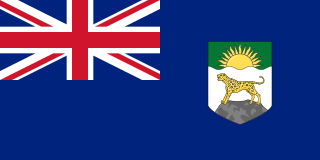
Nyasaland was a British protectorate located in Africa that was established in 1907 when the former British Central Africa Protectorate changed its name. Between 1953 and 1963, Nyasaland was part of the Federation of Rhodesia and Nyasaland. After the Federation was dissolved, Nyasaland became independent from Britain on 6 July 1964 and was renamed Malawi.

The British Central Africa Protectorate (BCA) was a British protectorate proclaimed in 1889 and ratified in 1891 that occupied the same area as present-day Malawi: it was renamed Nyasaland in 1907. British interest in the area arose from visits made by David Livingstone from 1858 onward during his exploration of the Zambezi area. This encouraged missionary activity that started in the 1860s, undertaken by the Universities' Mission to Central Africa, the Church of Scotland and the Free Church of Scotland, and which was followed by a small number of settlers. The Portuguese government attempted to claim much of the area in which the missionaries and settlers operated, but this was disputed by the British government. To forestall a Portuguese expedition claiming effective occupation, a protectorate was proclaimed, first over the south of this area, then over the whole of it in 1889. After negotiations with the Portuguese and German governments on its boundaries, the protectorate was formally ratified by the British government in May 1891.
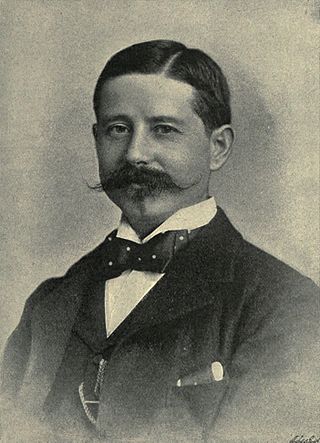
Sir Henry Hamilton Johnston was a British explorer, botanist, artist, colonial administrator, and linguist who travelled widely across Africa to speak some of the languages spoken by people on that continent. He published 40 books on subjects related to the continent of Africa and was one of the key players in the Scramble for Africa that occurred at the end of the 19th century.

Sir Roderick Impey Murchison, 1st Baronet was a Scottish geologist who served as director-general of the British Geological Survey from 1855 until his death in 1871. He is noted for investigating and describing the Silurian, Devonian and Permian systems.

The Shire is the largest river in Malawi. It is the only outlet of Lake Malawi and flows into the Zambezi River in Mozambique. Its length is 402 kilometres (250 mi). The upper Shire River issues from Lake Malawi and runs approximately 19 km (12 mi) before it enters shallow Lake Malombe. It then drains Lake Malombe and flows south through Liwonde National Park where large concentrations of hippopotamus are common along its shores. Between the towns of Matope and Chikwawa, the middle river drops approximately 400 m (1,300 ft) through a series of falls and gorges, including Kapachira Falls. Two hydroelectric dams have been built along the Shire northwest of Blantyre.

The Shire Highlands are a plateau in southern Malawi, located east of the Shire River. It is a major agricultural area and the most densely populated part of the country.

Alexandre Alberto da Rocha de Serpa Pinto, Viscount of Serpa Pinto was a Portuguese explorer of southern Africa and a colonial administrator.

The Murchison is a loosely defined area of Western Australia located within the interior of the Mid West region. It was the subject of a major gold rush in the 1890s and remains a significant mining district. The Murchison is also included as an interim Australian bioregion. The bioregion is loosely related to the catchment area of the Murchison River and has an area of 281,205 square kilometres (108,574 sq mi).
Chikwawa is a town with a population of 6,114 according to the 2018 census located in the Southern Region of Malawi on the west bank of the Shire River. It is the administrative capital of the Chikwawa District. Chikwawa lies almost 50 kilometres (30 mi) south of Blantyre, the commercial capital of Malawi.

The Shire of Murchison is a 49,500 km² local government area (LGA), within the Murchison sub-region, in the Mid West region of Western Australia. Encompassing most of the Murchison and East Murchison goldfields, the shire is named after the Murchison River. It is Australia's least-populated LGA and the only one without an official town. Five sparsely-populated rural localities, with a collective population of 101, comprise the entire shire. The shire offices, located 300 kilometres (186 mi) northeast of Geraldton, are the focal point of Murchison Settlement, a small part of the Murchison locality.

The wildlife of Malawi is composed of the flora and fauna of the country. Malawi is a landlocked country in southeastern Africa, with Lake Malawi taking up about a third of the country's area. It has around 187 species of mammal, some 648 species of birds have been recorded in the country and around 500 species of fish, many of them endemic, are found in its lakes and rivers. About 20% of the country has been set aside as national parks and game and forest reserves.
The Yalgar River is a 185-kilometre-long tributary of the Murchison River, located in the Shire of Meekatharra in central Western Australia. It rises in the Glengarry Range 25 km southeast of Mooloogool Station homestead, about 80 kilometres northeast of Meekatharra, flowing 145 kilometres westward to a junction with the Hope River. From there it flows north-northwesterly for about 40 kilometres, emptying into the upper reaches of the Murchison River, near Moorarie Station homestead on the Carnarvon-Meekatharra Road.
Ruo River is the largest tributary of the Shire River in southern Malawi and Mozambique. It originates from the Mulanje Massif (Malawi) and forms 80 km (50 mi) of the Malawi-Mozambique border. It joins the Shire River at Chiromo.
Wooleen Station is a pastoral lease that was previously operated as a sheep station and currently runs cattle. The station was established in 1886 in the Murchison region of Western Australia that is bisected by the Murchison River. The station is situated approximately 680 kilometres (423 mi) north of Perth in the Shire of Murchison.

Malawi–Mozambique relations refers to the current and historical relationship between the countries of Malawi and Mozambique. As Malawi shares a large border with Mozambique, much of the substance of their foreign relations pertain to the border separating the two nations. Both of the sovereign states have amicably agreed that lacustrine borders on Lake Malawi remain the largest priority between the two countries, as the exploitation of natural resources within the waters of Lake Malawi remain an issue the two countries continue to resolve. The moment considered an act of generosity and sympathy within the two countries relations is when, during the Mozambique Civil War, Malawi housed over one million Mozambican refugees between 1985 and 1995. After this gesture, Malawian relations with Mozambique crumbled under the tenure of Bingu wa Mutharika, notoriously reaching a nadir when Malawian police launched a raid into Mozambique's territory. Both countries are members of the African Union and Non-Aligned Movement.

The Shire Highlands Railway Company Ltd was a private railway company in colonial Nyasaland, incorporated in 1895 with the intention of constructing a railway from Blantyre to the effective head of navigation of the Shire River. After problems with routing and finance, a South African 3 ft 6 in gauge railway was constructed between 1903 and 1907, and extended in 1908 to a Nsanje, a distance of 113 miles (182 km) as water levels in the Shire River fell.
Kholombidzo Dam, also Kholombidzo Hydroelectric Power Station is a planned 200 megawatts (270,000 hp) hydroelectric dam in Malawi.


