Landeck is a city in the Austrian state of Tyrol, the capital of the district of Landeck.

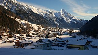
Fiss is a municipality in the Landeck district in the Austrian state of Tyrol located 10.5 kilometers (6.5 mi) south of Landeck on the upper course of the Inn River. The main source of income is tourism.
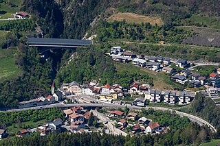
Faggen is a municipality in the Landeck district in the Austrian state of Tyrol located 10.5 km south of Landeck at the entrance of the Kauner Valley which is a side valley on the upper course of the Inn River.
Fendels is a municipality in the Landeck district in the Austrian state of Tyrol located 13 km south of Landeck on the upper course of the Inn River. The village was mentioned for the first time in documents in 1297. Until 1959 it was only reachable by cable car. The construction of a street helped the village to get connected. The main source of income is „gentle“ Winter tourism.

Fließ is a municipality in the Landeck district in the Austrian state of Tyrol located 5 km south of Landeck on the upper course of the river Inn, in the upper part of Upper Inn Valley. It has nine hamlets and was already populated at the Roman age; the village itself was founded around the 6th century. After a conflagration in 1933 Fließ was restored more spacious. The main source of income is tourism.
Grins is a municipality in the Landeck district in the Austrian state of Tyrol located 3.7 km west of Landeck and 18 km east of Sankt Anton am Arlberg. The village has 10 subdivisions. Settlement of the area already began 2000 years ago because of the sunny climate but the village was mentioned for the first time in documents in 1288 as „Grindes“.

Kaunerberg is a municipality in the district of Landeck in the Austrian state of Tyrol located 12.6 km southeast of Landeck in a valley with the same name at the upper course of the Inn River. The main source of income is agriculture.

Kauns is a tiny municipality in the district of Landeck in the Austrian state of Tyrol located about 12 km southeast of Landeck and 1 km below Kaunerberg at the upper course of the Inn River. Several fires have tortured the village; only a few houses survived the catastrophes.

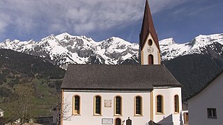
Ladis is a municipality in the district of Landeck (district) in the Austrian state of Tyrol located 9.5 km south of Landeck and 1.4 km west of Faggen. The village is known because of its sulphur and sour springs. Another important source of income is ski tourism.
Pettneu am Arlberg is a municipality in the district of Landeck in the Austrian state of Tyrol. It is located 16.3 km west of the city of Landeck. The location was first mentioned in 1300 as Ponte novu (nou) which means new bridge. The main sources of income are summer and winter tourism and agriculture.

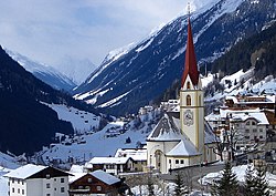
Pfunds is a municipality in the district of Landeck in the Austrian state of Tyrol located 19.7 km south of the city of Landeck and 5 km north of the border to Switzerland. The village was first mentioned in documents in 1282. The main source of income is tourism.
Pians also refers to the alumni association composed of St. Pius X Seminary and Sancta Maria Mater et Regina Seminarium alumni.

Ried im Oberinntal is a municipality in the district of Landeck in the Austrian state of Tyrol located 12 km south of the city of Landeck and 3 km below Prutz. It was first mentioned in documents in the 12th century. Tourism is the main source of income.

Schönwies is a municipality in the district of Landeck in the Austrian state of Tyrol located 8 km northeast of the city of Landeck and 7 km west of the city of Imst. The main source of income is the mining of limestone ballast stone.

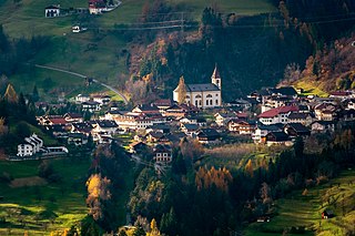
See is a municipality in the district of Landeck in the Austrian state of Tyrol located 8 km southwest of the city of Landeck. The village was founded in 1400 by farmers. Nowadays, tourism is the main source of income.

Spiss is a municipality in the district of Landeck in the Austrian state of Tyrol located 22 km south of the city of Landeck at the border of Switzerland. It is one of the smallest communities in the district. Formerly a part of Nauders, it became its own municipality in 1547. The main sources of income nowadays are tourism and agriculture.

Stanz bei Landeck is a municipality in the district of Landeck in the Austrian state of Tyrol located 1 km north of the city of Landeck. The village was first mentioned in documents in 1150 as „Stanuc“. The main source of income is plums which are processed into schnapps.

Strengen is a municipality in the district of Landeck in the Austrian state of Tyrol located 7.7 km west of the city of Landeck. The village was first mentioned in an atlas in 1774 as "Gstreng". The main source of income is tourism.
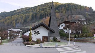
Tobadill is a municipality in the district of Landeck in the Austrian state of Tyrol located 4 km west of the town of Landeck.
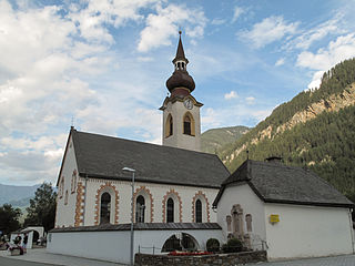
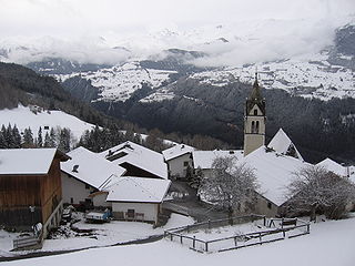
Tösens is a municipality in the district of Landeck in the Austrian state of Tyrol located 14 km south of the city of Landeck. The main source of income is tourism.