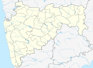
Satara is a city located in the Satara District of Maharashtra state of India, near the confluence of the river Krishna and its tributary, the Venna. The city was established in the 16th century and was the seat of the Chhatrapati of Maratha Empire, Shahu I. It is the headquarters of Satara Tehsil, as well as the Satara District. The city gets its name from the seven forts (Sat-Tara) which are around the city. The city is known as a Soldier's city as well as Pensioner's city.

Madipakkam is residential locality situated in south of Chennai, India. It has been recently placed under the Greater Chennai Corporation.
Bhor is a town and a municipal council in Pune district in the state of Maharashtra, India.
Godoli is a census town in Satara district in the Indian state of Maharashtra.
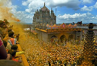
Jejuri is a city and a municipal council in Pune district in the Indian state of Maharashtra. It is famous for the main temple of Lord Khandoba. It is a famous temple town being the family deity of many houses in Maharashtra and Karnataka. Its economy is centered on businesses catering to the numerous devotees coming to worship the Khandoba Temple there. Recently the increase in property rates and the planning of an international airport near the town has seen a spurt of development happening there.
Kalambe Turf Thane is a census town in Kolhapur district in the Indian state of Maharashtra.

Kumbhkot is a census town in Kota district in the Indian state of Rajasthan.
Mhaswad or Mhasvad is a city in the Maan/Dahivadi taluka in the Satara district in the Indian state of Maharashtra.

Mullanpur Garibdass is a town in Mohali district in the Indian state of Punjab, north of the city of Chandigarh. Garibdas village is located in vicinity of this town.
Poladpur is a census town in Raigad district in the Indian state of Maharashtra.

Rahimatpur is a city and a municipal council in Satara district in the Indian state of Maharashtra.
Salumbar is a statutory town in Udaipur district in the Indian state of Rajasthan.
Sansarpur is a village in Jalandhar district in the Indian state of Punjab.
Shirwal is a census town in Satara district in the Indian state of Maharashtra.
Sindi Railway is a census town in Wardha district in the Indian state of Maharashtra.

Thevaram is a town in Theni district in the Indian state of Tamil Nadu. Thevaram is located in Tamil Nadu near on border of Kerala at the Eastern side foot-hill of the Western Ghats. It is connected with State Highway SH100.
Banvadi (Sadashivgad) is a census town in Satara district in the Indian state of Maharashtra.

Patan is a census town in Satara district in the Indian state of Maharashtra.
Khed is a census town in Satara district in the Indian state of Maharashtra.

Kerur is a City in Bagalkot district in Karnataka, which located on NH 218. It has an average elevation of 617 meters (2024 feet). It's a birthplace of Jagadish Shettar, a former Chief Minister of Karnataka. Kerur is a Town Panchayat city in district of Bagalkot, Karnataka. The Kerur city is divided into 16 wards for which elections are held every five years. The Kerur Town Panchayat has population of 19,731 of which 9,929 are males while 9,802 are females as per report released by Census India 2011.


 India
India