Kalikesam is located in the Kanyakumari wild life sanctuary in Kanyakumari district in Tamil Nadu, India. The Kali temple situated here.
Marthandam is a major trade centre in Kuzhithurai municipality across National Highway in the Kanyakumari district of Tamil Nadu, India. Formerly known as Thoduvetty, it was a portion of Kanyakumari district which was added to the state of Tamil Nadu on 1 November 1956.

Eraniel is a panchayat town in Kanyakumari district in the state of Tamil Nadu, India. It is of major commercial and political importance in the history of South India, as it was the seasonal capital of the affluent Venad and later Travancore kingdoms until the seventeenth century, when Padmanabhapuram and Thiruvananthapuram rose to prominence. Currently it is known for its archaeological importance for the ruins of the dilapidated Eraniel Palace.

Kanyakumari district, officially Kanniyakumari district, is one of the 39 districts of Tamil Nadu state and the southern most district in mainland India. It stands second in terms of population density among the districts of Tamil Nadu. It is also the richest district in Tamil Nadu in terms of per capita income, and also tops the state in Human Development Index (HDI), literacy, and education. The district's headquarters is Nagercoil.
Thuckalay or Thakkalai is a town in Kanyakumari district of Tamil Nadu, India. Thuckalay comes under the Padmanabhapuram Municipality, and is the administrative headquarters of Kalkulam Taluk. The Revenue Divisional Office is located in Mettukadai.
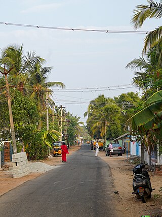
Kuzhithurai is a town and a municipality in Kanyakumari District in the Indian state of Tamil Nadu. It is the administrative headquarters of the Vilavancode Taluk. It is located 26 km (16 mi) north of the Nagercoil city and 42 km (26 mi) south of Kerala's capital city Trivandrum along NH66. It has a historical seaport where ancient merchants came from across the Arabian sea in ancient times. It is mentioned in ancient Indian maps. As of 2011, the town had a population of 21,307.
Nallur (Nalloor) is a panchayat town in Kanniyakumari district in the Indian state of Tamil Nadu.
Kulasekharam is a town located in the district of Kanyakumari, Tamil Nadu, India. It is one of the most important business centres in the district, after Marthandam.
Eraviputhenthurai is a village on the coast of the Arabian Sea, in Thoothoor Village Panchayat, Vilavancode Taluk, Kanyakumari District, Tamil Nadu, India.
Karunagappally is a municipality in the Kollam district of Kerala, India. It is 24 km north of Kollam and 60 km (37 mi) south of Alappuzha. Karunagappally taluk consists of Alappad, Ochira, Adinad, Karunagappally, Thazhava, Pavumba, Thodiyoor, Kallalibhagom, Thevalakkara, Chavara, Neendakara, Clappana, Kulasekharapuram, Thekkumbhagam, Ayanivelikulangara, Panmana, Ponmana and Vadakumthala. The taluk is bound on the north by Kayamkulam, on the east by Kunnathur taluk, on the south by Kollam and on the west by the Arabian Sea. It is one of the fastest developing towns in Kerala and is part of Kollam metropolitan area.
Thoothoor is a coastal town located in the southern district of Tamil Nadu, called Kanyakumari bordering the state of Kerala in India.
A. Nesamony, sometimes known as Marshal Nesamony, was a political leader from Kanyakumari district in Tamil Nadu, India. He was the second son of Kesavan Appavu Nadar, born on 12 June 1895 at Nesarpuram, Palliyadi in Vilavancode Taluk, Kanyakumari district. He graduated from Maharaja's College in Thiruvananthapuram, and studied at law college in Thiruvananthapuram. He began practising in 1921. He was among those involved with the merger of four Taluks from Southern Travancore to Tamil Nadu.
Karuparai(காருபாறை) is a village that comes under Vellimalai Town Panchayat, Kanyakumari District, Tamil Nadu, India, Karuparai Village comes under "Manavalakurichi Police Station". The village is surrounded by Ponds, Paddy fields, Banana trees, coconut trees, etc., Nagercoil, Kanyakumari district. Nearby Post office "Kalpadi, Sub-Post office"
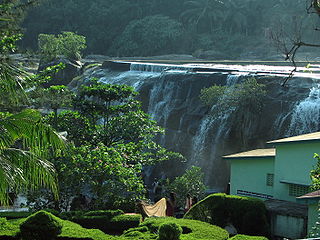
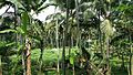
Thiruvarambu is one among the town of Thiruvattar town panchyat. The Thirparappu Falls is 3 km from Thiruvarambu. This having a canal like stream originated from some of the dams which provides more enough water to this village. Hence they plant banyan, coconut, banana, rubber, tapioca and other pulses such as pepper.
Kappukad/Kappukadu is an ancient village in southern Tamil Nadu in Kanyakumari District in Southern India. The village is also known as Kappiyankadu due to the belief that the ancient Tamil poet Tholkappiyar, the disciple of Agasthya, was born 1 May in the Tamil month of Chitirai on a pournami day in 865 BC.
Madichel is a village in Vilavancode taluk, Kanniyakumari district, Tamil Nadu, India. The village is near Kuzhithurai, a historical seaport where merchants came from across the Arabian sea in ancient times.
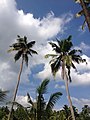
Thengapattanam, named after dense coconut grooves, is a major trade and tourism centre in the painkulam panchayath along the coastal plains of Kanyakumari district. Thengapattanam, once part of Travancore and later Kerala, was added to Tamil Nadu on 1 November 1956 along with some parts of today's Kanniyakumari District.
The St. Therese of Child Jesus Church, Kandanvilai is the first church which is dedicated to St. Therese after her beatification and blessed on 7 April 1924. Kandanvilai is a village in Kanyakumari District, Tamil Nadu, India. It is on the Nagercoil–Monday Nager Highway, 13 kilometres (8.1 mi) from Nagercoil. The nearest railway station is Erainel, and the nearest airport is Trivandrum. Kandanvilai Church has three substations; Eraniel, Chithanthopue and Pandaravilai.

Aruvikkarai is a village near Thiruvattar in Kanyakumari district in the state of Tamil Nadu, India. It lies near Thiruvattar, which is about 50 km from Thiruvananthapuram, Kerala. The nearest major city are Thiruvattar and Marthandam. Ponmanai is situated in the east, Thirparappu in the north-east and Arumanai in the north-west.. Hanging Bridge at Mathur is the prime attraction. Padmanabhapuram Palace, Thengapattinam, and Thriparappu Waterfalls are nearby tourist spots.

Kuzhithurai railway station is the second-biggest station in Kanyakumari district. For train transportation the Marthandam is the main hub for Kalkulam and Vilavancode talukas. The Kalkulam and Vilavancode talukas have the population around seven lakes. The Kuzhithurai station is found to be centered between Trivandrum–Kanniyakumari railway route. This railway station collection is more than seven crore per annum and a daily passenger patronage of more than 50,000 people. The station has two platforms and falls on the Kanniyakumari–Trivandrum line in the Trivandrum division of the Southern Railway zone. Most of all daily trains passing through the station halt in Kuzhithurai station