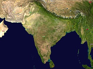
India is situated north of the equator between 8°4' north to 37°6' north latitude and 68°7' east to 97°25' east longitude. It is the seventh-largest country in the world, with a total area of 3,287,263 square kilometres (1,269,219 sq mi). India measures 3,214 km (1,997 mi) from north to south and 2,933 km (1,822 mi) from east to west. It has a land frontier of 15,200 km (9,445 mi) and a coastline of 7,516.6 km (4,671 mi).

Meghalaya is a state in northeast India. Meghalaya was formed on 21 January 1972 by carving out two districts from the state of Assam: (a) the United Khasi Hills and Jaintia Hills and (b) the Garo Hills. The estimated population of Meghalaya in 2014 was 3,211,474. Meghalaya covers an area of approximately 22,429 square kilometres, with a length-to-breadth ratio of about 3:1.

Northeast India, officially the North Eastern Region (NER), is the easternmost region of India representing both a geographic and political administrative division of the country. It comprises eight states—Arunachal Pradesh, Assam, Manipur, Meghalaya, Mizoram, Nagaland and Tripura, and the "brother" state of Sikkim.

East Khasi Hills is an administrative district in the state of Meghalaya in India. The district headquarters are located at Shillong. The district occupies an area of 2,748 km2 and has a population of 825,922. As of 2011, it is the most populous of Meghalaya's 12 districts.

Ri Bhoi is an administrative district in the state of Meghalaya in India. The district headquarters are located at Nongpoh. The district occupies an area of 2378 km² and has a population of 258,840. As of 2011 it is the second least populous district of Meghalaya, after South Garo Hills.

Karbi Anglong district is an administrative unit in the Indian state of Assam. It is an autonomous district administered by the Karbi Anglong Autonomous Council (KAAC) according to the provisions of the Sixth Schedule of the constitution of India. The district headquarters is in Diphu.

Dima Hasao district, is an administrative district in the state of Assam, India. As of 2011, it is the least populous district of Assam.

The Karbis or Mikir are a Tibeto-Burman ethnic group in Northeast India. They are mostly concentrated in the hill districts of Karbi Anglong and West Karbi Anglong of Assam.
The Dimasa language is a Tibeto-Burman language spoken by the Dimasa people of the Northeastern Indian states of Assam and Nagaland. The Dimasa language is known to Dimasas as "Grao-Dima" and it is similar to Boro, Kokborok and Garo languages. The Dimasa language is one of the oldest languages spoken in North East India, particularly in Assam, Nagaland.
Hamren is a hillside town and the headquarters of the West Karbi Anglong district in the Indian state of Assam.

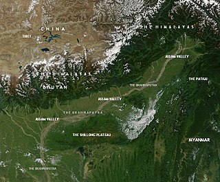
This article discusses the geological origin, geomorphic characteristics, and climate of the northeastern Indian state of Assam. Extending from 89° 42′ E to 96° E longitude and 24° 8′ N to 28° 2′ N latitude, it has an area of 78,438 km2, similar to that of Ireland or Austria.
Mikir Hills are a group of hills located to the south of the Kaziranga National Park, Assam. The easternmost Meghalaya comprising the detached Mikir Hills is partly isolated being surrounded by three sides. Karbi plateau or Mikir Hills is known as the oldest landform in Assam. It is pear-shaped and has an area of about 7000 sq. km.

The Dhansiri is an Indian river of Golaghat District of Assam and the Chümoukedima District and Dimapur District of Nagaland. It originates from Laisang peak of Nagaland. It flows through a distance of 352 kilometres (219 mi) from south to north before joining the Brahmaputra on its south bank. Its total catchment area is 1,220 square kilometres (470 sq mi).
Karbi Anglong plateau is an extension of the Indian Peninsular Plateau in Assam, a North Eastern state of India. This area receives maximum rainfall from the Southwest summer Monsoon from June through September.

Kaziranga National Park is an Indian national park and a World Heritage Site in Golaghat and Nagaon districts of Assam, India. It is refuge for the world's largest population of Great One-horned Rhinoceros. The park has many elephant, water buffalo and swamp deer. It is recognized as an Important Bird Area by BirdLife International for conservation of avifaunal species. The park has achieved notable progress in wildlife conservation despite several constraints.

The Karbi language is a Tibeto-Burman language spoken by the Karbi people of Northeastern India.

Kopili River is an interstate river in Northeast India that flows through the states of Meghalaya and Assam and is the largest south bank tributary of the Brahmaputra in Assam.

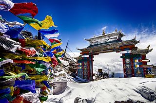
Northeast India consists of eight states: Arunachal Pradesh, Assam, Manipur, Meghalaya, Mizoram, Nagaland, Sikkim and Tripura. Tourism in this area is based around the unique Himalayan landscape and culture distinct from the rest of India.

The West Karbi Anglong district is an administrative unit in the Indian state of Assam. It is a relatively new district formed out of the existing Karbi Anglong district in 2016. The administrative headquarters of the district is located at Hamren. The district is a part of the Karbi Anglong Autonomous Council and is administered according to the provisions of the Sixth Schedule of the Indian Constitution.

Karbi Anglong Autonomous Council (KAAC) is an autonomous district council in the state of Assam, India for development and protection of tribals living in area namely Karbi Anglong and West Karbi Anglong district. The council is constituted under the Sixth Schedule of the Constitution of India and administratively functions under the Government of Assam. Its headquarters is in Diphu, Karbi Anglong district. The total administrative area of the Council is 10,434 sq. km with a population of 961,275 as of 2011.


