Related Research Articles

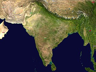
India is situated north of the equator between 8°4' north to 37°6' north latitude and 68°7' east to 97°25' east longitude. It is the seventh-largest country in the world, with a total area of 3,287,263 square kilometres (1,269,219 sq mi). India measures 3,214 km (1,997 mi) from north to south and 2,933 km (1,822 mi) from east to west. It has a land frontier of 15,200 km (9,445 mi) and a coastline of 7,516.6 km (4,671 mi).

The Vindhya Range is a complex, discontinuous chain of mountain ridges, hill ranges, highlands and plateau escarpments in west-central India.

The Chota Nagpur Plateau is a plateau in eastern India, which covers much of Jharkhand state as well as adjacent parts of Chhattisgarh, Odisha, West Bengal and Bihar. The Indo-Gangetic plain lies to the north and east of the plateau, and the basin of the Mahanadi river lies to the south. The total area of the Chota Nagpur Plateau is approximately 65,000 square kilometres (25,000 sq mi).

The geology of India is diverse. Different regions of India contain rocks belonging to different geologic periods, dating as far back as the Eoarchean Era. Some of the rocks are very deformed and altered. Other deposits include recently deposited alluvium that has yet to undergo diagenesis. Mineral deposits of great variety are found in the Indian subcontinent in huge quantities. Even India's fossil record is impressive in which stromatolites, invertebrates, vertebrates and plant fossils are included. India's geographical land area can be classified into the Deccan Traps, Gondwana and Vindhyan.

Periyar, IPA: [peɾijɐːr], is the longest river and the river with the largest discharge potential in the Indian state of Kerala. It is one of the few perennial rivers in the region and provides drinking water for several major towns. The Periyar is of utmost significance to the economy of Kerala. It generates a significant proportion of Kerala's electrical power via the Idukki Dam and flows along a region of industrial and commercial activity. The river also provides water for irrigation and domestic use throughout its course besides supporting a rich fishery. Due to these reasons, the river has been named the "Lifeline of Kerala". Kochi city, in the vicinity of the river mouth draws its water supply from Aluva, an upstream site sufficiently free of seawater intrusion. Twenty five percent of Kerala's industries are along the banks of river Periyar. These are mostly crowded within a stretch of 5 kilometres (3 mi) in the Eloor-Edayar region (Udhyogamandal), about 10 kilometres (6 mi) north of Kochi harbor.

Shahdol District is a district of Madhya Pradesh state in east central India. It old name was Matsya raj or Virat kingdom in the name of great king Maharaja Virata. With a total area of 6,205 km2 (2,396 sq mi) and a population of 10,66,063. Shahdol is an important district of Madhya Pradesh. The town of Shahdol is the district headquarters. The district formerly comprised Shahdol division.

Balaghat district is a district of Madhya Pradesh state in Central India. The town of Balaghat serves as its administrative headquarters.

Jhansi district is one of the districts of Uttar Pradesh state in northern India. The city of Jhansi is the district headquarters. The district is bordered on the north by Jalaun District, to the east by Hamirpur and Mahoba districts, to the south by Tikamgarh District of Madhya Pradesh state, to the southwest by Lalitpur District, which is joined to Jhansi District by a narrow corridor, and on the east by the Datia and Bhind districts of Madhya Pradesh. Population 19,98,603. Lalitpur District, which extends into the hill country to the south, was added to Jhansi District in 1891, and made a separate district again in 1974.
Amarpatan is a municipal city in Satna district in the state of Madhya Pradesh, India.
Bhander is a town and a nagar panchayat in Datia district in the state of Madhya Pradesh.
Pawai is a town and a nagar panchayat in the Panna district of Madhya Pradesh state in central India. It is mostly surrounded by rocky area.

The Western High Plateau, Western Highlands or Bamenda Grassfields is a region of Cameroon characterised by high relief, cool temperatures, heavy rainfall and savanna vegetation. The region lies along the Cameroon line and consists of mountain ranges and volcanoes made of crystalline and igneous rock. The region borders the South Cameroon Plateau to the southeast, the Adamawa Plateau to the northeast and the Cameroon coastal plain to the south.

Kaimur Range is the eastern portion of the Vindhya Range, about 483 kilometres (300 mi) long, extending from around Katangi in Jabalpur district of Madhya Pradesh to around Sasaram in Rohtas district of Bihar. It passes through the Rewa and Mirzapur divisions. The range never rises more than a few hundred metres above the surrounding plains and has a maximum width of around 80 km.
The Rewa Plateau covers a portion of Rewa district in the Indian state of Madhya Pradesh.
The Bijawar-Panna Plateau covers portions of Chhatarpur and Panna districts in the Indian state of Madhya Pradesh.
The Rohtas Plateau is a plateau that lies in the south-western part of the Indian state of Bihar.

Bhander Assembly constituency is one of the 230 Vidhan Sabha constituencies of Madhya Pradesh state in central India. This constituency is reserved for the candidates belonging to the Scheduled castes from its inception.
Bengabad is a village in the Bengabad CD block in the Giridih Sadar subdivision of the Giridih district in the Indian state of Jharkhand.
Mohanpur is a village in Mohanpur CD block in the Deoghar subdivision of the Deoghar district in the Indian state of Jharkhand.
Mirzaganj is a village in the Jamua CD block in the Khori Mahuwa subdivision of the Giridih district in the Indian state of Jharkhand.
References
- ↑ Bhander Plateau. Encyclopædia Britannica. Retrieved 2010-07-11.
- ↑ K. Bharatdwaj (2006). Physical Geography: Introduction To Earth. ISBN 9788183561631 . Retrieved 2010-06-28.
{{cite book}}:|work=ignored (help)