
Krishna district is a district in the coastal Andhra Region in Indian state of Andhra Pradesh, with Machilipatnam as its administrative headquarters. It is surrounded on the East by Bay of Bengal, West by Guntur, Bapatla and North by Eluru and NTR districts and South again by Bay of Bengal.

Bhadrachalam is a census town in Bhadradri Kothagudem district in the Indian state of Telangana. It is an important Hindu pilgrimage town with the Bhadrachalam Temple of Lord Rama, situated on the banks of Godavari river. It is located 312 kilometres (194 mi) east of state capital, Hyderabad,115 kilometres (71 mi) from Khammam,178 kilometres (111 mi) from Suryapet,180 kilometres (112 mi) from Warangal,187 kilometres (116 mi) from Vijayawada,220 kilometres (137 mi) and 350 kilometres (217 mi) from Visakhapatnam.

Miryalaguda is a city in Nalgonda district of the Indian state of Telangana. In 2015, the Government of India placed Miryalaguda under the Atal Mission for Rejuvenation and Urban Transformation scheme. It is located about 44 kilometres (27 mi) from the district headquarters Nalgonda, 142 kilometres (88 mi) from the state capital Hyderabad.

Nalgonda is a city and municipality in the Indian state of Telangana. It is the headquarters of the Nalgonda district, as well as the headquarters of the Nalgonda mandal in the Nalgonda revenue division. It is located about 90 kilometres (56 mi) from the state capital Hyderabad.

Guntur district is one of the twenty six districts in the Coastal Andhra region of the Indian state of Andhra Pradesh. The administrative seat of the district is located at Guntur, the largest city of the district in terms of area and with a population of 670,073. It has a coastline of approximately 100 km (62 mi) on the right bank of Krishna River, that separates it from Krishna district and NTR district. It is bounded on the south by Bapatla district and on the west by Palnadu district. It has an area of 2,443 km2 (943 sq mi) and with a population of 20,91,075 as per 2011 census of India.
Guntur is a city and the administrative headquarters of Guntur district in the Indian state of Andhra Pradesh. It is located on the Eastern Coastal Plains and is approximately 30 kilometres (19 mi) south of Amaravati, capital of the state. Based on 2011 Census of India data, city is the third most populous in the state with a population of 743,354. It is spread across 159.46 km square.
Jangaon (Janagama) is a city and the district headquarters of Jangaon district in the Indian state of Telangana. It is also the mandal and divisional headquarters of Jangaon Mandal and Jangaon revenue division respectively. It is about 85 kilometres (53 mi) from the state capital Hyderabad. It lies on the National Highway 163
Mancherial is a city and headquarters of the Mancherial district of the Indian state of Telangana. It is both the district and administrative headquarters of Mancherial mandal in the Mancherial revenue division. It is located on the north banks of the Godavari River. It is located about 244 kilometres (152 mi) from the state capital, Hyderabad, 84 kilometres (52 mi) from Karimnagar, 138 kilometres (86 mi) from Nirmal and 155 kilometres (96 mi) from Adilabad.

Repalle is a town in Bapatla district of the Indian state of Andhra Pradesh. The town is one of the 12 municipalities in Bapatla district and the headquarters of Repalle mandal under the administration of Repalle revenue division. It is situated near Krishna River in the Coastal Andhra region of the state.

Srisailam is a census town in Nandyal district of the Indian state of Andhra Pradesh. It is the mandal headquarters of Srisailam mandal in Atmakur revenue division. It is located about 160 kilometres (99 mi) from the district headquarters Nandyal, 180 kilometres (112 mi) from Kurnool, and it is located about 264 kilometres (164 mi) from Vijayawada. The town is famous for the Mallikarjuna Jyotirlinga Temple and is one of the holy pilgrimage sites for the Shaivism and Shaktism sects of Hinduism. The town is classified as both a Jyotirlinga and a Shakti Pitha.

Vinukonda is a town in Palnadu district of the Indian state of Andhra Pradesh. It is a municipality and the headquarters of Vinukonda mandal and administered under Narasaraopet revenue division.
Challapalli is a village in the Krishna district of the Indian state of Andhra Pradesh. It is located in the Challapalli mandal, Machilipatnam revenue division. Tollywood actor Nani is native of this village.
Piduguralla is a City in Palnadu district of the Indian state of Andhra Pradesh.The City is the headquarters of Piduguralla mandal and administered under Gurazala revenue division. The City is also known as Lime City of India as there are abundant reserves of limestone..
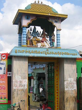
Pedakakani is a village in the Guntur district of the Indian state of Andhra Pradesh. It is located in Pedakakani mandal of Guntur revenue division. Hindu shrine of Shiva, Sri Bhramaramba Malleswara Swamy Temple is located in the village.
Addanki is a Municipal city in Bapatla district of the Indian State, Andhra Pradesh. Addanki North is the mandal headquarters of Addanki mandal in Addanki revenue division.
Inkollu is a small town located in the Bapatla district of the Indian state of Andhra Pradesh. It serves as the seat of Inkollu Mandal, an administrative district and is part of the chirala revenue division of Bapatla district. The nearest cities are Chirala, Bapatla, Guntur,Ongole, Addanki and Chilakaliripeta.

Dhone or Dronachalam is a town in Nandyal district of the Indian state of Andhra Pradesh. It is a municipality located in Dhone mandal. And it is the head quarters of Dhone revenue division.
Chilakaluripet is a city in Palnadu district of the Indian state of Andhra Pradesh. It is the Mandal headquarters of Chilakaluripet Mandal in Narasaraopet Revenue Division.
Narasaraopet mandal is one of the 28 mandals in Guntur district of the India state of Andhra Pradesh. It is under the administration of Narasaraopet revenue division and the headquarters are located at Narasaraopet city. The mandal is bounded by Rompicherla, Nekarikallu, Muppalla, Phirangipuram, Nadendla and Chilakaluripeta. It also borders Prakasam district.

Asifabad is a census town and the district headquarters of Kumuram Bheem district in the Indian state of Telangana. It is located in Asifabad mandal of Asifabad revenue division. It is situated on the banks of Peddavagu river. It is about 309 kilometres (192 mi) north of the state capital Hyderabad,86 kilometres (53 mi) from Ramagundam, 118 kilometres (73 mi) from Adilabad and 148 kilometres (92 mi) from Karimnagar.