
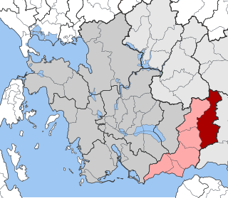
Aetolia-Acarnania is one of the regional units of Greece. It is part of the geographic region of Central Greece and the administrative region of West Greece. A combination of the historical regions of Aetolia and Acarnania, it is the country's largest regional unit. Its capital is Missolonghi for historical reasons, with its biggest city and economic centre at Agrinio. The area is now connected with the Peloponnese peninsula via the Rio-Antirio Bridge. The surrounding regional units take in Arta in Epirus, a narrow length bordering Karditsa of Thessaly, Evrytania to the northeast, and Phocis to the east.

Nafpaktos is a town and a former municipality in Nafpaktia, Aetolia-Acarnania, West Greece, situated on a bay on the north coast of the Gulf of Corinth, 3 km (2 mi) west of the mouth of the river Mornos.
Kryoneri may refer to numerous settlements in Greece:
Apodotia is a former municipality in Aetolia-Acarnania, West Greece, Greece. Since the 2011 local government reform it is part of the municipality Nafpaktia, of which it is a municipal unit. The municipal unit has an area of 257.635 km2. The seat of the municipality, established in 1996, was the village Ano Chora. An earlier municipality Apodotia existed between 1835 and 1912.

Chalkeia is a former municipality in Aetolia-Acarnania, West Greece, Greece. Since the 2011 local government reform it is part of the municipality Nafpaktia, of which it is a municipal unit. The municipal unit has an area of 114.189 km2. Population 2,219 (2021). The seat of the municipality was in Trikorfo.

Platanos is a village and a former municipality in Aetolia-Acarnania, West Greece, Greece. Since the 2011 local government reform it is part of the municipality Nafpaktia, of which it is a municipal unit. The municipal unit has an area of 169.678 km2. The community includes the village Kato Platanos. The river Evinos is situated east of the town.
Varetada is a small village in the municipality of Amfilochia, Aetolia-Acarnania, western Greece. Situated in the southern part of the Makrynoros mountains, its altitude is 480 meters above the sea level. Varetada is 10 km east of Amfilochia. In the village there is the church of Saint Demetrius and an old monastery.

Evinochori is a village and a community in the southern part of Aetolia-Acarnania, Greece. Evinochori is in the municipality of Missolonghi, located 10 km east of Missolonghi town centre. It is situated on the right bank of the river Evinos, about 10 km north of its outflow into the Ionian Sea. The community includes the village Nea Kalydona. Near Evinochori are the ruins of ancient Calydon, one of the most famous ancient cities in Aetolia.

Kryoneri is a seaside settlement in the community of Galatas, located about 14 km east from Messolonghi and west of Antirrio in Nafpaktia, Aetolia-Acarnania, Greece. According to the 2011 census, it had 94 inhabitants.

Nafpaktia, Latinized Naupactia, is the historical name for the region around the port town of Nafpaktos (Naupactus) in Central Greece.
Dafni is a village and a community in the municipality of Nafpaktia, Aetolia-Acarnania, Greece. The community consists of the villages Dafni, Kato Dafni and Trypou, now uninhabited. During the centuries of Ottoman occupation, Dafni was located higher up in the hills in an area called now Old Dafni (Paliodafni); of that settlement only the foundations of a few houses survive. The name Dafni means laurel. It comes either from the laurel plant that is indigenous to the area or from small plants called also dafni that grow in abundance on the banks of the nearby river Mornos.
Riza is a settlement in Aetolia-Acarnania, Greece. It is part of the community of Makyneia, within the municipality of Nafpaktia. According to 2011 census, it had 160 inhabitants.
Agrapidokampos is a settlement forming part of the community of Makyneia in Aetolia-Acarnania, Greece. At the 2011 census, it had 7 inhabitants. The village is located 5 km north of Makyneia, 8 km northwest of Antirrio and 10 km west of Nafpaktos.
Agios Polykarpos is a seaside settlement in Nafpaktia, Aetolia-Acarnania, Greece, located 6 km west of Antirrio and 15 km southwest of Nafpaktos. According to the 2011 census, it had 19 inhabitants.

Gavrolimni is a village and a community in Aetolia-Acarnania, western Greece, part of the municipality of Nafpaktia.
Molykreio is a village and a community in Nafpaktia, Aetolia-Acarnania, Greece. The community includes the villages Ano Platanitis, Fragkaiika and Platanitis.
Velvina is a village and a community in the municipal unit of Nafpaktos in Nafpaktia, Aetolia-Acarnania, Greece. According to the 2021 census, it had 43 inhabitants.
Platanitis is a settlement belonging to the community of Molykreio in Nafpaktia, Aetolia-Acarnania, Greece. At the 2011 census, the village had 606 inhabitants.
Galatas is a village and a community in western Chalkeia, Nafpaktia, Aetolia-Acarnania, Greece located at 14 m above sea level. According to the 2011 census, the village had 976 inhabitants, and the community, which includes the village Kryoneri, had 1,070 inhabitants.

Kravara is a historical socio-cultural mountain region in Aetolia-Acarnania, central Greece. It covers the northernmost part of the Nafpaktia Mountains, as well as parts of Thermo.

