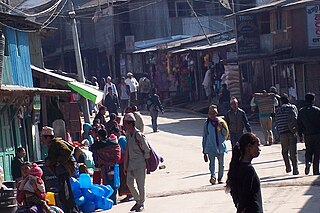
Boya is a village development committee in Bhojpur District in the Kosi Zone of eastern Nepal. At the time of the 1991 Nepal census it had a population of 4107 persons living in 447 individual households.
Deurali is a village development committee in Bhojpur District in the Kosi Zone of eastern Nepal. At the time of the 1991 Nepal census it had a population of 5367 persons living in 1052 individual households.
Jarayotar is a Village Development Committee in Bhojpur District in the Kosi Zone of eastern Nepal. At the time of the 2011 Nepal census it had a population of 4031 persons residing in 721 individual households. According to ancestors, this place had a large forest with many animals among which antelope were abundant and the land was dug by them to form a plain land. So, the name of the village was kept Jarayotar.
Kimalung,, is a village development committee in Bhojpur District in the Kosi Zone of eastern Nepal. At the time of the 1991 Nepal census it had a population of 1,594 persons living in 293 individual households.
Keurepani is a village development committee in Bhojpur District in the Kosi Zone of eastern Nepal. At the time of the 1991 Nepal census it had a population of 4,098 persons living in 794 individual households.
Khartimchha is a village development committee in Bhojpur District in the Kosi Zone of eastern Nepal. At the time of the 1991 Nepal census it had a population of 1847.
Kulung is a village development committee in Bhojpur District in the Kosi Zone of eastern Nepal. At the time of the 1991 Nepal census it had a population of 4095 persons living in 746 individual households. The postal code of Kulung bhojpur is 57001. The Kulung are one of the indigenous communities of Nepal, as well as parts of northeastern Sikkim and Darjeeling district of India, having their own Kulung language, culture, history and tradition. This name comes after their majority there but nowadays there is mixed locality.
Mulpani is a village development committee in Bhojpur District in the Kosi Zone of eastern Nepal. At the time of the 1991 Nepal census it had a population of 3,438 persons living in 705 individual households.
Nepaledanda is a village development committee in Bhojpur District in the Kosi Zone of eastern Nepal. At the time of the 1991 Nepal census it had a population of 3325 persons living in 659 individual households.
Siddheshwar is a village development committee in Bhojpur District in the Kosi Zone of eastern Nepal. At the time of the 1991 Nepal census it had a population of 3390 persons living in 630 individual households. Two major bazaars are Dama on the northwest ridge, where the secondary school is located, and Mandre in the eastern valley where the middle school is located.

The Eastern Development Region was one of Nepal's five development regions. It is also known as Kirata region. It was located at the eastern end of the country with its headquarters at Dhankuta. The town of Dhankuta was the headquarter of the Eastern Region, as well as the headquarter of the Dhankuta District.
Chainpur is a municipality in Sankhuwasabha District in the Kosi Zone of north-eastern Nepal. It was formed by merging five villages i.e. Chainpur, Siddhakali, Siddhapokhari, Baneshwar and Kharang. The municipality was implemented on 18 May 2014. At the time of the 1991 Nepal census it had a population of 4933 people in 948 households.
Piple, Tehrathum is a market center in Myanglung Municipality in the Himalayas of Terhathum District, Kosi Zone of eastern Nepal. Formerly known as the Village Development Committee, it merged into the municipality on May 18, 2014.

Pakhribas is an urban municipality out of three urban municipalities located in Dhankuta District of Province No. 1 of Nepal. Pakhribas municipality established on 2 December 2014 merging following VDCs: Pakhribas, Sanne, Phalate, Ghorlikharka and Muga.
Bhokraha is former a village development committee in Sunsari District in the Kosi Zone of south-eastern Nepal.Currently, it merged with Narsinghtappu to become a gaunpalika. At the time of the 1991 Nepal census it had a population of 12,683 people living in 2146 individual households.
Kaptanganj is a village development committee in Sunsari District in the Kosi Zone of south-eastern Nepal. At the time of the 1991 Nepal census it had a population of 6084 people living in 1034 individual households.

Bayarban was a village development committee in the Morang District, Koshi Zone of south-eastern Nepal. It was named for the village of Bayarban Bazar. In 2017 it was absorbed by the newly created Kanepokhari Rural Municipality.

Hoklabari was a village development committee in Morang District in the Koshi Zone of south-eastern Nepal. In 2017 it was absorbed by the newly created Kanepokhari Rural Municipality.
Jante is a village development committee in Morang District in the Kosi Zone of south-eastern Nepal. At the time of the 1991 Nepal census it had a population of 5622 people living in 1010 individual households. It contains various communities like Limbu, Rai, Brahmin, Chettri, Magar and Newar.It contains many temples and church. This village development committee is connected by the Jante-Pathari and Jante-Letang highways.
Katahari Gaupalika rural municipality, established in 2017, is a Gaupalika(rural municipality) located in the Morang District of the Kosi Zone in Province No. 1 of Nepal.


