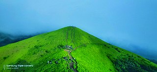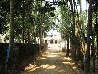
Kasaragod ([kɑːsɑrɡoːɖɨ̆] formerly known in English as Kassergode, and Malayalam as Kanhirakode, is a municipal town and administrative headquarters of Kasaragod district of Kerala state in India. Established in the year 1966, Kasaragod was the first municipal town in Kasaragod district. It is the northernmost district of Kerala and is also known as Saptha Bhasha Sangama Bhoomi.

South Canara was a district of the Madras Presidency of British India, located at 13.00°N 75.40°E. It covered the areas of the present-day Dakshina Kannada and Udupi districts of Karnataka, and the Kasaragod District of Kerala, with the capital in Mangalore. South Canara was one of the most heterogeneous areas of Madras Presidency, with Tulu, Malayalam, Kannada, Arebashe, Konkani, Marathi, Urdu, & Beary languages being spoken side by side. It was succeeded by the Tulu-spoken region of Dakshina Kannada, and the Malayalam-spoken regions of Kasaragod and Amindivi islands in the year 1956.

Thrikaripur a small town located in south part of Kasaragod District in the state of Kerala, India. Its southernmost end Olavara touches Payyannur, Kannur District.

The Tulu people or Tuluva people are an ethno-linguistic group native to Southern India. They are native speakers of the Tulu language and the region they traditionally inhabit is known as Tulu Nadu. This region comprises the districts of Dakshina Kannada and Udupi in Karnataka and a part of Kasaragod district in Kerala, with Mangalore, Karnataka being the commercial hub. The Census report of 2011 reported a population of 1,846,427 native Tulu speakers living in India.

Manjeshwar is a town and a minor port in Kasaragod district at the northern tip of Kerala. It is situated at a distance of 584 kilometres (360 mi) from the state capital Thiruvanathapuram, 28 kilometres (20 mi) north of district HQ Kasaragod and 30 kilometres (20 mi) south of Mangalore city in neighbouring Karnataka. It is a coastal town in Kasaragod district.

Udma is a census town in Kasaragod district in the Indian state of Kerala.

Kumbla is a small town in Kasaragod district of Kerala state in India. It is located 12 km north of Kasaragod town.

Kasaragod is one of the 14 districts in the southern Indian state of Kerala. Its northern border Thalappady is located just 10 km south to Ullal, which is the southernmost portion of the major port city Mangalore, on the southwestern Malabar coast of India.

Neerchal is a village in Kasaragod district of Kerala state, India. Neerchal is located 12 kilometers from Kasaragod.

Adhur is a village in Kasaragod district in the state of Kerala, India.

Badiyadka officially known as "Badiadka" is a town and gram panchayat in the Kasaragod district, state of Kerala, India.

Bandadka is a small town in Kasaragod district in the state of Kerala, India. Which is also called as kottakal because of Bandadka Fort.It comes under Kuttikol Panchayath. It belongs to North Kerala Division. It is located 37 km towards East from District headquarters Kasaragod and 592 km from State capital Thiruvananthapuram.Bandadka Pin code is 671541 and postal head office is Chengala.

Karadka is a village in Kasaragod district in the state of Kerala, India.

Karindalam is a village in Kasaragod district in the state of Kerala, India. As of 2001 India census, Karindalam had a population of 5690 with 2795 males and 2895 females.

Mangalpady is a Panchayath in Kasaragod district, Kerala. Uppala is the major town in this panchayat.

Angadimogar is a village in Kasaragod district in the state of Kerala, India, that is located 17.5 km from the city of Kasaragod. It is rich in arecanut and coconut trees.

Heroor is a village in Kasaragod district in the state of Kerala, India.

Mangad is a village in Thrissur district in the state of Kerala, India.There are others places called Mangad in Kasaragod, Kannur and Kollam.

Shiriya is a village in the Kasaragod district of Kerala, India. Shiriya is composed of several smaller villages, those being Shiriya, Shiriya kunnil, Muttam-gate, and Olayam.
Kasaragod is a taluk which along with Hosdurg taluk, Manjeshwaram Taluk and Vellarikundu taluk constitute the Kasaragod district, Kerala, India. Its educational center is Vidyanagar. The major areas include Kasaragod municipality, Chemnad, Bedira, and Chengala. The Central Plantation Crops Research Institute is located in the taluk.


