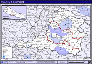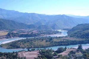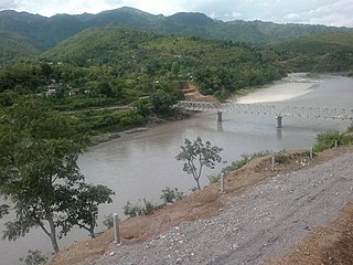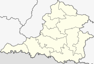
Syangja District, a part of Gandaki Province, is one of the seventy-seven districts of Nepal. The district, with Syangja bazaar as its district headquarters, covers an area of 1,164 km2 (449 sq mi) and had a population of 289,148 It lies in the hilly region at an altitude ranging from about 300 meters along the banks of Kaligandaki river up to a couple of thousands meters above the sea level. It lies at about latitude 28°4'60 North and longitude 83°52'0 East.
Dhut magar is the language of Magars, an ethnic group, indigenous native from Nepal. The Magar Language is mainly spoken in Nepal, but a small number of Nepali Magar people include from Southern Bhutan, Darjeeling, and Sikkim, India. It is divided into two groups and further dialect divisions give a distinct tribal identity. In Nepal, 788,530 people speak the language.

Waling Municipality, the heart of Syangja, is a small valley covered with hills formed on 27 January 1997 by merging of the then three VDCs namely Waling, Dhanubase and Pekhubaaghkhor. It is a town and municipality in the western hilly region of Nepal. It is in the Aadhikhola valley in Syangja District, Gandaki Zone of Nepal. Waling will be the first municipality to have houses all coloured with pink and will be named as Pink City. Waling has grabbed an award for the best municipality of the country.

Alamdevi is a village development committee in Syangja District in the Gandaki Zone of central Nepal. At the time of the 2011 Nepal census it had a population of 3844 people living in 908 individual households. Alamdevi Temple appeared on the national stamps in 2019.

Chapakot is a municipality in the southeastern part of Syangja District in Gandaki Pradesh of central Nepal. The new municipality was formed by merging three existing villages—Ratnapur, Kuwakot and Chapakot—on 18 May 2014. In 12 March 2017 The government implemented the new local administrative structure consisting of 744 local units. With the implementation of this new local administrative structure, the old structure will no longer be in existence. According to the new structure, VDCs will be replaced with village councils. Newly merged VDCs are Sankhar, Sekham, Ward no. 8 of Pakbadi & Ward no. of Malengkot. The office of the municipality is that of the former Chapakot Municipality.
Chisapani, Gandaki is a village development committee in Syangja District in the Gandaki Zone of central Nepal. At the time of the 2011 Nepal census it had a population of 4281 people living in 953 individual households.

Phedikhola is a Village council in Syangja District in Gandaki Pradesh, central Nepal.

Jagatradevi is a village development committee in Syangja District in the Gandaki Zone of central Nepal. At the time of the 2011 Nepal census it had a population of 8700 people living in 2050 individual households.

Pelakot is a village development committee in Syangja District in the Gandaki Zone of central Nepal. At the time of the 2011 Nepal census it had a population of 5748 people living in 1220 individual households.

Sankhar is a village development committee in Chapakot Municipality of Syangja District in Gandaki Pradesh of central Nepal. At the time of the 2011 Nepal census it had a population of 4,630 people residing in 1,055 individual households. Majuwa, Mohami, Bhattarai Danda, Keladighat, Patasar, Panglung, Salghari, Manechaur, Khasa Bankata, Pipalchhap, Khardi, Samakot, Tangle, Gahate, Ajingare, and Hadiban are major villages in Sankhar.

Srikrishna Gandaki is a village development committee in Syangja District in the Gandaki Zone of central Nepal. At the time of the 2011 Nepal census it had a population of 8815 people living in 1993 individual households.

Rampur is a municipality in Palpa District in Lumbini Province of West southern Nepal. According to hindu mythology, Maharishi Vasistha taught Yogavasistha to lord Rama in the cave of Rampur. Rampur is 65 km northeast from the headquarter city Tansen. The valley is bounded by Syangja District in the north, Tanahun District in the northeast, and Nawalparasi District in the east. The popular religious river Kaligandaki disconnects the boundary in the northern part.

Keladi is a village in Sankhar VDC at Ward No-6, Nepal.

Bhirkot is a municipality in Syangja District of Gandaki Zone of central Nepal. The new municipality was formed by merging four existing villages—Banethok Deurali, Darsing Dahathum, Dhapuk Simal Bhanjyang and Khilung Deurali—on 18 September 2015. The office of the municipality is that of the former Darsing Dahathum village development committee's Bayarghari Bazaar.

Gandaki Province is one of the seven federal provinces established by the current constitution of Nepal which was promulgated on 20 September 2015. Pokhara is the province's capital city. It borders the Tibet Autonomous Region of China to the north, Bagmati Province to the east, Karnali Province to the west, and Lumbini Province and Bihar of India to the south. The total area of the province is 21,504 km² - about 14.57% of the country's total area. According to the latest census, the population of the province was 2,403,757. The newly elected Provincial Assembly adopted Gandaki Province as the permanent name by replacing its initial name Province no. 4 in July 2018. Krishna Chandra Nepali is the present chief minister of Gandaki province

Samakot is a village in Sankhar village development committee Ward No-2, Syangja District, Gandaki Zone, Nepal. According to the 2011 Nepal census, held by Central Bureau of Statistics, it had a total population of 141. There are 120 males and 261 females living in 82 households.

Murchaur is a village in Sankhar village development committee Ward No-9, Syangja District, Gandaki Zone, Nepal. According to the 2011 Nepal census, held by Central Bureau of Statistics, it had a total population of 241.

Manechaur is a village in Sankhar village development committee Ward No-4, Syangja District, Gandaki Zone, Nepal. According to the 2011 Nepal census, held by Central Bureau of Statistics, it had a total population of 201.

Galyang is a Municipality in Syangja District in Gandaki Pradesh, central Nepal. In 12 March 2017, The government of Nepal implemented the new local administrative structure consisting of 744 local units. With the implementation of this new local administrative structure, VDCs have been replaced with village councils. Galyang is one of these 744 local municipal units. Galyang is created by merging Malunga, Jagatradevi, (1-6,9) Wards of Pakwadi, (1,6-9) Wards of Tindobate, Tulsibhanjyang, Nibuwakharka, PindikholaBatuwa & (1-4,7-9) Wards of Pelakot.


