
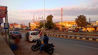
Dhamtari is a municipal corporation and headquarters of the Dhamtari district in the state of Chhattisgarh, India, which is part of the Mahasamund Lok Sabha constituency formed on 6 July 1998. The district is home to 3.13 percent of Chhattisgarh's total population.
Indravati National Park is a national park located in Bijapur district of Chhattisgarh state in India. The park derives its name from the Indravati River, which flows from east to west and forms the northern boundary of the reserve with the Indian state of Maharashtra.

Jagdalpur is a city located in the southern part of Chhattisgarh state in India. It is the administrative headquarters of the Bastar district and Bastar division. Before the independence of India, it also served as the capital of the erstwhile princely state of Bastar.
Malkangiri, historically known as Malikamardhangiri, is a town and municipality in Malkangiri district in the Indian state of Odisha. It is the headquarter of the Malkangiri district. Malkangiri has been the new home of the East Bengali refugees from erstwhile East Pakistan, who have been rehabilitated since 1965 under the Dandakaranya Project. Some Sri Lankan Tamil refugees were also rehabilitated in the town, following the armed struggle of the Liberation Tigers of Tamil Eelam (LTTE) in the early 1990s, although most of them have now returned to their country. Currently, it is one of the most naxalite-affected areas of the state, and is a part of the Red Corridor.

Bade Bacheli is a town and a Nagar Palika in Dantewada district in the state of Chhattisgarh, India. It is now very well known as NMDC Township with nature all around to explore and witness. It is situated roughly 400 km from Raipur, capital of Chhattisgarh. The way to travel is by Road with frequent bus service from Raipur, Bhilai, Jagdalpur, and Hyderabad, Visakhapatnam or by train from Jagdalpur and Vishakhapatnam.
Geedam is a census town and tehsil in Dantewada district in the state of Chhattisgarh, India. It is situated in National highway number 63 about 75 km from Jagdalpur. It is a town between the Bijapur-Jagdalpur NH63 route. About 15 km away from Dantewara City. It has a railway station about 3 km from the proper town and a helipad just 1km away from the town. Bus connectivity for Raipur, Jagdalpur City, Vishakapatnam City, Hyderabad City, Dantewara, Bijapur, Sukma, Bhopalpatnam, Barsoor and Kirandul is available.
Kanker is a municipality and the headquarters of Kanker District, in the Indian state of Chhattisgarh. It is the second largest city of Bastar division after Jagdalpur.

Khariar is a city and a Notified Area Council in Nuapada District of the Indian state of Odisha.

Kirandul is a town and a municipality in Dantewada district in the Indian state of Chhattisgarh. It is located roughly 400 km south of Raipur, capital of Chhattisgarh and 41 km southwest of Dantewada-the district headquarters. The way to travel is by road with frequent bus service from Raipur, Bhilai and Jagdalpur or by train from Jagdalpur and Visakhapatnam.It has the world's largest iron ore mine according to 2021 survey
Kondagaon a municipality about 70 kilometers from Jagdalpur city is the headquarter of Kondagaon district in the Indian state of Chhattisgarh. It is the third largest city of Bastar division. Kondagaon separated from Bastar district on 24 January 2012 and formed as 27th district of the Chhattisgarh state. It is mostly renowned for its bell metal craft and other art forms native to the tribal of Bastar. Also known as the Shilp sheher of Chhattisgarh owing to the variety of indigenous crafts produced in the area.

Swami Vivekananda Airport, formerly known as Mana Airport, is a domestic airport serving the state of Chhattisgarh, India. The airport is located at Mana, approximately 15 km (9.3 mi) south-east of Raipur and 10 km (6.2 mi) east of Naya Raipur, situated conveniently between the two cities. On 24 January 2012, the airport was renamed after Swami Vivekananda, the iconic Hindu monk and philosopher who spent three years of his youth in Raipur between 1877 and 1879.

Nava Raipur, officially known as Atal Nagar-Nava Raipur, is a planned city and fully Greenfield city in Indian state of Chhattisgarh. It is planned to replace Raipur as the capital city of Chhattisgarh. The Government of Chhattisgarh, the state's administrative body is situated here. The city is located between National Highway 53 and National Highway 30, about 17 km south-east of the capital city Raipur. Swami Vivekananda Airport separates Raipur and Nava Raipur.
Pharasgaon or Parasgaon is a town in Kondagaon district, Chhattisgarh, India.

National Highway 30 is a primary national highway in India. NH 30 connects Sitarganj in Uttarakhand with Ibrahimpatnam, Vijayawada in Andhra Pradesh. The total length of this highway is 1,984.3 km (1,233.0 mi). It starts at the junction of NH 9 at Sitarganj and ends at the junction of NH 65 at Ibrahimpatnam, Vijayawada. Development of Ibrahimpatnam-Jagadalpur Route is under process. Rajdeep Rohan joint venture is the contract agency for this project. Second bridge which was under construction completed on 17 April 2024 at pilgrimage city of Bhadrachalam which is famous for temple of Lord Shri Rama. NH-30 runs through the states of Uttarakhand, Uttar Pradesh, Madhya Pradesh, Chhattisgarh, Telangana and Andhra Pradesh in India.
The proposed Dalli Rajhara–Jagdalpur rail line, on paper for almost three decades, once completed, would connect Dalli Rajhara to Jagdalpur, both towns being in Chhattisgarh state in India. It would also connect Raipur, the capital city of Chhattisgarh, to Jagdalpur by rail via Durg. Jagdalpur, which is about 300 km from Raipur, is currently meaningfully connected to it only by road. There is though a roundabout rail route to reach Raipur from Jagdalpur via Koraput and Rayagada in Orissa; it is much longer and takes much longer time to be of any utility. In view of this, almost all the transport, in relation to both people and goods, between Raipur and Jagdalpur, happens only by road.
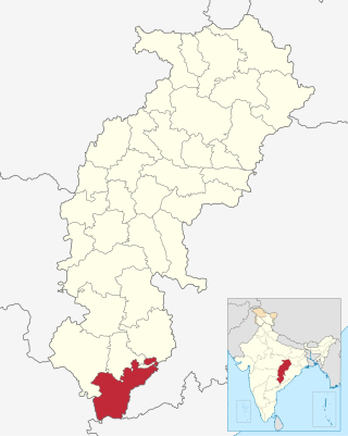
Sukma district is the southernmost district in the Indian state of Chhattisgarh. It is located in the Bastar region, known for its tribal culture. Sukma district borders with Odisha, Telangana and Andhra Pradesh.
Alor or Allur is a village in Chhattisgarh, India.
Antagarh is a town and a Nagar Panchayat located in the Kanker district of Chhattisgarh, India. It is the administrative headquarters of its eponymous development block, tehsil, and Assembly constituency.
Aamaguhan is a settlement situated in Bade Rajpur Tehsil of Bastar District of the Indian state of Chhattisgarh. It is a medium-sized village that falls under the Gram Panchayat of Baijanpuri and Baderajpur with Kondagaon.

Raipur–Visakhapatnam Expressway (NH-130CD), part of Raipur–Visakhapatnam Economic Corridor (EC-15), is an under-construction, six-lane, 464 km (288 mi) long greenfield expressway, which will pass through the states of Chhattisgarh, Odisha and Andhra Pradesh in central and east-central India. At present, from Durg, it runs between NH-30 and NH-130C till Borigumma, then runs east of NH-26 till Sunabeda and then west of NH-26 till Visakhapatnam after terminating with NH-16 at Vizianagaram. Along the new route, it will connect Raipur by starting at Abhanpur in Raipur district with the cities of Dhamtari, Kanker, Kondagaon, Koraput, and Sabbavaram before terminating at Visakhapatnam Port.


