Khairachatar

Last updated
Khairachatar
town
Khairachatar NRJ.jpg
India Jharkhand location map.svg
Red pog.svg
Khairachatar
India location map.svg
Red pog.svg
Khairachatar
Coordinates: 23°32′21″N85°55′58″E / 23.53917°N 85.93278°E / 23.53917; 85.93278
CountryFlag of India.svg  India
State Jharkhand
District Bokaro
Elevation
400 m (1,300 ft)
Population
 (2011)
  Total2,363
Time zone UTC+5:30 (IST)
Vehicle registration JH

Khairachatar is a small town and a gram panchayat in Bokaro district in the Indian state of Jharkhand. It is the most developed gram panchayat in Kasmar block of Bokaro District in terms of economy and literacy.

Contents

Geography

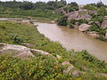
Khairachatar is located in Kasmar Block of Bokaro District. It lies at the fringes of Chota Nagpur Plateau and has an average elevation of 400 metres above mean sea level.

Economy

Approximately 50 villages are dependent on markets located in Khairachatar for basic needs. It witnesses a tremendous congregation of people from surrounding villages on Monday, Wednesdays and Saturdays who attend Bazaar in order to sell and purchase goods. Agriculture is by far the most important medium of earning in the surrounding villages, although a large part of the population of Khairachatar derives its income from small businesses. Another major source of income is money sent by a large number of immigrants working in distant cities. Khariachatar is witnessing small industrial growth as well. A few steel workshops, flour mills, and dairy farms have been set up.

Transportation

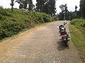
Roads are the only medium one can use to reach Khairachatar. It is not connected to rail lines; the nearest rail station is the Bokaro/Pundag rail station. The closest commercial airport to Khairachatar is in Ranchi. Many buses, mini buses, and cars travel daily to all major nearby places.

Education

Educational institutions in Khairachatar include:

Demographics

In 2011, the India census determined that Khairachatar had a population of 2363 of which 1239 are males while 1124 are females. The population of children with age 0-6 is 296, which makes up 12.53% of the total population of the village. The average Sex Ratio of Khaira Chatar village is 907 which is lower than the Jharkhand state average of 948. The Child Sex Ratio for the Khairachatar as per census is 783, lower than the Jharkhand average of 948. The village has a higher literacy rate compared to Jharkhand. In 2011, the literacy rate of Khairachatar was 79.00% compared to 66.41% of Jharkhand. In Khairachatar Male literacy stands at 89.00% while female literacy rate was 68.21%. [1] Khairachatar has a government facilitated hospital. Khairachatar boasts its high educational standards in the science, art, and commerce streams of education. Khairachatar has been a major beneficiary of The Mahatma Gandhi National Rural Employment Guarantee Act although a large part of the population is still dependent on agriculture. It is home to a harmonious blend of people of different castes and religion. It is known for its many festival celebrations throughout the year. Durga Puja is particularly popular.

Durga Puja Celebration Durga Puja NRJ.jpg
Durga Puja Celebration

Related Research Articles

<span class="mw-page-title-main">Purulia district</span> District in West Bengal, India

Purulia district is one of the twenty-three districts of West Bengal state in Eastern India. Purulia is the administrative headquarters of the district. Some of the other important towns of Purulia district are Raghunathpur-Adra, Jhalda, Anara and Balarampur.

<span class="mw-page-title-main">Dhanbad district</span> District of Jharkhand in India

Dhanbad district is one of the twenty-four districts of Jharkhand state, India, and Dhanbad is the administrative headquarters of this district. As of 2011, it is the second most populous district of Jharkhand, after Ranchi. It also has the lowest sex ratio in Jharkhand, at 908.

Bermo is a community development block that forms an administrative division in the Bermo subdivision of the Bokaro district, Jharkhand state, India.

Chandankiyari is a community development block that forms an administrative division in the Chas subdivision of the Bokaro district in the Indian state of Jharkhand.

Chas is a community development block that forms an administrative division in the Chas subdivision of the Bokaro district, Jharkhand state, India.

Jaridih is a community development block that forms an administrative division in the Bermo subdivision of the Bokaro district, Jharkhand state, India.

Gomia is a community development block that forms an administrative division in the Bermo subdivision of the Bokaro district, Jharkhand state, India.

Kasmar is a community development block that forms an administrative division in the Bermo subdivision of the Bokaro district, Jharkhand state, India.

Nawadih is a community development block that forms an administrative division in the Bermo subdivision of the Bokaro district, Jharkhand state,

Petarwar is a community development block that forms an administrative division in the Bermo subdivision of the Bokaro district, Jharkhand state, India.

<span class="mw-page-title-main">Chandrapura</span> Census Town in Jharkhand, India

Chandrapura is a census town in the Chandrapura CD block in the Bermo subdivision of the Bokaro district in the Indian state of Jharkhand. It is situated on the northern banks of the river Damodar. The town is well known for the Chandrapura Thermal Power Station, a thermal-coal based power generation unit of Damodar Valley Corporation (DVC) and De Nobili school which was established by Roberto de Nobili. The school is one of 16 schools supported by Damodar Valley Corporation, an Indian state-owned corporation.

Malkera is a census town in Baghmara CD block in Dhanbad Sadar subdivision of Dhanbad district in the Indian state of Jharkhand.

Tenudam-cum-Kathara is a census town in the Gomia CD block in the Bermo subdivision of the Bokaro district in the Indian state of Jharkhand.

<span class="mw-page-title-main">Mankada</span> Village in Kerala, India

Mankada is a hillside village in the Malappuram district of Kerala state. It is located 15 km (9.3 mi) from Malappuram and is part of the Malappuram parliament constituency. The municipal town of Perinthalmanna is just 10 km (6.2 mi) away. Also, the municipal towns of Manjeri and Malappuram are just 15 km (9.3 mi) away. Mankada Kadannamanna Kovilakam was the seat of ruling family of the erstwhile Kingdom of Valluvanad.

Hirekudi is a village in the southern state of Karnataka, India. It is located in the Chikodi taluk of Belgaum district in Karnataka.

Sono is a 'tehsil'/block in the Jamui district of the Indian state of Bihar. It lies in the southern part of Bihar very close to the Jharkhand border. Sono block is divided into 19 Gram panchayats.

Gopaipali is a small village under Barpali block in Bargarh District with village code 72500 as per 2001 Census.

Chandrapura is a community development block that forms an administrative division in the Bermo subdivision of the Bokaro district, Jharkhand state, India.

<span class="mw-page-title-main">Mokar</span> Village in Bihar, India

Mokar is a Village located in Sasaram tehsil of Rohtas district in Bihar, India. It is situated 5 km away from Sasaram, which is both district & sub-district headquarter of Mokar village. As per 2009 stats, Mokar village is also a gram panchayat.

<span class="mw-page-title-main">Sijua, Bokaro</span> Census Town in Jharkhand, India

Sijua is a Census town and Gram Panchayat in the Chandrapura CD Block in the Bermo subdivision of the Bokaro district in the state of Jharkhand, India. The Sijua Gram Panchayat consists of mainly SC & OBC Populations.

References

  1. "Khaira Chatar Village Population - Kasmar - Bokaro, Jharkhand".