Khandvi

Last updated

Khandvi
Village
Gate of Khandvi.jpg
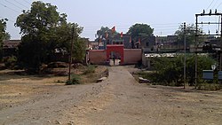
Entrance of the Khandvi village
India Maharashtra location map.svg
Red pog.svg
Khandvi
Location in Maharashtra, India
India location map.svg
Red pog.svg
Khandvi
Khandvi (India)
Coordinates: 20°58′21″N76°28′42″E / 20.9725°N 76.4782°E / 20.9725; 76.4782
CountryFlag of India.svg  India
State Maharashtra
District Buldana
Languages
  Official Marathi
Time zone UTC+5:30 (IST)
Vehicle registration MH-28

Khandvi is a village in Jalgaon Jamod tehsil of Buldhana district, Maharashtra. [1]

Contents

Location

Situated on the confluence of State highways 194 and 196, it serves as an important juncture connecting the Jalgaon Jamod tehsil of Buldhana district to the Muktainagar tehsil of the adjacent Jalgaon Khandesh district.

Demographics

Employment

The main occupation of the village is agriculture.

Places of Importance

There is a temple of Gajanan Maharaj, created on the land donated by Shree Nitin Dnyandeo Pachpor. It is also the birthplace of Mr. Pushkar Pachpor

Notes

  1. "Basic Population Figures of India, States, Districts, Sub-District and Village, 2011". censusindia.gov.in. Ministry of Home Affairs. 2011. Archived from the original on 11 July 2022. Retrieved 10 May 2025.