
Bardiya District, one of the seventy-seven Districts of Nepal, is part of Lumbini Province of Nepal. The district, with Gulariya as its headquarters, covers an area of 2,025 km2 (782 sq mi) and according to the 2001 census the population was 382,649 in 2011 it has 426,576.
Dadeldhura district, a part of Sudurpashchim Province, is one of the seventy-seven districts of Nepal. The district, with Dadeldhura as its district headquarters, covers an area of 1,538 km2 (594 sq mi) and had a population of 126,162 in 2001 and 142,094 in 2011.

A Village Development Committee (VDC) in Nepal was the lower administrative part of its Ministry of Federal Affairs and Local Development. Each district had several VDCs, similar to municipalities but with greater public-government interaction and administration. There were 3,157 village development committees in Nepal. Each VDC was further divided into several wards depending on the population of the district, the average being nine wards.

Pagretar is a village development committee in Sindhupalchowk District in the Bagmati Zone of central Nepal. Kothe is a populated location within the committee area. In 1991, there were 633 houses, and at the time of the 2001 Nepal census Pagretar had a population of 3,352. By 2011, the population had become 2,952 in 762 households.
Bishalpur is a village development committee in Baitadi District in Sudurpashchim Province of western Nepal. At the time of the 2011 Nepal census it had a population of 4,174 and had 699 houses in the village.
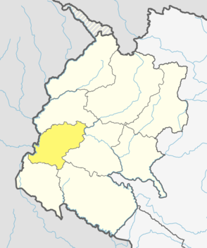
Durgasthan is a village development committee in Baitadi District in the Mahakali Zone of western Nepal. At the time of the 2011 Nepal census it had a population of 3995 and had 726 houses in the town. It had a male population of 1784 and a female population of 2211.
Gajuri(Nepali: गजुरी ; gajuri) is a Gaupalika in Dhading District in the Bagmati Zone of central Nepal. It has a literacy rate of 64.28%. The city hosts as one of the city with highest literacy rate in the Dhading district. The local body was formed by merging three VDCs namely Gajuri, Pida, Nepal, Kiranchok.
Jorpati is a village and former Village Development Committee that is now part of Gokarneshwar Municipality in Kathmandu District in Province No. 3 of central Nepal. At the 2011 census it had a population of 84,567 making it one of the largest villages in the world. At the time of the 1991 Nepal census it had a population of 10,796 and had 1,988 households in it.
Mulpani is a village and former Village Development Committee that is now part of Kageshwari-Manohara Municipality in Kathmandu District in Province No. 3 of central Nepal. Mulpani was previously known as Bhaimal, meaning "no fear". At the time of the 1991 Nepal census it had a population of 4,718 living in 843 households. The main occupation of the people living in this village is agriculture. Mulpani is surrounded by Bagmati and Manohara river. Mulpani is famous for the Nepal's biggest International Cricket Ground, known as Mulpani Cricket Stadium, which is under construction. In the recent years, Mulpani has seen much change in its infrastructure and people as well. The main occupation in Mulpani was agriculture but now employment is more diverse.
Kapalleki is a village development committee in Doti District in the Seti Zone of western Nepal. At the time of the 2011 Nepal census it had a population of 4049.
Chhinnamasta is a village development committee in Saptari District in the Sagarmatha Zone of south-eastern Nepal. At the time of the 2011 Nepal census it had a population of 10,136 people living in 1,916 individual households.
Talawang is a village development committee in Rolpa District in the Rapti Zone of mid-western development region of north-eastern Nepal. At the time of the 2011 Nepal census it had a population of 5180 people living in 1048 individual households.
Banfikot is a village development committee in Western Rukum District in Karnali Province of western Nepal. At the time of the 2011 Nepal census it had a population of 5164 people living in 1075 individual households.
Bhalakachha is a village development committee in Western Rukum District in Karnali Province of western Nepal. At the time of the 2011 Nepal census it had a population of 3713 people living in 748 individual households.
Chaurjahari is a Municipality in Western Rukum District in Karnali Province of Nepal that was established in 2015 through the merging the two former Village development committees Bijayaswori and Kotjahari. It lies on the bank of Sani Bheri River. At the time of the 2011 Nepal census it had a population of 27,438 people living in 5,422 individual households.
Muru is a village development committee in Western Rukum District in Karnali Province of western Nepal. At the time of the 2011 Nepal census it had a population of 3931 people living in 788 individual households.
Nuwakot is a former village development committee in Western Rukum District in Karnali Province of western Nepal. At the time of the 2011 Nepal census it had a population of 5709 people living in 1059 individual households..
Pathari Shanishchare (पथरी-शनिश्चरे) is a Municipality in Morang District in the Koshi Zone of south-eastern Nepal. It was formed by merging three existing village development committees i.e. Hasandaha, Pathari and Sanischare in May 2014.
Nepal conducted a widespread national census in 2011 by the Nepal Central Bureau of Statistics. Working with the 58 municipalities and the 3915 Village Development Committees at a district level, they recorded data from all the municipalities and villages of each district. The data included statistics on population size, households, sex and age distribution, place of birth, residence characteristics, literacy, marital status, religion, language spoken, caste/ethnic group, economically active population, education, number of children, employment status, and occupation.

Bhanu is a municipality of Tanahun District in Gandaki Zone of western Nepal. The municipality was established on 19 September 2015 by merging the existing Bhanu village development committee or VDC, Barbhanjyang VDCs, Rupakot (VDC), Tanahunsur Village Development Committee, Purkot VDC, Mirlung VDC, Satiswara VDC, Risti VDC, Basantapur VDC and Chok Chisapani VDC. The center of the municipality is established in former VDC Office of Bhanu. After merging the population of all of the VDCs, it had a total population of 46,179 according to 2011 Nepal census. After the government decision the number of municipalities has reached 217 in Nepal. Nepali poet Bhanubhakta Acharya was born in Bhanu Municipality. It was named after him.
