Kheda is a city and a municipality in the Indian state of Gujarat. It was former administrative capital of Kheda district. India's First Deputy Prime Minister Vallabhbhai Patel Was Born In Kheda District of Gujarat State. Kheda city is famous for tobacco farming. The nearest railway station is Mahemadavad Kheda Road. The nearest airport is Ahmedabad airport. The nearest bus station is Kheda Bus Station.
Limbdi is a taluka in Surendranagar district in the Indian state of Gujarat.
Devgadh Baria is a municipality in Dahod district in the state of Gujarat, India. It is a small town nestled in the foothills on the eastern border of Gujarat State. It is 41 kilometers from Godhra in the west, 55 kilometers from Dahod in the east and 14 kilometers south of Ahmedabad-Indore highway. Devgadh Baria is located on the bank of Panam River and is part of Dahod district in the state of Gujarat. The name, Devgadh Baria of the place derived two words Devgadh and Baria. Devgadh is the name of the mountain that is surrounding the town and Baria is the name of local tribe.
Dhrangadhra is a town, taluka headquarters and a municipality in Surendranagar district in the state of Gujarat, India. During the period of the British Raj, the city was the capital of Dhrangadhra State, one of the eight first-class princely states of the Kathiawar Agency in the Bombay Presidency.
Radhanpur is a city and a municipality in Patan district in the Indian state of Gujarat.
Chandlodia is an area under Ahmedabad Municipal Corporation in Ahmedabad district in the state of Gujarat, India.
Dahegam is a city and a municipality in the Gandhinagar district in the state of Gujarat, India.
Dhandhuka is a city and a municipality in the Ahmedabad district in the state of Gujarat, India. Moreover, it is a part of the Bhal region.
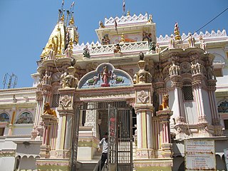
Gadhada is a town and a municipality in Botad District in the state of Gujarat, India. Gadhada is situated at bank of River Ghela. Swaminarayan lived here for more than 25 years.
Kheralu is a city and a municipality in Mehsana district in the Indian state of Gujarat. It is a little north of Mahesana Proper town and it is approximately half the size of Mehsana.
Lambha is a census town in Ahmadabad district in the Indian state of Gujarat. Parts of Vejalpur, Daskroi, Danilimda, Vatva, and Maninagar assembly constituencies jut into Lambha. Many parts of Kheda, Gandhinagar, Ahmedabad West, and Ahmedabad East Lok Sabha constituencies fall in Lambha.

Prantij is a town and a municipality in Sabarkantha district in the Indian state of Gujarat.
Ramol is a city and a municipality in Ahmedabad district in the Indian state of Gujarat.
Surgana is a census town and taluka in Nashik District in the Indian state of Maharashtra.
Thaltej is a census town and a suburb in Ahmedabad district in the Indian state of Gujarat. The town comes under Ward No:8, North West Zone of Ahmedabad Municipal Corporation, the civic body that governs the City of Ahmedabad.
Vastral is a posh locality and a municipality in Ahmedabad district in the Indian state of Gujarat.
Vejalpur is a Census Town in the New West Zone of the metropolitan city of Ahmedabad in the Indian state of Gujarat.
Jodhpur is a city and a municipality in Ahmedabad district in the Indian state of Gujarat.
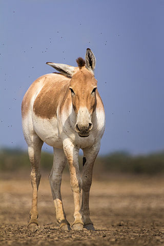
The Indian wild ass, also called the Indian onager or, in the local Gujarati language, Ghudkhur and Khur, is a subspecies of the onager native to South Asia.
Khopala is a village and a grampanchayat in Botad district in the state of Gujarat, India. Khopala is situated near Gadhada.

