
Da'el is a town in southern Syria located on the old road between Daraa and Damascus, located approximately 14 kilometers north of Daraa. Administratively, it belongs to the Daraa District of the Daraa Governorate and is the center of the Da'el nahiyah ("subdistrict") which also includes one other town, Abtaa, to the immediate north. Other nearby localities include Tafas to the west, Ataman to the south, Khirbet al-Ghazaleh to the east, Nimer and Qarfa to the northeast, al-Shaykh Maskin to the north and al-Shaykh Saad to the northwest.

Tubna is a village in southern Syria, administratively part of the Daraa Governorate in the Hauran region. It is located 58 km south of Damascus and 42 km from Daraa.
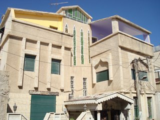
Al-Hirak is a town in southern Syria, administratively belonging to the Izra' District of the Daraa Governorate. It is situated about 40 kilometers northeast of Daraa, and is surrounded by the towns of Maliha al-Gharbiyah to the east and Izra' to the northeast. According to the 2004 census by the Central Bureau of Statistics, al-Hirak had a population of 20,760. Its inhabitants are predominantly Muslims. It was inhabited by families most of whom came from the Hijaz in the seventeenth and eighteenth centuries and settled there, such as Al-Zamil, Al-Salamat and Abu Salem, and all of whom belong to the Onaizah tribe spread in the Arabian Peninsula and Syria. Among its most important features is the ancient mosque, once a Christian monastery and before that a pagan temple for the worship of Baal, the sun god.
Al-Harra, also spelled Khirbet al-Harra; translation: "the Hot") is a town in southern Syria, administratively belonging to the al-Sanamayn District of the Daraa Governorate. Situated in the Hauran plain, it is 55 kilometers (34 mi) north of Daraa, and just east of Bir Ajam and the Golan Heights, northwest of Jasim, west of al-Sanamayn and southwest of Kafr Shams. In the 2004 census by the Central Bureau of Statistics, al-Harra had a population of 17,172.
Busra al-Harir is a town in southern Syria, part of the Daraa Governorate situated in the Hauran plain. It is located northeast of Daraa and northwest of as-Suwayda. Nearby localities include Maliha al-Atash to the southeast, al-Shaykh Maskin to the east, Izra to the northeast, Harran to the northwest, Najran to the west, al-Mazraa to the southwest and Nahitah to the south. In the 2004 census by the Central Bureau of Statistics (CBS) Busra al-Harir had a population of 13,315.
Abtaa is a town in southern Syria, administratively part of the Daraa District in the Daraa Governorate. Nearby localities include Da'el to the south, Khirbet Ghazaleh to the southeast, Namer to the east, Qarfa to the northeast and al-Shaykh Maskin to the north. According to the Syria Central Bureau of Statistics Abtaa had a population of 14,283.
Ghabaghib is a town in southern Syria, administratively part of the Daraa Governorate, located north of Daraa. Nearby localities include Muthabin to the southeast, al-Sanamayn to the south, Deir al-Bukht, Deir al-Adas to the east, Khan Dannun to the north and al-Qin to the northwest.
Ghasm is a village in southern Syria, administratively part of the Daraa Governorate, located northeast of Daraa and west of Bosra. Other nearby localities include Maaraba to the east, al-Sahwah to the north, al-Jiza to west and al-Mataaiya to the south. According to the Syria Central Bureau of Statistics (CBS), Ghasm had a population of 3,666 in the 2004 census.
Deir al-Bukht is a town in southern Syria, administratively part of the al-Sanamayn District of the Daraa Governorate located north of Daraa. It is situated about 63 kilometers south of the capital Damascus. Nearby localities include al-Sanamayn to the south, Kafr Shams to the southwest, Deir al-Adas to the west, Ghabaghib to the northeast, Muthabin to the east and Jabab to the southeast. In the 2004 census by the Syria Central Bureau of Statistics (CBS), Deir al-Bukht had a population of 5,381.
Kafr Nasij is a village in the al-Sanamayn District of the Daraa Governorate in southern Syria. Nearby localities include al-Tiha to the west, Aqraba and al-Harra to the southwest, Zimrin to the south, Kafr Shams to the southeast, Deir al-Adas to the east and Kanakir to the north. In the 2004 census by the Central Bureau of Statistics (CBS), Kafr Nasij had a population of 2,381.
Qarfa is a village in southern Syria, administratively belonging to the Izra' District of the Daraa Governorate. Nearby localities include al-Shaykh Maskin to the northwest, Izra to the northeast, Maliha al-Atash to the east, Namir to the southeast, Khirbet Ghazaleh to the south and Abtaa to the southwest. In the 2004 census by the Central Bureau of Statistics, al-Hirak had a population of 20,760.

Al-Musayfirah is a town in southern Syria, administratively part of the Daraa Governorate, located east of Daraa and 37 kilometers southeast of Damascus. Nearby localities include Kahil to the southwest, al-Jiza to the south, al-Sahwah to the southeast, 'Ara to the east, Umm Walad to the northeast, al-Karak to the north, al-Ghariyah al-Sharqiyah to the northwest and Saida to the west. Al-Musayfirah has an area of 705 hectares. According to the Syria Central Bureau of Statistics, al-Musayfirah had a population of 10,466 in the 2004 census. It is the administrative center of the al-Musayfirah nahiyah ("subdistrict") which consisted of four localities with a collective population of 32,473 in 2004. In recent times its population was estimated to be about 13,600 in 2009. Its largest family is the al-Zu'bi (al-Zoubi) clan.
Al-Sahwah ; also known as Sahwat al-Qamh or Sehwet el-Kamh is a village in southern Syria, administratively part of the Daraa Governorate, located east of Daraa. Nearby localities include al-Jiza to the southwest, Ghasm to the south, Maaraba, Daraa to the southeast, Umm Walad to the northeast, al-Musayfirah to the north and Kahil to the west. According to the Syria Central Bureau of Statistics, al-Sahwah had a population of 3,950 in the 2004 census, making it the least populous locality in the al-Musayfirah nahiyah ("subdistrict").
Al-Ghariyah al-Gharbiyah also known as Western Ghariyah is a town in the Daraa District in southern Syria, northeast of Daraa city, on the M5 motorway between Damascus and the Nasib Border Crossing with Jordan. It is a historical town with many Roman-era ruins. The area is surrounded by fertile plains, and a number of its inhabitants depend on the agriculture for income. According to the Syria Central Bureau of Statistics, it had a population of 9,784 in the 2004 census.
Al-Naimah, also al-Naima, al-Naimeh or Elnaymah, is a village in southern Syria, administratively part of the Daraa Governorate, located east of Daraa. Nearby localities include Ataman to the northwest and Saida to the east.
Al-Shajara is a town in southern Syria, administratively part of the Daraa Governorate, located west of Daraa, in between the Israeli-occupied Golan Heights and Jordan. Nearby localities include Saham al-Jawlan to the east, Nafia to the north, Jamla to the northwest and Bayt Ara to the southwest.
′Ataman, also spelled ′Atman, Athman, Osmane or Othman, is a village in southern Syria, administratively part of the Daraa Governorate, located 4 kilometers north of Daraa. Other nearby localities include al-Yadudah to the west, Tafas to the northwest, Da'el to the north, Khirbet Ghazaleh to the northeast, al-Ghariyah al-Gharbiyah to the east and al-Naimah to the southeast. According to the Syria Central Bureau of Statistics, Ataman had a population of 8,929 in the 2004 census.
Saida, also spelled Sayda, is a village in southern Syria, administratively part of the Daraa Governorate, located east of Daraa. Nearby localities include al-Naimah to the west, Al-Ghariyah al-Gharbiyah to the north, Kahil and al-Musayfirah to the east and al-Taybah and Umm al-Mayazen to the south. According to the Syria Central Bureau of Statistics (CBS), Saida had a population of 11,215 in the 2004 census.
Jamrin is a village in southern Syria, administratively part of the Daraa Governorate, located east of Daraa and immediately north of Bosra. Other nearby localities include Maaraba to the west, Kharaba to the northwest, al-Mujaymer to the north and al-Qurayya to the east. According to the Syria Central Bureau of Statistics (CBS), Jamrin had a population of 1,000 in the 2004 census.
Alma or Elmah is a village in the Daraa District of the Daraa Governorate, Syria. According to the 2004 census, the population was estimated at 6,297 people.


