Kilberry

Last updated

Kilberry
Graveslabs at Kilberry.jpg
Late medieval grave slabs at Kilberry
Argyll and Bute UK location map.svg
Red pog.svg
Kilberry
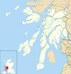
Location within Argyll and Bute
Civil parish
Council area
Country Scotland
Sovereign state United Kingdom
Police Scotland
Fire Scottish
Ambulance Scottish
List of places
UK
Scotland
55°49′11″N5°38′53″W / 55.81972°N 5.64806°W / 55.81972; -5.64806

Kilberry (Scottish Gaelic : Cill Bheiridh) is a village in Argyll and Bute, Scotland. It is close to the western coast of the district of Knapdale.

Kilberry Castle, just to the west of the village, was built in 1497 as a L-plan castle by a cadet branch of Clan Campbell. The castle was destroyed by an English pirate in 1513. The ruins were incorporated into the present mansion, built in 1844 by John Campbell and enlarged in 1871. [1] [2]

A group of sculptured stones, in the care of Historic Environment Scotland, are on display in a purpose-built shelter in the grounds of the castle. The stones, which include cross-slabs and medieval grave markers, originally came from the medieval parish church, which was destroyed in the 17th century. [3]
People from Kilberry

Related Research Articles

<span class="mw-page-title-main">Knapdale</span> Parishes and area in Scotland

Knapdale forms a rural district of Argyll and Bute in the Scottish Highlands, adjoining Kintyre to the south, and divided from the rest of Argyll to the north by the Crinan Canal. It includes two parishes, North Knapdale and South Knapdale. The area is bounded by sea to the east and west, whilst the sea loch of West Loch Tarbert almost completely cuts off the area from Kintyre to the south. The name is derived from two Gaelic elements: Cnap meaning hill and Dall meaning field.

<span class="mw-page-title-main">Kildrummy Castle</span> Ruined castle in Kildrummy, Aberdeenshire, Scotland

Kildrummy Castle is a ruined castle near Kildrummy, in Aberdeenshire, Scotland. Though ruined, it is one of the most extensive castles dating from the 13th century to survive in eastern Scotland, and was the seat of the Earls of Mar. It is owned today by Historic Environment Scotland and is open to the public as a scheduled ancient monument with gardens that are included in the Inventory of Gardens and Designed Landscapes in Scotland.

<span class="mw-page-title-main">Joseph Edgar Boehm</span> British sculptor (1834–1890)

Sir Joseph Edgar Boehm, 1st Baronet, was an Austrian-born British medallist and sculptor, best known for the "Jubilee head" of Queen Victoria on coinage, and the statue of the Duke of Wellington at Hyde Park Corner. During his career Boehm maintained a large studio in London and produced a significant volume of public works and private commissions. A speciality of Boehm's was the portrait bust; there are many examples of these in the National Portrait Gallery. He was often commissioned by the Royal Family and members of the aristocracy to make sculptures for their parks and gardens. His works were many, and he exhibited 123 of them at the Royal Academy from 1862 to his death in 1890.

<span class="mw-page-title-main">Duart Castle</span> Castle in Scotland

Duart Castle, or Caisteal Dhubhairt in Scottish Gaelic, is a castle on the Isle of Mull, beside the Sound of Mull off the west coast of Scotland, within the council area of Argyll and Bute. The castle dates back to the 13th century and is the seat of Clan MacLean. One source states that the castle was "brought back from ruin in 1911". The regimental colours of the WW1 Canadian Expeditionary Force 236th Battalion, CEF are laid up in the Great Hall.

Portmahomack is a small fishing village in Easter Ross, Scotland. It is situated in the Tarbat Peninsula in the parish of Tarbat. Tarbat Ness Lighthouse is about three miles from the village at the end of the Tarbat Peninsula. Ballone Castle lies about one mile from the village.

<span class="mw-page-title-main">Kilmartin</span> Village in Argyll and Bute, Scotland

Kilmartin is a small village in Argyll and Bute, western Scotland. It is best known as the centre of Kilmartin Glen, an area with one of the richest concentrations of prehistoric monuments and historical sites in Scotland. It contains over 800 monuments within a six-mile (ten-kilometre) radius. It is home to Kilmartin Museum and the Kilmartin Hotel.

<span class="mw-page-title-main">Boat of Garten</span> Village in Scotland

Boat of Garten is a small village and post town in Badenoch and Strathspey, Highland, Scotland. In 1951, the population was less than 400; in 1971, it was almost 500; in 1981, it was almost 700, and the same in 2001.

<span class="mw-page-title-main">Lochbuie, Mull</span> Human settlement in Scotland

Lochbuie is a settlement on the Isle of Mull in Scotland about 22 kilometres (14 mi) west of Craignure.

<span class="mw-page-title-main">Kenmore, Perth and Kinross</span> Human settlement in Scotland

Kenmore is a small village in Perthshire, in the Highlands of Scotland, located where Loch Tay drains into the River Tay.

<span class="mw-page-title-main">Dunstaffnage Castle</span> Castle in Argyll and Bute, Scotland, UK

Dunstaffnage Castle is a partially ruined castle in Argyll and Bute, western Scotland. It lies 3 miles (5 km) NNE of Oban, situated on a platform of conglomerate rock on a promontory at the south-west of the entrance to Loch Etive, and is surrounded on three sides by the sea. The castle and the nearby chapel ruin have been a Historic Scotland property since 1958. Both are Scheduled Ancient Monuments.

<span class="mw-page-title-main">Kingston, East Lothian</span> Human settlement in Scotland

Kingston is a small hamlet near North Berwick in East Lothian, Scotland.

Dalmally is a village in Argyll and Bute, Scotland. It is near the A85 road and is served by Dalmally railway station.

<span class="mw-page-title-main">Meigle</span> Human settlement in Scotland

Meigle is a village in Strathmore, Scotland. It lies in the council area of Perth and Kinross in the Coupar Angus and Meigle ward. It lies on the A94 road between Perth and Forfar.The A94 used to be the main route between Aberdeen and Perth. Other smaller settlements nearby are Balkeerie, Kirkinch and Kinloch. Meigle is accessed from the north and south via the B954 road. In 1971 it had a population of 357.

<span class="mw-page-title-main">Castle Sween</span> 11th century castle in Scotland

Castle Sween, also known as Caisteal Suibhne, and Caistéal Suibhne, is located on the eastern shore of Loch Sween, in Knapdale, south of the forestry village of Achnamara on the west coast of Argyll, Scotland. Castle Sween is thought to be one of the earliest stone castles built in Scotland, having been built in the late 11th century. The castle's towers were later additions to wooden structures which have since vanished.

<span class="mw-page-title-main">Ballumbie</span> Human settlement in Scotland

Ballumbie is a residential area on the north-east edge of Dundee, Scotland. The area was formerly an estate centred on Ballumbie Castle, a mid-16th-century fortification, which was followed by the 19th-century Ballumbie House. There is also a golf course surrounded by a medieval wall and the site of a late medieval parish church. The castle and house are located just outside the City of Dundee, in Angus.

<span class="mw-page-title-main">Antonine Wall</span> Defensive fortification in Roman Britain

The Antonine Wall was a turf fortification on stone foundations, built by the Romans across what is now the Central Belt of Scotland, between the Firth of Clyde and the Firth of Forth. Built some twenty years after Hadrian's Wall to the south, and intended to supersede it, while it was garrisoned it was the northernmost frontier barrier of the Roman Empire. It spanned approximately 63 kilometres and was about 3 metres high and 5 metres wide. Lidar scans have been carried out to establish the length of the wall and the Roman distance units used. Security was bolstered by a deep ditch on the northern side. It is thought that there was a wooden palisade on top of the turf. The barrier was the second of two "great walls" created by the Romans in Great Britain in the second century AD. Its ruins are less evident than those of the better-known and longer Hadrian's Wall to the south, primarily because the turf and wood wall has largely weathered away, unlike its stone-built southern predecessor.

Kilberry Castle is a Category B listed country house near Kilberry in South Knapdale in the county of Argyll, in western Scotland on the shores of the Sound of Jura.

<span class="mw-page-title-main">Kirkcolm</span> Human settlement in Scotland

Kirkcolm is a village and civil parish on the northern tip of the Rhinns of Galloway peninsula, south-west Scotland. It is in Dumfries and Galloway, and is part of the former county of Wigtownshire. The parish is bounded on the north and west by the sea, on the east by the bay of Loch Ryan and on the south by Leswalt parish.

<span class="mw-page-title-main">Pierowall</span> Human settlement in Scotland

Pierowall is a village of Westray in the Orkney Islands, off the coast of the northern Scottish mainland. The village is the island's largest settlement and lies near its northern end, around Pierowall Bay. It has a variety of historical remains dating from the Neolithic, the Iron Age, the Middle Ages, and later, including a large pagan Norse cemetery. In 1961 it had a population of 108.

Marion Campbell was a Scottish archaeologist. She was one of the first people to complete an archaeological survey of Kilmartin Glen in Mid Argyll. Campbell was an advocate for local history; she promoted and donated to several Argyll museums and published works about Argyll's history. She also published several fictional novels.

References

  1. "Kilberry Castle". 2009. Retrieved 14 July 2009.
  2. "Groomes Gazetter". 2009. Retrieved 14 July 2009.
  3. "Kilberry Sculptured Stones". Historic Environment Scotland. Retrieved 4 April 2017.