Montgomery County is a county located in Southeast Kansas. Its county seat is Independence, and its most populous city is Coffeyville. As of the 2020 census, the county population was 31,486. The county was named after Richard Montgomery, a major general during the American Revolutionary War.
Smith County is a county located in the U.S. state of Kansas. Its county seat is Smith Center. As of the 2020 census, the population was 3,570. The county is named in memory of J. Nelson Smith, a major in the 2nd Colorado Cavalry, killed at the Battle of Westport on October 21, 1864. The geographic center of the contiguous United States is located within the county, near Lebanon.

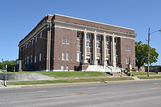
Russell County is a county in the U.S. state of Kansas. Its county seat and largest city is Russell. As of the 2020 census, the population was 6,691. The county was named for Avra Russell. The city of Russell was the home of former U.S. Senate Majority leader and 1996 GOP presidential nominee Bob Dole for many years.

Rooks County is a county located in the U.S. state of Kansas. Its county seat is Stockton, and its largest city is Plainville. As of the 2020 census, the county population was 4,919. The county was named for John Rooks, a private in Company I of the 11th Kansas Cavalry Regiment, who died at the Battle of Prairie Grove during the American Civil War.

Rice County is a county located in the U.S. state of Kansas. Its county seat and largest city is Lyons. As of the 2020 census, the county population was 9,427. The county was named in memory of Samuel Allen Rice, Brigadier-General, United States volunteers, killed April 30, 1864, at Jenkins Ferry, Arkansas.

Pratt County is a county located in the U.S. state of Kansas. Its county seat and largest city is Pratt. As of the 2020 census, the county population was 9,157. The county was named for Caleb Pratt, a U.S. soldier who died in the Battle of Wilson's Creek during the American Civil War and had previously been involved in Bleeding Kansas.

Osborne County is a county located in the U.S. state of Kansas. It county seat and largest city is Osborne. As of the 2020 census, the county population was 3,500. The county is named for Vincent Osborne, a captain in the American Civil War.

Ness County is a county located in the U.S. state of Kansas. Its county seat and largest city is Ness City. As of the 2020 census, the county population was 2,687. The county was named for Noah Ness, a corporal of the 7th Kansas Cavalry.

Meade County is a county located in the U.S. state of Kansas. Its county seat and largest city is Meade. As of the 2020 census, the county population was 4,055. The county was created in 1873 and named in honor of George Meade, a general during the American Civil War.

Lincoln County is a county located in the U.S. state of Kansas. Its county seat and largest city is Lincoln Center. As of the 2020 census, the county population was 2,939. The county was named after Abraham Lincoln, the 16th president of the United States.

Graham County is a county located in the U.S. state of Kansas. Its county seat and most populous city is Hill City. As of the 2020 census, the county population was 2,415. The county was named for John Graham, a captain in the American Civil War that died during the Battle of Chickamauga. The county is home to Nicodemus, founded 1877, which is the only remaining western town established by African Americans during the Reconstruction Period following the American Civil War.

Finney County is a county located in the U.S. state of Kansas. Its county seat and most populous city is Garden City. As of the 2020 census, the county population was 38,470. The county was named for David Finney, the Lieutenant Governor of Kansas from 1881 and 1885. In 2020, 51.4 percent of the population in the county was Hispanic, one of a few counties in Kansas with a Hispanic majority population.

Ellis County is a county located in the U.S. state of Kansas. Its county seat and most populous city is Hays. As of the 2020 census, the county population was 28,934. The county was named for George Ellis, a first lieutenant of the Twelfth Kansas Infantry. Ellis County is the official German Capital of Kansas. German immigrants settled in Hays, Ellis, Victoria, and nearby villages in the 1870s and 1880s.

Decatur County is a county located in Northwest Kansas. Its county seat and most populous city is Oberlin. As of the 2020 census, the county population was 2,764. The county was named in honor of Stephen Decatur, Jr., a commodore in the United States Navy who served during both Barbary Wars in North Africa, the Quasi-War with France, and the War of 1812 with Britain.

Andover is a city in Butler County, Kansas, United States, and a suburb of Wichita. As of the 2020 census, the population of the city was 14,892. Andover is the most populated city in Butler County.

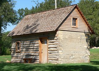
Nicodemus is a census-designated place (CDP) in Graham County, Kansas, United States. As of the 2020 census, the population was 14. The community was founded in 1877 and is named for the Biblical figure Nicodemus.

Fairview Township is a township in Russell County, Kansas, United States. As of the 2010 United States Census, it had a population of 466.
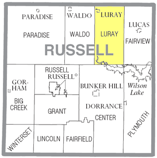
Luray Township is a township in Russell County, Kansas, United States. As of the 2010 United States Census, it had a population of 258.
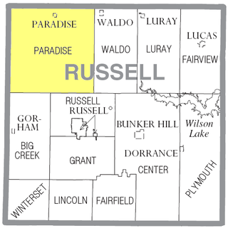
Paradise Township is a township in Russell County, Kansas, United States. As of the 2010 United States Census, it had a population of 166.

Waldo Township is a township in Russell County, Kansas, United States. As of the 2010 United States Census, it had a population of 78. It includes the town of Waldo.


