Kilmaurs Castle

Last updated

Kilmaurs Castle
Kilmaurs, East Ayrshire, Scotland
UK grid reference NS 42027 40849
Kilmaurs Castle site with field clearance stones, Jocksthorn Farm.JPG
Field clearance stones at the site of Kilmaurs Castle
Scotland relief location map.jpg
Red pog.svg
Kilmaurs Castle
Coordinates 55°38′08″N4°30′41″W / 55.635480°N 4.511272°W / 55.635480; -4.511272
TypeA tower castle
Site information
OwnerJocksthorn Farm
Open to
the public
Yes
ConditionDemolished and 'robbed'
Site history
Built byThe De Morville or Cunninghame family
MaterialsStone

Kilmaurs Castle was located on the lands of Jocksthorn Farm, near Kilmaurs in East Ayrshire, Scotland. It is described by Timothy Pont in the early 17th century as "Ye castell is ane ancient ftronge building belonging to ye Earls of Glencairne environed with a fair park called Carmell wod from ye vatter of Carmell yat runs by it." [1] Dobie goes on to state that "The old baronial manor place is supposed to have been situated about a mile south-east of Kilmaurs, where some ruins can still be pointed out on the farm of Jakisthorn [2] or Jock's-thorn, probably the original Villam de Cuninghame - the first possession of the family." [3] The castle is not to be confused with the later Cunninghame family possession known as Kilmaurs Place which Dobie calls "..comparatively modern" in 1876. [3]

Contents

History

McNaught's Map of Kilmaurs Parish. McNaughtmap.jpg
McNaught's Map of Kilmaurs Parish.

The castle would have been originally held by the De Morville family. In 1527 Cuthbert Cunninghame is said to have lived at both Jocksthorn and The Place, "assuming that Jocksthorn is indeed Kilmaurs Castle and that the now ruined late-16th or early-17th range at The Place was itself preceded by an earlier building. After the building of the later Place, the castle must have quickly fallen into disuse and decay." [4]

The map by Timothy Pont from circa 1600 shows a typical tower castle within an enclosure with a second area of enclosed woodland running up beside the Carmell Water. A mill is indicated and the dwelling of 'Karmel-Wood' is marked, a farm of that name surviving today (2015). The site is named 'Kilmaers' and lies to the south of the church. Only one tower is indicated in the area and Jocksthorn is not shown. Kilmaurs Castle is the only site in the area shown to have a second wooded enclosure. [5]

In 1612 John Monipennie stated that Kilmaurs Castle was the residence of the Earls of Glencairn, indicating that Kilmaurs Place had not yet been constructed [4] at least not in the form of a suitable residence.

Moll's map of the early 1700s shows the castle but no enclosures. Jocksthorn and Kilmaurs Place are not shown. [6]

The Statistical Account of 1791-99 says of the Earl of Glencairn "that noble family then resided in this parifh, where they had a houfe, fome fmall ruins of which yet remain on the farm which is called Jock's-thorn, near to the road leading from Stewarton to Kilmarnock, ..." [7]

Roys military map of the area dating from the 1750s indicates a large area of probable woodland/land that is not being cultivated where Kilmaurs Castle is said to have once stood. [8] Armstrong's map of 1775 indicates a castle-style building at the supposed site although the name 'Jock's Thorn' appears to be linked with it. [9]

Adamson relates in 1875 that the ancient castle was in the vicinity of Jackisthorn, [2] Jock's or Jack's Thorn farm, now 'Jocksthorn' and several old people from Kilmaurs in 1875 remembered playing amongst the ruined remnants of masonry which occupied the site of this old castle of the Cunninghames. [10]

A typical Scottish Tower Castle at Smailholm. Smailholm Tower - geograph.org.uk - 625921.jpg
A typical Scottish Tower Castle at Smailholm.

Adamson also talks of the typical woodland policies of such a dwelling still existing in the 1870s with venerable old trees, what sounds like roundels of trees, avenues that may have defined lanes or rides, etc. All of these are not normally associated with farms [10] and he appears to clinch the argument of the castles site by describing the "..sward covered circular mound" or motte at the 'traditional' site. [10]

In 1884-6 the Ordnance Gazetteer of Scotland records that "... a neighbouring farm, Jock's Thorn, contains vestiges of the original or more ancient residence of the Glencairn family, to whom Kilmaurs gave the title of Baron both while they were Earls of Glencairn and for 53 years earlier." [11]

The RCAHMS records cartographic evidence of a castellated building at this site, [12] probably a typical Scottish tower castle.

The lack of stone on the site and the clear written records of ruins at this precise location indicate a high degree of 'robbing' for use in building projects such as Jocksthorn Farm, The Place and other sites. The old castle stood on a lane that provided easy transport of building materials to other sites.

Other site evidence

The term 'Thorn' in Jocksthorn may derive from 'torn, thorn, a tower', as in Jocks-Thorn on Cumbrae, "alias Jock-Torn; and head, an eminence; hence tower-hill." [13] 'Thorn' occurs in words meaning ‘assembly’, ‘meeting place’ and ‘piece of land' or ‘clearing’. [14]

The traditional site has a great deal of field clearance stones laid along the line of the hedge leading to Jocksthorn Farm where medieval coins have been found.

Although the site is not set in a strong defensive position it has exceptional views of the surrounding area as shown in the gallery below.

Views from the Site of Kilmaurs Castle

The RCAHMS Canmore site records that "Slight undulations suggest previous disturbance and many large, shapeless stones are dumped against an adjacent hedge. The farmer at Jocksthorn reports that this is a difficult, stony area to plough, ..." [12]

Davis records that the local farmer has noted that pottery and stones are brought up by ploughing at an elevated spot (NS 417 411) off the old entrance to Jocksthorn farm at a point east of both Tour House and Jock's Thorn. [4]

Metal detectorists have found a number of medieval coins in this area amongst what may be old building and foundation stones. The 19th-century 6 inch OS Map of Kilmaurs marks the supposed site of Kilmaurs Castle as lying off the side of the farm road leading to Jocksthorn Farm from the old Stewarton Road.

William Aiton's map of 1811 showing the site of the ruins of Kilmaurs Castle near Jocksthorn. Map of Dunduff castle & roads.jpg
William Aiton's map of 1811 showing the site of the ruins of Kilmaurs Castle near Jocksthorn.

Dobie in 1874 that the old baronial residence was about a mile South-East of Kilmaurs and ruins could still be pointed out on the farmlands of Jocksthorn. [3]

Etymology
Carmel, the oldest form of which is Caremuall, is thought to be derived, according to McNaught, [15] from the Gaelic 'Car' meaning a 'fort', and 'Meall'. meaning a hill. Therefore, 'The fort on the hill'.

Micro-history

Dobie records that the castle stood within a park known as 'Carmell Wood' after the Carmell Water'. A farm known as Carmellwood is located to the north-east of the castle site. [3]

The Tour Burn runs underground in a culvert from the Stewarton road near Grassmillside to near the corner of the neighbouring field lying next to the Tour woodland policies. It is not recorded if this is related to the requirements of agriculture in some way connected with the castle and its motte, associated grounds, garden, etc. [16]

The site is nearly two miles from Kilmarnock and four miles from Stewarton.

See also

Related Research Articles

Stewarton The Bonnet Toun

Stewarton is a town in East Ayrshire, Scotland. In comparison to the neighbouring towns of Kilmaurs, Fenwick, Dunlop and Lugton, it is a relatively large town, with a population estimated at over 7,400. It is 300 feet above sea level. The town is served by Stewarton railway station.

Kilmaurs Village in Scotland

Kilmaurs is a village in East Ayrshire, Scotland which lies just outside of the largest settlement in East Ayrshire, Kilmarnock. It lies on the Carmel Water, 21 miles southwest of Glasgow. Population recorded for the village in the 2001 Census recorded 2,601 people resided in the village It was in the Civil Parish of Kilmaurs.

Lambroughton is a village in the old Barony of Kilmaurs, Scotland. This is a rural area famous for its milk and cheese production and the Ayrshire or Dunlop breed of cattle.

Cunninghamhead is a hamlet in North Ayrshire, Scotland. It was the centre of the lands of Cunninghamhead, Perceton and Annick Lodge in Cunninghame. This mainly rural area is noted for its milk and cheese production and the Ayrshire, Cunninghame or Dunlop breed of cattle.

Barony and Castle of Corsehill Barony in East Ayrshire, Scotland

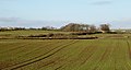
The old Barony and castle of Corsehill lay within the feudal Baillerie of Cunninghame, near Stewarton, now East Ayrshire, Scotland.

Kerelaw Castle

Kerelaw Castle is a castle ruin owned by a surviving male descendant of the Hamilton family, Logan Neely. It is situated on the coast of North Ayrshire, Scotland in the town of Stevenston.

The village or hamlet of Gatehead is located in East Ayrshire, Parish of Kilmaurs, Scotland. It is one and a quarter miles from Crosshouse and one and a half miles from Kilmarnock. In the 18th and 19th centuries the locality was a busy coal mining district. The settlement runs down to the River Irvine where a ford and later a bridge was located.

Knockentiber is a village in East Ayrshire, Parish of Kilmaurs, Scotland. Knockentiber is two miles west-northwest of Kilmarnock and 12 mile northeast of Crosshouse. Latitude:55.6193°N Longitude:4.5455°W and grid reference NS397392. The population was 359 in 1991, however the population is much higher following the construction of several housing estates (2007). In the 18th and 19th and mid 20th centuries the locality was a highly industrialised coal mining district. The settlement is on the Carmel Burn, which runs into the River Irvine, around one mile to the south.

River Irvine River in southwest Scotland

The River Irvine is a river that flows through southwest Scotland. Its watershed is on the Lanarkshire border of Ayrshire at an altitude of 810 feet (250 m) above sea-level, near Loudoun Hill, Drumclog, and 7 miles SW by W of Strathaven. It flows 29+12 mi (47.5 km) westward, dividing the old district of Cunninghame from that of Kyle, until it reaches the sea via Irvine Harbour in the form of the Firth of Clyde, and flows into Irvine Bay by the town of Irvine. It has many tributaries, some of which form parish, district and other boundaries.

Kilmaurs Place, The Place or Kilmaurs House, is an old mansion house and the ruins of Kilmaurs Tower grid reference NS41234112 are partly incorporated, Kilmaurs, East Ayrshire, Scotland. The house stands on a prominence above the Carmel Water and has a commanding view of the surrounding area. Once the seat of the Cunningham Earls of Glencairn it ceased to be the main residence after 1484 when Finlaystone became the family seat. Not ot be confused with Kilmaurs Castle that stood on the lands of Jocksthorn Farm.

The Lands of Lochridge

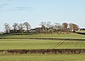
The Lochridge estate was in the old feudal Baillerie of Cunninghame, near Stewarton in what is now East Ayrshire, Scotland.

Busbie Castle

Busbie Castle was situated in what is now known as Knockentiber, a village in East Ayrshire, Parish of Kilmaurs, Scotland. Knockentiber is 2 miles (3.2 km) WNW of Kilmarnock and 1/2 mile NE of Crosshouse. The castle overlooked the Carmel Glen and its Burn, which runs into the River Irvine, a mile or so to the south, after passing through the old Busbie Mill.

Castle and Barony of Robertland

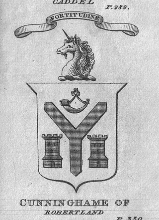
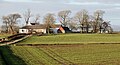
The Castle and Barony of Robertland is located near Stewarton, off the B769 road, in the old district of Cunninghame, Parish of Stewarton, and now part of East Ayrshire, Scotland.

Lands of Lainshaw The Lands Of Lainshaw Have Been In Place For Many Years And Was Used In The War.

The Lands of Lainshaw lie in Strathannick and were part of the Lordship of Stewarton, in East Ayrshire, Scotland. Lainshaw House is a category B listed mansion, lying in a prominent position above the Annick Water and its holm in the Parish of Stewarton, Scotland. Part of the much older Lainshaw Castle is contained within the several later building phases of the present day Lainshaw House. The names 'Langshaw' or 'Langschaw' were used in historic times. Law Mount near the High and Laigh Castleton farms has been suggested as the site of the original castle, granted in the 12th century to Godfrey de Ross by Hugo de Morville.

Lambroughton Loch

Lambroughton Loch or Wheatrig Loch was situated in a low-lying area between the farms and dwellings of Hillhead, Lambroughton, Wheatrig, Titwood and Lochridge mainly in the Parish of Dreghorn, North Ayrshire. The loch was mainly fed by the Lochridge Burn, the Garrier Burn and surface runoff, such as from the old rig and furrows indicated by Roy's maps of the mid-18th century. The loch outflow was via the Lochridge Burn that runs into the Garrier Burn, passes the site of the old Lochend habitation and into the Bracken Burn near Little Alton. The rivulet or watercourse is known as the Garrier Burn beyond this point.

Polkelly Castle

Polkelly Castle, also Pokelly, was an ancient castle located near Fenwick, at NS 4568 4524, in the medieval free Barony of Polkelly, lying north of Kilmarnock, Parish of Fenwick, East Ayrshire, Scotland. The castle is recorded as Powkelly (c1747), Pockelly (c1775), Pow-Kaillie, Ponekell, Polnekel, Pollockelly, Pollockellie, Pokellie, Pothelly, Pathelly Ha' and Polkelly. The name is given circa 1564 as Powkellie when it was held by the Cunninghams of Cunninghamhead.

Murder of Hugh Montgomerie

The Murder of Hugh Montgomerie, 4th Earl of Eglinton at the Annick Ford in Stewarton, East Ayrshire, Scotland, took place in 1586 as a consequence of a long running feud between the Montgomeries, Earls of Eglinton and the Cunninghames, Earls of Glencairn, families who were competing for power and influence locally and nationally. The significant repercussions of this act were felt throughout the county of Ayrshire and beyond. The spelling 'Montgomerie' is used throughout for both the family and Montgomery for the clan and clan and district names 'Cunninghame' in the same fashion.

Lands of Tour and Kirkland Human settlement in Scotland

The Lands of Tour and Kirkland (NS416406) formed a small estate close to the old Kirktoun and St Maurs-Glencairn collegiate church about 1 km south-east of Kilmaurs, East Ayrshire, Parish of Kilmaurs, Scotland. The word 'Tour' in Scots refers to a 'tower' and 'kirk' to a parish church.

Lands of Blacklaw Human settlement in Scotland

The Lands of Blacklaw formed a small property of five merks worth, in the Lordship of Stewarton at the eastern extremity of Strathannick, between the hamlet of Kingsford in East Ayrshire and the East Renfrewshire boundary, Scotland. It was first recorded in 1484 in the Acta Auditorum. Black Law is a prominent whinstone crag lying above Blacklaw Hill Farm.

Glencairn Aisle

The Glencairn Aisle or Glencairn Vault at Kilmaurs, East Ayrshire is a vaulted sepulchral chapel built as a place for private contemplation and prayer that also contains a large memorial monument, as well as the burial crypt of the Cunningham Earls of Glencairn and their family members. It houses an exceptional ornately carved stone mural monument dated 1600 that commemorates James Cunningham, the 7th Earl of Glencairn, his countess, Margaret Campbell and eight of their children. It is the oldest such 'Glorious Tomb' monument built in the 17th century in Ayrshire and one of the oldest post-reformation monument in Scotland. The other Ayrshire examples being the Kennedy or Bargany Aisle at Ballantrae of circa 1601, the Skelmorlie Aisle at Largs of 1639, the Crauford Monument at Kilbirnie and the Hamilton Aisle at Dunlop of 1641.

References

Notes
Sources