
The Chaga or Chagga are a Bantu-speaking indigenous Africans and the third largest ethnic group in Tanzania. They traditionally live the slopes of Mount Kilimanjaro and eastern Mount Meru in both Kilimanjaro Region and eastern Arusha Region. Their relative economic wealth comes from favorable fertile soil of mount Kilimanjaro and successful agricultural methods, which include extensive irrigation systems, terracing, and continuous organic fertilization methods practiced for thousands of years.

Kilimanjaro Region is one of Tanzania's 31 administrative regions with a postcode number 25000. The regional capital and largest city is the municipality of Moshi. With a HDI of 0.613, Kilimajaro is one among the most developed regions of Tanzania. According to the 2012 national census, the region had a population of 1,640,087, which was lower than the pre-census projection of 1,702,207. For 2002-2012, the region's 1.8 percent average annual population growth rate was the 24th highest in the country. It was also the eighth most densely populated region with 124 people per square kilometer.

Tanga Region is one of Tanzania's 31 administrative regions. The regional capital is the municipality of Tanga city. Located in northeast Tanzania, the region is bordered by Kenya and Kilimanjaro Region to the north; Manyara Region to the west; and Morogoro and Pwani regions to the south. It has a coastline to the east with the Indian Ocean. According to the 2012 national census, the region had a population of 2,045,205.
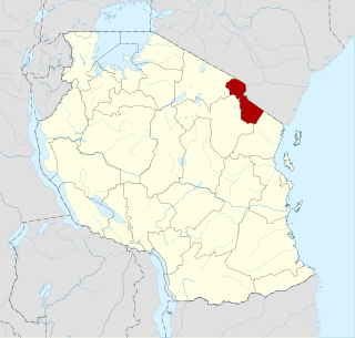
The Pare people are members of an ethnic group indigenous to the Pare Mountains of northern Tanzania, part of the Kilimanjaro Region. Historically, Pareland was also known as Vuasu and Vughonu to its inhabitants. The location lies on one of the northern routes of the historic East-African long-distance trade, connecting the hinterland with the coast of the Indian Ocean.
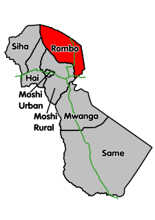
Rombo District is one of the seven districts of the Kilimanjaro Region of Tanzania. It is bordered to the north and east by Kenya, to the west by the Siha District and Hai District, and to the south by the Moshi Rural District.

Hai District is one of the seven districts of the Kilimanjaro Region of Tanzania. It is bordered to the south and west by the Arusha Region, to the west by the Siha District, and to the east by the Moshi Urban District and Moshi Rural District and the Rombo District.

Same is one of the seven districts of the Kilimanjaro Region of Tanzania. It is bordered to the north by the Mwanga District, to the northeast by Kenya, to the south and southeast by the Tanga Region, and to the west by the Manyara Region. The district capital is the town of Same, Tanzania.

Mwanga is one of the seven districts of the Kilimanjaro Region of Tanzania. It is bordered to the northeast by Kenya, to the northwest by the Moshi Rural District, to the southwest by the Manyara Region, and to the south by the Same District. Its administrative seat is the town of Mwanga.
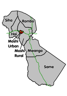
Moshi Urban District Kilimanjaro Region of Tanzania. The regional capital of Moshi is located in the Moshi Urban District. The district is bordered to the north by the Moshi Rural District, to the east by the Mwanga District and to the south and west by the Manyara Region.

The Moshi District Council is one of the seven administrative councils of the Kilimanjaro Region of Tanzania. The council is bordered to the north by the Rombo District, to the west by the Hai District, to the east by the Mwanga District and Kenya, and to the south by the Arusha Region district.

The Matengo are an ethnic and linguistic group based in Mbinga District, Ruvuma Region in southern Tanzania. In 1957, the population estimate was 57,000, while in 2010, the Matengo population was estimated to number 284,000. Their religious affiliation is to Christianity. Their Affinity Bloc is Sub-Saharan African. Their main language is Matengo, which is one of the Bantu languages.

The Kuria people (also known as the AbaKurya, are a Bantu community in Tanzania and Kenya. Their homeland is bounded on the east by the Migori River and on the west by the Mara River estuary. Traditionally a pastoral and farming community, the Kuria grow maize, beans and cassava as food crops and coffee and maize as cash crops.
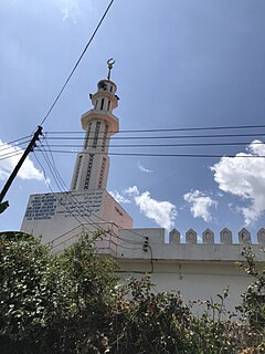
Elerai is an administrative ward in Arusha District, Arusha Region of Tanzania. It is one of 19 urban administrative wards in the municipality. The ward is bordered by Olasiti ward to the west, Kiranyi ward to the north, Ngarenaro ward to the east, Sombetini to the south and, a tiny portion of Unga L.T.D ward to the southeast. The ward covers an area of 3.746 km2 and ranks number eleven in the area in Arusha city. The ward is home to the national National College of Tourism, the African Court and Tanzania National Parks Authority (TANAPA)'s national headquarters, also the Arusha Modern school. The school's famous alumna is Tanzanian recording artist, Vanessa Mdee, who received secondary education there. According to the 2012 census, the ward had a total population of 40,749.
Magugu is an administrative ward in the Babati district of the Manyara Region of Tanzania. According to the 2002 census, the ward has a total population of 23,682. It is famous for its aromatic rice.
Mwika Kusini is a town and ward in the Moshi Rural district of the Kilimanjaro Region of Tanzania. Its population according to the 2012 census was 19,645. The economic activities conducted include agriculture, transportation, and business. The natives plant maize, coffee, and bananas which are exported to Dar es salama
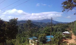
Ugweno is located within the Mwanga District, Kilimanjaro Region, Tanzania, Africa. It is situated at 3° 39' 0" South and 37° 39' 0" East in the Pare Mountains. The people who live in Ugweno are known as Wagweno and their common language is Kigweno.

Agriculture is the main part of Tanzania's economy. As of 2016, Tanzania had over 44 million hectares of arable land with only 33 percent of this amount in cultivation. Almost 70 percent of the poor population live in rural areas, and almost all of them are involved in the farming sector. Land is a vital asset in ensuring food security, and among the nine main food crops in Tanzania are maize, sorghum, millet, rice, wheat, beans, cassava, potatoes, and bananas. The agricultural industry makes a large contribution to the country's foreign exchange earnings, with more than US$1 billion in earnings from cash crop exports.

Buhigwe District is one of the eight districts of the Kigoma Region of Tanzania. It is one of the 20 new districts that were formed in Tanzania since 2010; it was split off from Kasulu Rural District. Buhigwe District is bordered to the north by Burundi, to the east by Kasulu Rural District and Kasulu Urban District, and to the west by Kigoma Rural District. Its administrative seat is the town of Buhigwe.

Mwanga is a town in northern Tanzania at the foot of the north Pare Mountains. It is the district capital of Mwanga District.

Songwe is a region of Tanzania created on 29 January 2016 from the western half of Mbeya Region. Its capital is Vwawa.


