Kingsway, Ohio

Last updated

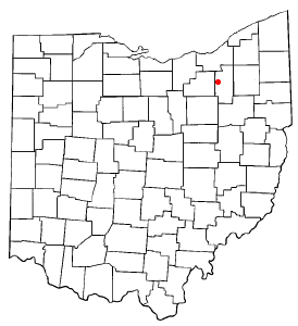
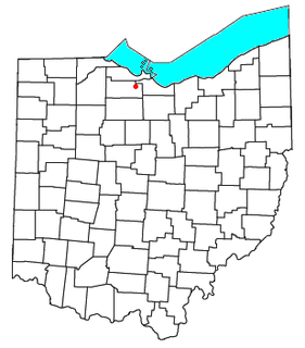
Kingsway is an unincorporated community in Rice Township, Sandusky County, Ohio, United States. [1]

Unincorporated area Region of land not governed by own local government

In law, an unincorporated area is a region of land that is not governed by a local municipal corporation; similarly an unincorporated community is a settlement that is not governed by its own local municipal corporation, but rather is administered as part of larger administrative divisions, such as a township, parish, borough, county, city, canton, state, province or country. Occasionally, municipalities dissolve or disincorporate, which may happen if they become fiscally insolvent, and services become the responsibility of a higher administration. Widespread unincorporated communities and areas are a distinguishing feature of the United States and Canada. In most other countries of the world, there are either no unincorporated areas at all, or these are very rare; typically remote, outlying, sparsely populated or uninhabited areas.

Rice Township, Sandusky County, Ohio Township in Ohio, United States

Rice Township is one of the twelve townships of Sandusky County, Ohio, United States. As of the 2000 census, 1,437 people lived in the township.

United States Federal republic in North America

The United States of America (USA), commonly known as the United States or America, is a country composed of 50 states, a federal district, five major self-governing territories, and various possessions. At 3.8 million square miles, the United States is the world's third or fourth largest country by total area and is slightly smaller than the entire continent of Europe's 3.9 million square miles. With a population of over 327 million people, the U.S. is the third most populous country. The capital is Washington, D.C., and the largest city by population is New York City. Forty-eight states and the capital's federal district are contiguous in North America between Canada and Mexico. The State of Alaska is in the northwest corner of North America, bordered by Canada to the east and across the Bering Strait from Russia to the west. The State of Hawaii is an archipelago in the mid-Pacific Ocean. The U.S. territories are scattered about the Pacific Ocean and the Caribbean Sea, stretching across nine official time zones. The extremely diverse geography, climate, and wildlife of the United States make it one of the world's 17 megadiverse countries.

History

A post office called Kingsway was established in 1882, and remained in operation until 1911. [2] The community was named for George W. King, first postmaster. [3]

Related Research Articles

Sandusky County, Ohio County in the United States

Sandusky County is a county in the U.S. state of Ohio located southeast of the Toledo Metropolitan Area. As of the 2010 census, the population was 60,944. Its county seat is Fremont. The county was formed on February 12, 1820, from portions of Huron County. The name is derived from the Wyandot word meaning "water". The Sandusky River runs diagonally northeast through the county to its mouth on Sandusky Bay. The bay opens into Lake Erie.

Montrose, Ohio human settlement in Ohio, United States of America

Montrose is an unincorporated community on the border between Bath Township, Copley Township, and the city of Fairlawn in Summit County, Ohio, United States. It is an area of restaurants, stores, and businesses located along a stretch of State Route 18 near Interstate 77. The community is served by the Fairlawn (44333) post office. It is included in the Montrose-Ghent census-designated place. It had been a quiet hamlet for much of its history, with such establishments as a drive-in theater, golf courses and a church. It became a busy retail area in the 1990s as new commercial development moved in.

Sandusky River river in the United States of America

The Sandusky River is a tributary to Lake Erie in north-central Ohio in the United States. It is about 133 miles (214 km) long and flows into Lake Erie at the southwest side of Sandusky Bay.

Vickery, Ohio town in Ohio, United States

Vickery is an unincorporated community and census-designated places in western Townsend Township, Sandusky County, Ohio, United States. Although it is unincorporated, it has a post office, with the ZIP code of 43464 and a volunteer fire department called Townsend Township FD.

Millersville, Ohio human settlement in Ohio, United States of America

Millersville is an unincorporated community in northwestern Jackson Township, Sandusky County, Ohio, United States, within the Toledo Metropolitan Area. It lies at the intersection of Millersville Road and the Greensburg Pike. Muddy Creek, which flows into Sandusky Bay near the mouth of the Sandusky River, flows past the community. The community is served by the Helena (43435) post office.

Wrights Corner, Indiana Unincorporated community in Indiana, United States

Wrights Corner is an unincorporated community in Manchester Township, Dearborn County, Indiana.

Rollersville, Ohio Unincorporated community in Ohio, United States

Rollersville is an unincorporated community on the border between Madison and Scott townships in Sandusky County, Ohio, United States. It is located on the Grand Army of the Republic Highway, approximately 4.5 miles (7.2 km) west of Helena, Ohio. Rollersville had a post office from 1839 to 1908.

Sandusky County Courthouse local government building in the United States

The Sandusky County Courthouse is a local government building in Fremont, Ohio, United States. Built in the 1840s and since greatly modified, it remains in use by the government of Sandusky County.

Havens is an unincorporated community in Jackson Township, Sandusky County, Ohio, United States.

Hessville is an unincorporated community and census-designated places in Washington Township, Sandusky County, Ohio, United States.

Little Sandusky is an unincorporated community in Wyandot County, in the U.S. state of Ohio.

Colby is an unincorporated community in Sandusky County, in the U.S. state of Ohio.

Erlin is an unincorporated community in Sandusky County, in the U.S. state of Ohio.

Galetown is an unincorporated community in Sandusky County, in the U.S. state of Ohio.

Green Creek is an unincorporated community in Sandusky County, in the U.S. state of Ohio.

Tinney is an unincorporated community in Sandusky County, in the U.S. state of Ohio.

Whitmore is an unincorporated community in Sandusky County, in the U.S. state of Ohio.

Winters Station is an unincorporated community in Sandusky County, in the U.S. state of Ohio.

York is an unincorporated community in Sandusky County, in the U.S. state of Ohio.

References

Coordinates: 41°25′03″N83°08′08″W / 41.41750°N 83.13556°W / 41.41750; -83.13556

Geographic coordinate system Coordinate system

A geographic coordinate system is a coordinate system that enables every location on Earth to be specified by a set of numbers, letters or symbols. The coordinates are often chosen such that one of the numbers represents a vertical position and two or three of the numbers represent a horizontal position; alternatively, a geographic position may be expressed in a combined three-dimensional Cartesian vector. A common choice of coordinates is latitude, longitude and elevation. To specify a location on a plane requires a map projection.