Stony Prairie, Ohio

Last updated
Stony Prairie, Ohio
CDP
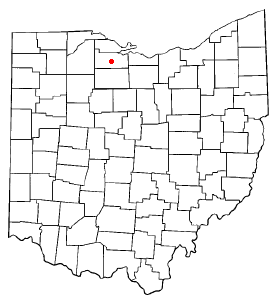
OHMap-doton-Stony Prairie.png
Location of Stony Prairie, Ohio
Coordinates: 41°20′45″N83°09′08″W / 41.34583°N 83.15222°W / 41.34583; -83.15222
Country United States
State Ohio
County Sandusky
Township Sandusky
Area
[1]
  Total1.60 sq mi (4.15 km2)
  Land1.60 sq mi (4.15 km2)
  Water0.00 sq mi (0.00 km2)
Elevation
[2]
548 ft (167 m)
Population
 (2020)
  Total1,218
  Density759.35/sq mi (293.21/km2)
Time zone UTC-5 (Eastern (EST))
  Summer (DST) UTC-4 (EDT)
FIPS code 39-74832 [3]
GNIS feature ID2393249 [2]

Stony Prairie is a census-designated place (CDP) in Sandusky County, Ohio, United States. The population was 1,218 at the 2020 census.

Contents

"Stony Prairie" originally referred to a region in the area. [4]

Geography

According to the United States Census Bureau, the CDP has a total area of 1.5 square miles (3.9 km2), all land.

Demographics

Historical population
CensusPop.Note
2020 1,218
U.S. Decennial Census [5]

As of the census [3] of 2000, there were 836 people, 349 households, and 233 families residing in the CDP. The population density was 542.3 inhabitants per square mile (209.4/km2). There were 367 housing units at an average density of 238.1 per square mile (91.9/km2). The racial makeup of the CDP was 91.75% White, 0.96% African American, 0.24% Asian, 5.38% from other races, and 1.67% from two or more races. Hispanic or Latino of any race were 16.51% of the population.

There were 349 households, out of which 24.6% had children under the age of 18 living with them, 51.6% were married couples living together, 10.6% had a female householder with no husband present, and 33.0% were non-families. 28.7% of all households were made up of individuals, and 16.6% had someone living alone who was 65 years of age or older. The average household size was 2.40 and the average family size was 2.95.

In the CDP the population was spread out, with 22.7% under the age of 18, 7.9% from 18 to 24, 26.4% from 25 to 44, 22.5% from 45 to 64, and 20.5% who were 65 years of age or older. The median age was 41 years. For every 100 females there were 94.9 males. For every 100 females age 18 and over, there were 86.7 males.

The median income for a household in the CDP was $39,569, and the median income for a family was $46,346. Males had a median income of $36,823 versus $23,317 for females. The per capita income for the CDP was $16,871. About 7.4% of families and 6.6% of the population were below the poverty line, including none of those under age 18 and 28.8% of those age 65 or over.

Related Research Articles

<span class="mw-page-title-main">Sandusky County, Ohio</span> County in Ohio, United States

Sandusky County is a county located in the northwestern part of the U.S. state of Ohio. As of the 2020 census, the population was 58,896. Its county seat and largest city is Fremont. The county was formed on February 12, 1820, from portions of Huron County.

<span class="mw-page-title-main">Stony River, Alaska</span> Census-designated place in Alaska, United States

Stony River is a census-designated place (CDP) in Bethel Census Area, Alaska, United States. The population was 54 at the 2010 census, down from 61 in 2000.

<span class="mw-page-title-main">Fairview Lanes, Ohio</span> Unincorporated community and Census-designated place in Ohio, United States

Fairview Lanes is an unincorporated community in Perkins Township, Erie County, Ohio, United States. The area was delineated as a census-designated place (CDP) for the 2000 census, at which time its population was 1,015. The area was not a CDP for the 2010 census. It is part of the Sandusky, Ohio Metropolitan Statistical Area.

<span class="mw-page-title-main">Sandusky South, Ohio</span> Census-designated place in Ohio, United States

Sandusky South is an census-designated place in Perkins Township, Erie County, Ohio, United States. The population was 6,599 at the 2000 census. It was not delineated as a CDP for the 2010 census. It is part of the Sandusky, Ohio Metropolitan Statistical Area.

<span class="mw-page-title-main">Dillonvale, Hamilton County, Ohio</span> Census-designated place in Ohio, United States

Dillonvale is a census-designated place (CDP) in Sycamore Township, Hamilton County, Ohio, United States. The population was 3,436 at the 2020 census.
<span class="mw-page-title-main">Grandview, Hamilton County, Ohio</span> Census-designated place in Ohio, United States

Grandview is a census-designated place (CDP) in Hamilton County, Ohio, United States. The population was 1,312 at the 2020 census.
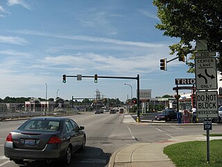
<span class="mw-page-title-main">Kenwood, Ohio</span> Census-designated place in Ohio, United States

Kenwood is a census-designated place (CDP) in Sycamore Township, Hamilton County, Ohio, United States. The population was 7,570 at the 2020 census. It is a major shopping destination for the Cincinnati area, featuring properties such as Kenwood Towne Centre and The Kenwood Collection.

<span class="mw-page-title-main">Pleasant Run Farm, Ohio</span> Census-designated place in Ohio, United States

Pleasant Run Farm is a census-designated place (CDP) in Springfield Township, Hamilton County, Ohio, United States. The population was 4,779 at the 2020 census.

<span class="mw-page-title-main">White Oak, Ohio</span> Census-designated place in Ohio, United States

White Oak is a census-designated place (CDP) in Hamilton County, Ohio, United States. It is seven miles northwest of Cincinnati. The population was 19,541 at the 2020 census. White Oak is situated in both Green Township and Colerain Township.

<span class="mw-page-title-main">Pleasant Grove, Ohio</span> CDP in Ohio, United States

Pleasant Grove is a census-designated place (CDP) in Muskingum County, Ohio, United States. The population was 1,726 at the 2020 census.

<span class="mw-page-title-main">Logan Elm Village, Ohio</span> CDP in Ohio, United States

Logan Elm Village is a census-designated place (CDP) in Pickaway County, Ohio, United States, near the site of the Logan Elm. The population was 1,062 at the 2000 census.

<span class="mw-page-title-main">Ballville, Ohio</span> CDP in Ohio, United States

Ballville is a census-designated place (CDP) in Sandusky County, Ohio, United States, adjacent to Fremont. The population was 3,823 at the 2020 census.

<span class="mw-page-title-main">Helena, Ohio</span> Village in Ohio, United States

Helena is a village in Sandusky County, Ohio, United States. The population was 211 at the 2020 census.

<span class="mw-page-title-main">Perry Heights, Ohio</span> Census-designated place in Ohio, United States

Perry Heights is a census-designated place in Stark County, Ohio, United States. The population was 8,391 at the 2020 census. It is part of the Canton–Massillon metropolitan area.

<span class="mw-page-title-main">Maplewood Park, Ohio</span> Census-designated place in Ohio, United States

Maplewood Park is an unincorporated community and census-designated place in southern Hubbard Township, Trumbull County, Ohio, United States. The population was 243 at the 2020 census. It is part of the Youngstown–Warren metropolitan area.

<span class="mw-page-title-main">South Canal, Ohio</span> Census-designated place in Ohio, United States

South Canal is an unincorporated community and census-designated place in western Newton Township, Trumbull County, Ohio, United States. The population was 1,101 at the 2020 census. It is part of the Youngstown–Warren metropolitan area.

Stony Point is a census-designated place (CDP) in Sequoyah County, Oklahoma, United States. It is part of the Fort Smith, Arkansas-Oklahoma Metropolitan Statistical Area. The population was 177 at the 2000 census.

Altamont is a census-designated place (CDP) in Schuylkill County, Pennsylvania, United States. The population was 2,689 at the 2000 census.

<span class="mw-page-title-main">Loveland Park, Ohio</span> Census-designated place in Ohio, United States

Loveland Park is a census-designated place (CDP) located in Symmes Township, Hamilton County and Deerfield Township, Warren County, in the southwestern part of the U.S. state of Ohio. The CDP is named after the city of Loveland. The population was 1,737 at the 2020 census.
<span class="mw-page-title-main">Stony Point (CDP), New York</span> Census-designated place in New York, United States

Stony Point is a hamlet and census-designated place in the town of Stony Point, Rockland County, New York, United States. It is located north of West Haverstraw, east of Harriman State Park, south of Tomkins Cove, and west of the Hudson River. The population was 12,147 at the 2010 census.

References

  1. "ArcGIS REST Services Directory". United States Census Bureau. Retrieved September 20, 2022.
  2. 1 2 U.S. Geological Survey Geographic Names Information System: Stony Prairie, Ohio
  3. 1 2 "U.S. Census website". United States Census Bureau . Retrieved 2008-01-31.
  4. Meek, Basil (1909). Twentieth Century History of Sandusky County, Ohio: And Representative Citizens. Richmond-Arnold Publishing Company. p. 94.
  5. "Census of Population and Housing". Census.gov. Retrieved June 4, 2016.