Related Research Articles

Brierley Hill is a town and electoral ward in the Metropolitan Borough of Dudley, West Midlands, England, 3 miles (4.8 km) south of Dudley and 1 mile (1.6 km) north of Stourbridge. Part of the Black Country and in a heavily industrialised area, it has a population of 13,935 at the 2011 census. It is best known for glass and steel manufacturing, although the industry has declined considerably since the 1970s. One of the largest factories in the area was the Round Oak Steelworks, which closed down and was redeveloped in the 1980s to become the Merry Hill Shopping Centre. Brierley Hill was originally in Staffordshire.

Kingswinford is a town of the Metropolitan Borough of Dudley in the English West Midlands, situated 5 miles (8 km) west-southwest of central Dudley. In 2011 the area had a population of 25,191, down from 25,808 at the 2001 Census.

Ashwood is a small area of Staffordshire, England.

Amblecote is a village in the Metropolitan Borough of Dudley in the West Midlands, England. It lies immediately north of the historic town of Stourbridge on the southwestern edge of the West Midlands conurbation. Historically, Amblecote was in the parish of Oldswinford, but unlike the rest of the parish it was in Staffordshire, and as such was administered separately. It borders Audnam, Quarry Bank and Wollaston.

A civil parish is a subnational entity, forming the lowest unit of local government in England. There are 21 civil parishes in the ceremonial county of West Midlands, most of the county being unparished; Dudley, Sandwell, Walsall and Wolverhampton are completely unparished. At the 2001 census, there were 89,621 people living in the parishes, accounting for 3.5 per cent of the county's population.

Stourbridge is a constituency in West Midlands represented in the House of Commons of the UK Parliament since 2024 by Cat Eccles from the Labour Party.

Quarry Bank is an area and village in the Dudley district, in the county of the West Midlands, England. It is one of the few villages in Dudley with a majority of independent shops and cafes.
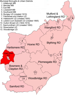
East Stow was a rural district in East Suffolk, England from 1894 to 1934.
Walsall was a rural district in Staffordshire, England from 1894 to 1934.
Seisdon was a rural district in Staffordshire, England from 1894 to 1974. It lay to the west of Wolverhampton and was formed under the Local Government Act 1894 based on the Seisdon rural sanitary district.
Wall Heath is a suburban village in the Dudley Metropolitan Borough in the West Midlands of England. It is located on the A449 road, approximately 1.5 miles northwest of Kingswinford, 5 miles west of Dudley Town Centre and 9 miles north of Kidderminster. It forms part of the West Midlands-South Staffordshire border.
Prestwood is a hamlet now in the parish of Kinver, but in the Kingswinford until the creation of Brierley Hill Urban District in the 1930s.
Kinver Forest was a Royal Forest, mainly in Staffordshire.

Brierley Hill Urban District was an Urban District in Staffordshire, England, comprising the areas of Brierley Hill, Kingswinford, Quarry Bank, and Pensnett, now within the modern-day Dudley Metropolitan Borough in the West Midlands county.
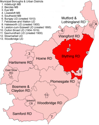
Blything Rural District was a rural district within the administrative county of East Suffolk between 1894 and 1934.

Mutford and Lothingland Rural District was a rural district within the administrative county of East Suffolk between 1894 and 1934. It was created out of the earlier Mutford and Lothingland rural sanitary district. It was named after the historic hundred of Mutford and Lothingland, whose boundaries it closely matched.
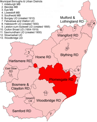
Plomesgate Rural District was a rural district within the administrative county of East Suffolk between 1894 and 1934.
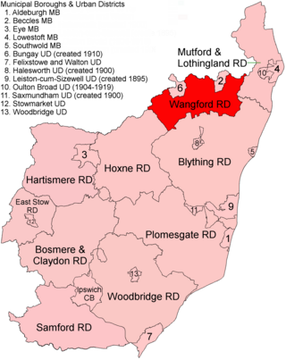
Wangford Rural District was a rural district within the administrative county of East Suffolk between 1894 and 1934. It was created out of the earlier Wangford rural sanitary district. It was named after the historic hundred of Wangford, whose boundaries it closely matched. It contained the group of small villages collectively known as The Saints.
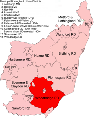
Woodbridge Rural District was a rural district within the administrative county of East Suffolk between 1894 and 1934. It was created out of the earlier Woodbridge rural sanitary district. It surrounded the town of Woodbridge, which had earlier been created as an urban district.

Cheadle Rural District was a rural district in the administrative county of Staffordshire, England from 1894 to 1974, covering an area in the north of the county centred on the small town of Cheadle.
References
- ↑ "1911 Census: Population tables". Kingswinford RD through time. Vision of Britain. Retrieved 10 April 2012.
- 1 2 "Historical statistics - Population". Kingswinford RD through time. Vision of Britain. Retrieved 10 April 2012.
- ↑ Kingswinford Rural District at Vision of Britain. Retrieved 31 January 2006.