
The Glarus Alps are a mountain range in central Switzerland. They are bordered by the Uri Alps and the Schwyz Alps to the west, the Lepontine Alps to the south, the Appenzell Alps to the northeast. The eastern part of the Glarus Alps contains a major thrust fault that was declared a geologic UNESCO World Heritage Site.

Lake Zurich is a lake in Switzerland, extending southeast of the city of Zürich. Depending on the context, Lake Zurich or Zürichsee can be used to describe the lake as a whole, or just that part of the lake downstream of the Hurden peninsula and Seedamm causeway. In the latter case, the upstream part of the lake is called Obersee, whilst the lower part is sometimes also referred to as the Lower Lake, respectively.
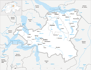
The canton of Schwyz is a canton in central Switzerland between the Alps in the south, Lake Lucerne to the west and Lake Zürich in the north, centred on and named after the town of Schwyz.
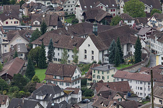
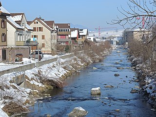
Schwyz is a town and the capital of the canton of Schwyz in Switzerland.
Einsiedeln is a municipality and district in the canton of Schwyz in Switzerland known for its monastery, the Benedictine Einsiedeln Abbey, established in the 10th century.
Alpthal is a village and municipality in Schwyz District in the canton of Schwyz in Switzerland. Besides the village of Alpthal, the municipality includes the ski resort of Brunni, and settlement of Eigen.

The Muota is a river in the Swiss canton of Schwyz and a tributary of Lake Lucerne. It has a length of 29 km (18 mi).
The Bös Fulen is a mountain in the Schwyz Alps, located on the border between the cantons of Schwyz and Glarus. It overlooks the valleys of Muotathal (Schwyz) and Linthal. It is the highest summit of the canton of Schwyz. Politically, it is split between the municipalities of Muotathal (Schwyz) and Glarus. Braunwald is the nearest locality.

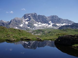
The Ortstock is a mountain in the Schwyzer Alps, located at an elevation of 2,717 m (8,914 ft) on the border between the cantons of Schwyz and Glarus. It overlooks Braunwald and Linthal on its east side, while the west side overlooks the high valley of Glattalp.

The Fronalpstock is a mountain in Switzerland, in the Schwyzer Alps and the canton of Schwyz near the south-east corner of the Four Valley Lakes. It has an elevation of 1,921 metres (6,302 ft) above sea level. The summit is accessible by a chair lift from the village of Stoos.

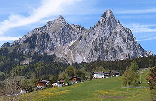
The Grosser Mythen is a mountain in the Schwyzer Alps of Central Switzerland. The mountain lies in the canton of Schwyz, to the east of the town of Schwyz, and to the south of the village of Alpthal in the valley of the river Alp.

The Etzel is a mountain on the south side of Lake Zürich in Switzerland. Although its elevation, of 1,098 metres (3,602 ft), is relatively modest, it is notable for its aspect when viewed from the lake and its surroundings. It is also well known for its views over the lake, and there is a mountain inn at the summit.

Schwyz railway station is a railway station in the municipality of Schwyz, the capital of the canton of Schwyz in Switzerland. Opened in 1882, it is owned and operated by the Swiss Federal Railways, and forms part of the Gotthard railway, which links northern Switzerland and Immensee with Chiasso and Italy, via the Gotthard Tunnel.
Friedrich Huwyler was a Swiss politician. He was affiliated to the Free Democratic Party.

The Rotenfluh is a mountain in the Swiss Prealps, located east of Schwyz in Central Switzerland. It is part of the range surrounding the valley of Alpthal, culminating at the Gross Mythen. The Rotenfluh is a popular vantage point over the Lake Lucerne region.

Grossner Hafner is one of the 111 serial sites of the UNESCO World Heritage Site Prehistoric pile dwellings around the Alps, of which are 56 located in Switzerland.

Prehistoric pile dwellings around Lake Zurich are pile dwelling sites located around Lake Zurich in the cantons of Schwyz, St. Gallen and Zürich.
The Alp is a river in the Swiss canton of Schwyz and a tributary of the Sihl. It has a length of 19.3 km (12.0 mi). The river rises on the northwestern flanks of the Brünnelistock and the northern flanks of the Kleiner and Grosser Mythen mountains near Brunni, and flows in generally northerly direction through the village of Alpthal, the village of Trachslau, the town of Einsiedeln and the village of Biberbrugg. At Biberbrugg, the river Biber joins the Alp. Some 2 km (1.2 mi) north of Biberbrugg, at Dreiwässern the Alp flows into the Sihl.

The Schwyz Alps are a mountain range in Switzerland. They form part of the North-Eastern Swiss Alps and are bordered by the Glarus Alps to the east, the Appenzell Alps to the north-east, the Emmental Alps in the west, and the Uri Alps to the south-west. The Klausen Pass is the highest point between the Schwyz Alps and the Glarus Alps.

