The Glarus Alps are a mountain range in central Switzerland. They are bordered by the Uri Alps and the Schwyz Alps to the west, the Lepontine Alps to the south, the Appenzell Alps to the northeast. The eastern part of the Glarus Alps contains a major thrust fault that was declared a geologic UNESCO World Heritage Site.

Lake Zurich is a lake in Switzerland, extending southeast of the city of Zürich. Depending on the context, Lake Zurich or Zürichsee can be used to describe the lake as a whole, or just that part of the lake downstream of the Seedamm at Rapperswil, whilst the part upstream of Rapperswil may be called the Obersee or Upper Lake.
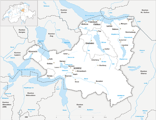
The canton of Schwyz is a canton in central Switzerland between the Alps in the south, Lake Lucerne to the west and Lake Zürich in the north, centred on and named after the town of Schwyz.

The 26 cantons of Switzerland are the member states of the Swiss Confederation. The nucleus of the Swiss Confederacy in the form of the first three confederate allies used to be referred to as the Waldstätte. Two important periods in the development of the Old Swiss Confederacy are summarized by the terms Acht Orte and Dreizehn Orte.
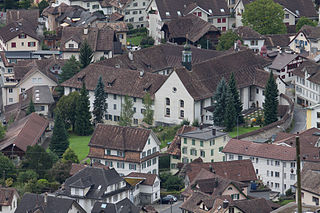
The town of Schwyz is the capital of the canton of Schwyz in Switzerland.
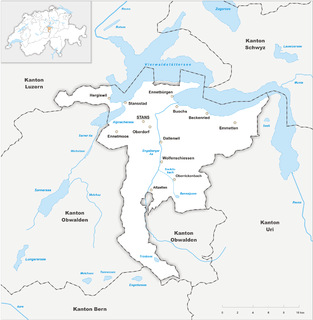
Nidwalden, also Nidwald is one of the 26 cantons forming the Swiss Confederation. It is composed of eleven municipalities and the seat of the government and parliament is in Stans. It is traditionally considered a "half-canton", the other half being Obwalden.

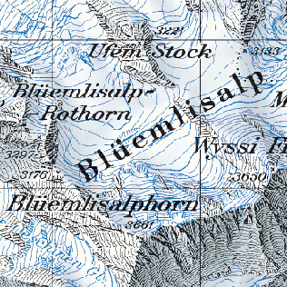
Swisstopo is the official name for the Swiss Federal Office of Topography, Switzerland's national mapping agency.
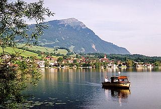
The Rigi is a mountain massif of the Alps, located in Central Switzerland. The whole massif is almost entirely surrounded by the water of three different bodies of water: Lake Lucerne, Lake Zug and Lake Lauerz. The range is in the Schwyzer Alps, and is split between the cantons of Schwyz and Lucerne, although the main summit, named Rigi Kulm, at 1,798 meters above sea level, lies within the canton of Schwyz. The Rigi Kulm Hotel, established in 1816, is located on the summit.

Einsiedeln is a municipality and district in the canton of Schwyz in Switzerland known for its monastery, the Benedictine Einsiedeln Abbey, established in the 10th century.
Alpthal is a village and municipality in Schwyz District in the canton of Schwyz in Switzerland. Besides the village of Alpthal, the municipality includes the ski resort of Brunni, and settlement of Eigen.
The cartography of Switzerland is the history of surveying and creation of maps of Switzerland. Switzerland has had its current boundaries since 1815, but maps of the Old Swiss Confederacy were drawn since the 16th century. The first topographical survey on a federal level began in 1809, resulting in the Topographic Map of Switzerland or Dufour Map. From 1869 to 1901, this map was replaced by the Topographic Atlas of Switzerland or Siegfried Map.

The English name of Switzerland is a compound containing Switzer, an obsolete term for the Swiss, which was in use during the 16th to 19th centuries. The English adjective Swiss is a loan from French Suisse, also in use since the 16th century.
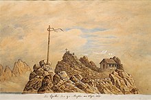
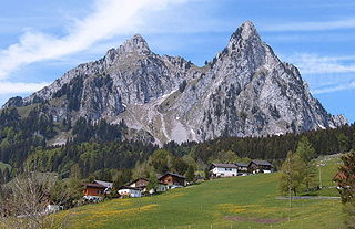
The Kleiner Mythen is a mountain in the Schwyzer Alps of Central Switzerland. The mountain lies in the canton of Schwyz, to the east of the town of Schwyz, to the south of the village of Alpthal in the valley of the Alp river, and to the north of the Grosser Mythen.

The Rotenfluh is a mountain in the Swiss Prealps, located east of Schwyz in Central Switzerland. It is part of the range surrounding the valley of Alpthal, culminating at the Gross Mythen. The Rotenfluh is a popular vantage point over the Lake Lucerne region.
In legend and in the early historiography of Switzerland there is an account of a migration of a population of Swedes and Frisians settling in the Swiss Alps, specifically in Schwyz and in Hasli (Schwedensage).

Buechberg is an elongated molasse hill in the Swiss cantons of Schwyz and St. Gallen on Obersee lakeshore.
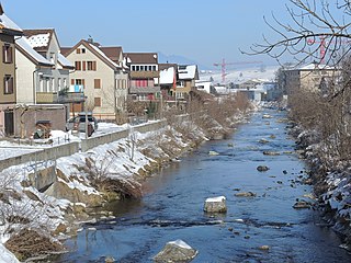
The Alp is a river in the Swiss canton of Schwyz and a tributary of the Sihl. It has a length of 19.3 km (12.0 mi). The river rises on the northwestern flanks of the Brünnelistock and the northern flanks of the Kleiner and Grosser Mythen mountains near Brunni, and flows in generally northerly direction through the village of Alpthal, the village of Trachslau, the town of Einsiedeln and the village of Biberbrugg. At Biberbrugg, the river Biber joins the Alp. Some 2 km (1.2 mi) north of Biberbrugg, at Dreiwässern the Alp flows into the Sihl.