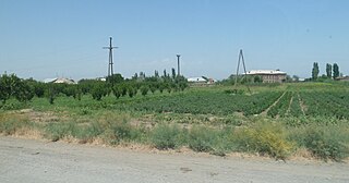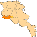
Yervandashat is a village in the Armavir Province of Armenia. The village has a ruined basilica dated to the 4th or 5th century and the Saint Shushanik church of the 10th to 17th century. Along the main highway leading to and from the area are khachkar monuments. It is named after the nearby Armenian historic city of Yervandashat

Hatsik is a town in the Armavir Province of Armenia. The town was founded in 1933. It was named in honor of Kliment Voroshilov, a Soviet politician, and later called Nairi from 1963 to 1991. Population is 2973.

Khoronk is a town in the Armavir province of Armenia. The town's church dates to 1880.

Norapat is a former town in the Armavir Province of Armenia. The town is now part of Armavir.

Amasia is a village in the Armavir Province of Armenia.

Aygeshat, known as Ghuzigidan until 1950, is a village in the Armavir Province of Armenia.

Baghramyan, Bagramyan or Bagramian, is a village in the Armavir Province of Armenia. It is named after the Soviet Armenian military commander and Marshal of the Soviet Union Hovhannes Baghramyan.

Berkashat is a village in the Armavir Province of Armenia.

Dalarik is a town in the Armavir Province of Armenia.

Hushakert is a town in the Armavir Province of Armenia.

Lenughi is a village in the Armavir Province of Armenia. The town's church, dedicated to Saint Nshan, dates from the 1870s. The "MAP" brandy and wine factory is located in Lenughi.

Nor Armavir is a village in the Armavir Province of Armenia. The village was founded in 1923 by Armenian refugees from Turkey, who named the village after the ancient city of Armavir, which has its ruins nearby. However, The village is known first and foremost for the Battle of Sardarabad during the Caucasus Campaign, as the battle occurred on the modern site of the town in 1918.

Shavarut is a town in the Armavir Province of Armenia.

Shenavan is a town in the Armavir Province of Armenia.

Arevadasht, is a village in the Armavir Province of Armenia.

Talvorik is a village in the Armavir Province of Armenia.

Aygevan ; formerly Sovkhoz Nomer Shest –, later Imeni Stalina, later Dzerzhinski and Imeni Dzerzhinskogo, is a village in the Armavir Province of Armenia. It was founded as a state farm in 1946 and named after Felix Dzerzhinski, head of the Soviet secret police.

Nor Kesaria is a town in the Armavir Province of Armenia. The town was founded in 1949 as a state farm for geranium oil extraction.

Shenik, is a village in the Armavir Province of Armenia. It was founded in 1969 in the southwestern part of Armavir Province, at an area was once closed to foreigners.

Argina is a town in the Armavir Province of Armenia. The town was named after the Argina Monastery, which is across the border in Turkey.


