Jrashen, Armavir

Last updated

Coordinates: 40°05′N44°01′E / 40.083°N 44.017°E / 40.083; 44.017

Geographic coordinate system Coordinate system

A geographic coordinate system is a coordinate system that enables every location on Earth to be specified by a set of numbers, letters or symbols. The coordinates are often chosen such that one of the numbers represents a vertical position and two or three of the numbers represent a horizontal position; alternatively, a geographic position may be expressed in a combined three-dimensional Cartesian vector. A common choice of coordinates is latitude, longitude and elevation. To specify a location on a plane requires a map projection.

Jrashen
Ջրաշեն
Armenia adm location map.svg
Red pog.svg
Jrashen
Coordinates: 40°05′N44°01′E / 40.083°N 44.017°E / 40.083; 44.017
Country Armenia
Marz (Province) Armavir
Founded 1928
Population (2001)
  Total 727
Time zone   (UTC+4)

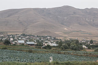
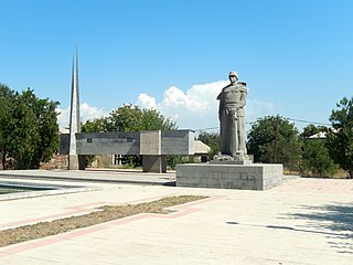
Jrashen (Armenian : Ջրաշեն), is a village in the Armavir Province of Armenia. It was founded in 1928. According to the 2001 census, the population was 727.

Armenian language Indo-European language

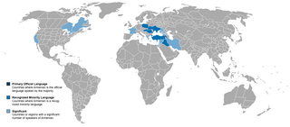
The Armenian language is an Indo-European language spoken primarily by Armenians. It is the official language of Armenia. Historically being spoken throughout the Armenian Highlands, today, Armenian is widely spoken throughout the Armenian diaspora. Armenian is written in its own writing system, the Armenian alphabet, introduced in 405 AD by Mesrop Mashtots.

Armavir Province Province in Armenia

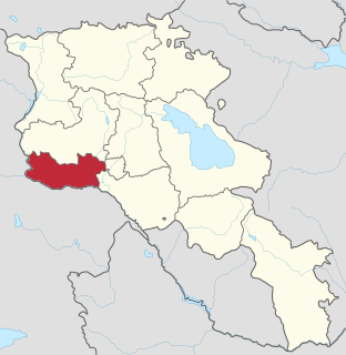
Armavir, is a province (marz) in the western part of Armenia. Located in the Ararat plain dominated by Mount Ararat from the south and Mount Aragats from the north, the province's capital is the town of Armavir while the largest city is Vagharshapat (Etchmiadzin). The province shares a 72 km (45 mi)-long border with Turkey to the south and west.

See also

Related Research Articles

Janfida Place in Armavir, Armenia

Janfida, is a village in the Armavir Province of Armenia.

Jrashen, Lori Place in Lori, Armenia

Jrashen, formerly known as Vardnav), is a major village in the Lori Province of Armenia.

Khoronk Place in Armavir, Armenia

Khoronk is a town in the Armavir province of Armenia. The town's church dates to 1880.

Norapat Place in Armavir, Armenia

Norapat is a former town in the Armavir Province of Armenia. The town is now part of Armavir.

Tairov Place in Armavir, Armenia

Tairov, is a village in the Armavir Province of Armenia. It belongs to the community of Parakar village.

Voskehat, Armavir Place in Armavir, Armenia

Voskehat is a town in the Armavir Province of Armenia.

Amasia, Armavir Place in Armavir, Armenia

Amasia is a village in the Armavir Province of Armenia.

Amberd, Armavir Place in Armavir, Armenia

Amberd ; known as Franganots until 1978, is a village in the Armavir Province of Armenia. The village is home to the historic church of Thomas the Apostle, dating back to the 12th century.

Aragats, Armavir Place in Armavir Province, Armenia

Aragats is a village in the Armavir Province of Armenia. The village's church, dedicated to Saint Stepanos, dates to 1870. There is a Urartian fortress nearby.

Araks, Vagharshapat Place in Armavir, Armenia

Araks, known as Nerkin Karkhun and Sharifabad until 1946, is a village in the eastern part of the Armavir Province of Armenia.

Argavand, Armavir Place in Armavir, Armenia

Argavand is a village in the Armavir Province of Armenia.

Artimet Place in Armavir Province, Armenia

Artimet is a village in the Armavir Province of Armenia. The church of the village named after Saint Gregory the Illuminator, dates back to 1876.

Aygeshat, Armavir Place in Armavir, Armenia

Aygeshat, known as Ghuzigidan until 1950, is a village in the Armavir Province of Armenia.

Jrarat, Armavir Place in Armavir, Armenia

Jrarat formerly known as Gharkhun or Verin Gharkhun, is a village in the Armavir Province of Armenia. It has a large poultry industry and nearby is a piece of land reserved for the cochineal dye beetles, Porphyrophora hamelii.

Lusagyugh, Armavir Place in Armavir, Armenia

Lusagyugh is a town in the Armavir Province of Armenia.

Shahumyan, Armavir Place in Armavir, Armenia

Shahumyan formerly known as Molla Dursun, is a village in the Armavir Province of Armenia. It was renamed after Stepan Shahumyan, an Armenian Bolshevik commissar.

Tandzut, Armavir Place in Armavir, Armenia

Tandzut is a village in the Armavir Province of Armenia.

Vardanashen Place in Armavir, Armenia

Vardanashen is a town in the Armavir Province of Armenia.

Haykavan, Armavir Place in Armavir, Armenia

Haykavan is a town in the Armavir Province of Armenia.

Shahumyani trchnafabrika Place in Armavir, Armenia

Shahumyani trchnafabrika is a village in the Armavir Province of Armenia.

References

    The GEOnet Names Server (GNS) provides access to the National Geospatial-Intelligence Agency's (NGA) and the U.S. Board on Geographic Names's (BGN) database of geographic feature names and locations for locations outside the United States. The database is the official repository of foreign place-name decisions approved by the US BGN. Approximately 20,000 of the database's features are updated monthly. The database never removes an entry, "except in cases of obvious duplication".

    National Statistical Service of Republic of Armenia is the national statistical agency of Armenia.