Kokerbin Rock

Last updated

Kokerbin Rock
Kokerbin Hill
Kokerbin Rock.JPG
Kokerbin Rock in the morning
Highest point
Elevation 122 m (400 ft)
Coordinates 31°53′20″S117°42′24″E / 31.88898°S 117.706778°E / -31.88898; 117.706778 (Kokerbin Rock)
Geography
Australia relief map.jpg
Red triangle with thick white border.svg
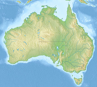
Kokerbin Rock
Location in Australia
Location Shire of Bruce Rock, Wheatbelt, Western Australia

Kokerbin Rock, also known as Kokerbin Hill, is a granite rock formation located within Kokerbin Nature Reserve in the Wheatbelt region of Western Australia. [1] [2] The area has special significance for the Nyoongar. [3] There are claims that Kokerbin Rock is the third largest monolith in Australia, [1] [2] [4] [5] [6] with Mount Wudinna in South Australia being the second largest and Uluru in the Northern Territory being the largest.

Contents

Kokerbin Nature Reserve was established in 1991, and has an area of 91 hectares (220 acres). [7] It is approximately 40 km (25 mi) east of Quairading and 30 km (19 mi) south of Kellerberrin by road.

Description

Rock formation on Kokerbin Rock. Kokerbin Rock Formation, March 2013.jpg
Rock formation on Kokerbin Rock.
Stone Well near Kokerbin Rock Stone Well near Kokerbin Rock.JPG
Stone Well near Kokerbin Rock

Caves, rock formations, and the summit are accessible by marked bush walks. [4] The rock formations include a wave rock formation, Dog Rock and Devil's Marbles. On the western side of Kokerbin Rock is a historic stone well [8] and an old school site, remainders of early European settlement.

A picnic area and toilet facilities are located on the eastern side of Kokerbin Rock. [4]

Kokerbin Rock
Kokerbin Rock is located within the Kokerbin Nature Reserve

See also

References

  1. 1 2 "Kokerbin Rock". Shire Of Bruce Rock. Archived from the original on 10 December 2013. Retrieved 1 December 2013.
  2. 1 2 "Kokerbin Rock". Shire Of Kellerberrin. Archived from the original on 14 March 2016. Retrieved 1 December 2013.
  3. "Literature Review for Avon Basin Noongar Heritage and Cultural Significance of Natural Resources" (PDF). Murdoch University. Archived from the original (PDF) on 16 March 2016. Retrieved 19 January 2016.
  4. 1 2 3 "Kokerbin Nature Reserve". Department of Parks and Wildlife. Retrieved 1 December 2013.
  5. "Roaming Down Under". Graham Barker. Archived from the original on 1 December 2013. Retrieved 1 December 2013.
  6. "Which are the biggest three monoliths in Australia?". AustraliaSoMuchtoSee.com. Retrieved 1 December 2013.
  7. UNEP-WCMC (May 2022). "Protected Area Profile for Kokerbin". World Database of Protected Areas. Retrieved 22 May 2022.
  8. "Granite Outcrops in the Wheatbelt". Central Wheatbelt Visitor Centre, Merredin. Archived from the original on 26 April 2014. Retrieved 1 December 2013.

Further reading

  1. Griffiths, M; Lewis, P (2009). Kokerbin Nature Reserve Fauna Survey (PDF). M Griffiths and P Lewis Fauna Consultants. Archived from the original (PDF) on 2 May 2013. Retrieved 1 December 2013.
  2. Inglis, Rowan; Jolliffe, David; Blechynden, Paul (2008). Black-Flanked Rock-Wallaby Conservation Plan for the Central Wheatbelt Populations 2008-2013 (PDF). Department of Environment and Conservation. Archived from the original (PDF) on 4 May 2013. Retrieved 1 December 2013.

Commons-logo.svg Media related to Kokerbin Rock at Wikimedia Commons