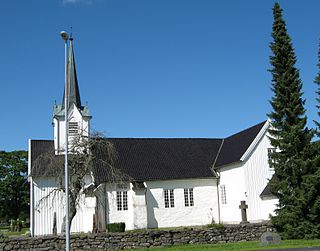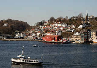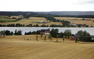
Oppland[ˈɔ̂plɑn](listen) is a former county in Norway which existed from 1781 until its dissolution on 1 January 2020. The old Oppland county bordered the counties of Trøndelag, Møre og Romsdal, Sogn og Fjordane, Buskerud, Akershus, Oslo and Hedmark. The county administration was located in the town of Lillehammer.

Oppegård is an area in Nordre Follo, Viken, Norway. Oppegård was a municipality in the former county Akershus.

Gausdal is a municipality in Innlandet county, Norway. It is located in the traditional district of Gudbrandsdal. The administrative centre of the municipality is the village of Segalstad bru. Other villages in Gausdal include Follebu, Forset, and Svingvoll.

Østre Toten is a municipality in Innlandet county, Norway. It is part of the traditional region of Toten. The administrative centre of the municipality is the village of Lena.

Vestre Toten is a municipality in Innlandet county, Norway. It is part of the traditional region of Toten. The administrative centre of the municipality is the small town of Raufoss.

Nord-Aurdal is a municipality in Innlandet county, Norway. It is located in the traditional district of Valdres. The administrative centre of the municipality is the town Fagernes. Other urban centres in Nord-Aurdal include the villages of Aurdal, Leira, and Skrautvål. The municipality is served by Fagernes Airport, Leirin. In Nord-Aurdal, there is an alpine skiing center called Valdres Alpinsenter.

Øystre Slidre is a municipality in Innlandet county, Norway. It is located in the traditional district of Valdres. The administrative centre of the municipality is the village of Heggenes. Other villages in the municipality include Hegge, Rogne, Volbu, Moane, Skammestein, Beito, and Beitostølen.

Vestre Moland is a former municipality in the old Aust-Agder county in Norway. The administrative centre of the municipality was the village of Møglestu where the Vestre Moland Church is located. The 103-square-kilometre (40 sq mi) municipality existed from 1838 until 1962 when it was merged into the municipality of Lillesand. Today, the area of Vestre Moland covers the northern part of the present-day municipality of Lillesand in Agder county.

Slidre is the administrative centre of Vestre Slidre Municipality in Innlandet county, Norway. The village is located along the Slidrefjorden in the Valdres district. The village is located along the European route E16 highway, about 25 kilometres (16 mi) northwest of Fagernes.

Barbu is a former municipality in the old Aust-Agder county in Norway. Today, it is part of the is part of the town of Arendal in Agder county. The 15.3-square-kilometre (5.9 sq mi) municipality existed from 1878 until 1902 when it was merged into the town of Arendal. The municipality was located just to the north of what was then the 0.34-square-kilometre (84-acre) town of Arendal. The administrative centre of the small, urban municipality was called Barbu as well. Barbu Church was the church for the municipality.

Østre Gausdal is a former municipality in the old Oppland county, Norway. The 227-square-kilometre (88 sq mi) municipality existed from 1879 until its dissolution in 1962. The area is now part of Gausdal Municipality. The administrative centre was the village of Segalstad bru.

Vestre Gausdal is a former municipality in the old Oppland county, Norway. The 959-square-kilometre (370 sq mi) municipality existed from 1879 until its dissolution in 1962. The area is now part of Gausdal Municipality. The administrative centre was the village of Forset.

Bakke is a former municipality in Vest-Agder county, Norway. The 244-square-kilometre (94 sq mi) municipality existed from 1838 until its dissolution in 1965. It was located in the present-day municipalities of Sirdal and Flekkefjord. It included the whole Sirdalen valley along the Rogaland county border, stretching from the Aust-Agder county border in the north to Sirnes and the lake Lundevatnet in the south. The administrative center was the village of Sira where Bakke Church is located.

Vardal is a former municipality in the old Oppland county, Norway. The 263-square-kilometre (102 sq mi) municipality existed from 1838 until its dissolution in 1964. The area is now divided between Gjøvik Municipality and Vestre Toten Municipality in the traditional district of Vestoppland. The administrative centre was the village of Vardal.

Austre Moland is a former municipality in the old Aust-Agder county in Norway. The roughly 72-square-kilometre (28 sq mi) municipality existed from 1838 until 1962 when it was merged with several neighboring municipalities to form the new municipality of Moland. It is now part of the municipality of Arendal in Agder county. The administrative centre was at Brekka where the Austre Moland Church is located.

Segalstad bru is the administrative centre of Gausdal Municipality in Innlandet county, Norway. The village is located at the crossroad between Østre Gausdal and Vestre Gausdal. The village sits along the north side of the river Jøra, about 3 kilometres (1.9 mi) to the northwest of the village of Follebu and about 5 kilometres (3.1 mi) to the northeast of the village of Forset.

Arendal is a city in Agder county, Norway. The city is the administrative centre of the municipality of Arendal and the seat of the County Governor of Agder. The city also includes a small area in the neighbouring municipality of Grimstad as well. In Norway, Arendal is considered a by which can be translated as either a "town" or "city" in English.

Brandbu is a former municipality in the old Oppland county, Norway. The 471-square-kilometre (182 sq mi) municipality existed from 1897 until its dissolution in 1962. The area is now part of Gran Municipality in the traditional district of Hadeland. The administrative centre was the village of Brandbu. The municipality included land on both sides of the large lake Randsfjorden, although most of the municipal residents lived on the east side of the lake.

Kolbu is a former municipality in the old Oppland county, Norway. The 132-square-kilometre (51 sq mi) municipality existed from 1908 until its dissolution in 1964. The area is now part of Østre Toten Municipality in the traditional district of Toten. The administrative centre was the village of Kolbu.

Eina is a former municipality in the old Oppland county, Norway. The 104-square-kilometre (40 sq mi) municipality existed from 1908 until its dissolution in 1964. The area is now part of Vestre Toten Municipality in the traditional district of Toten. The administrative centre was the village of Eina.


