
The Upper Palatinate is one of the seven administrative districts of Bavaria, Germany, and is located in the east of Bavaria. It consists of seven districts and 226 municipalities.
Würzburg is a Landkreis (district) in the northwestern part of Bavaria, Germany. Neighboring districts are Main-Spessart, Schweinfurt, Kitzingen, Neustadt (Aisch)-Bad Windsheim, and the district Main-Tauber in Baden-Württemberg. The city Würzburg is not part of the district, although it is completely enclosed by it.
Tirschenreuth is a Landkreis (district) in the northeastern part of Bavaria, Germany. Neighboring districts are Neustadt an der Waldnaab, Bayreuth and Wunsiedel. To the east are the Czech districts of Tachov (Plzeň) and Cheb.

Therese Neumann was a German Catholic mystic and stigmatic. Neumann has been considered Servant of God by the Catholic Church since 2005.

Tirschenreuth is the capital city of the district of Tirschenreuth. It is located in the northeast of Bavaria, very close to the Czech-Bavarian border.
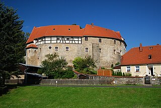
Waldershof is a town in the district of Tirschenreuth, in Bavaria, Germany. It is situated 22 km northwest of Tirschenreuth, and 3 km southwest of Marktredwitz.
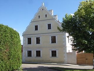
Wallerstein is a municipality and former principality in the district of Donau-Ries in Bavaria in Germany.

Andechs is a municipality in the district of Starnberg in Bavaria in Germany. It is renowned in Germany and beyond for Andechs Abbey, a Benedictine monastery that has brewed beer since 1455. The monastery brewery offers tours to visitors.

Altendorf is a community in the Upper Franconian district of Bamberg, Bavaria, Germany.

Gerach is a community in the Upper Franconian district of Bamberg and a member of the administrative community (Verwaltungsgemeinschaft) of Baunach. It lies in the Naturpark Haßberge roughly 20 km north of Bamberg and roughly 10 km south of Ebern.
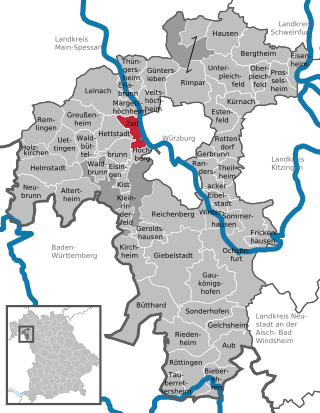
Zell am Main is a municipality in the district of Würzburg in Bavaria in Germany, situated on the river Main.

Außernzell is a municipality in the district of Deggendorf in Bavaria in Germany. It is part of the municipal union of Schöllnach.

Saal is a municipality in the district of Kelheim in Bavaria in Germany. It is located along the banks of the Danube River, around 25 km southwest of Regensburg.
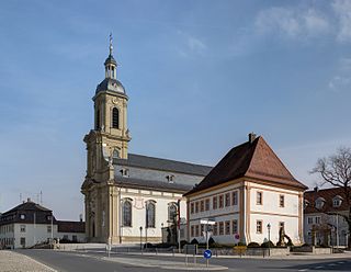
Wiesentheid is a municipality in the district of Kitzingen in Bavaria in Germany.

Aura im Sinngrund is a community in the Main-Spessart district in the Regierungsbezirk of Lower Franconia (Unterfranken) in Bavaria, Germany and a member of the Verwaltungsgemeinschaft of Burgsinn.

Großheubach is a market community in the Miltenberg district in the Regierungsbezirk of Lower Franconia (Unterfranken) in Bavaria, Germany.
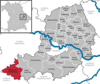
Mallersdorf-Pfaffenberg is a municipality in the district of Straubing-Bogen in Bavaria, Germany and has around 7000 inhabitants.

Helmstadt is a municipality in the Lower Franconian district of Würzburg in Bavaria in Germany.

Halfing is a municipality in the district of Rosenheim in Bavaria in Germany. It is located in the western part of the Chiemgau area, half-way between Chiemsee and Wasserburg am Inn.
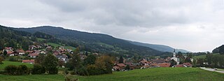
Elisabethszell is a parish village (Pfarrdorf) in the municipality of Haibach in the Lower Bavarian county of Straubing-Bogen in Germany.


