Swabia is one of the seven administrative regions of Bavaria, Germany. It consists of ten districts and 340 municipalities with Augsburg being the administrative capital. It is the only german region officially be named Swabia in the principle of spatiality.
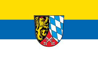
The Upper Palatinate is an administrative district in the east of Bavaria, Germany. It consists of seven districts and 226 municipalities, including three cities.
Neustadt an der Waldnaab is a Landkreis (district) in Bavaria, Germany. It is bounded by the districts of Schwandorf, Amberg-Sulzbach, Bayreuth and Tirschenreuth, and by the Czech Republic. The city of Weiden in der Oberpfalz is enclosed by, but does not belong to the district.
Wunsiedel is a Landkreis (district) in the northeastern part of Bavaria, Germany. Neighbouring districts are Tirschenreuth, Bayreuth, Hof, and to the east the Czech Republic.
Tirschenreuth is a Landkreis (district) in the northeastern part of Bavaria, Germany. Neighboring districts are Neustadt an der Waldnaab, Bayreuth and Wunsiedel. To the east are the Czech districts of Tachov (Plzeň) and Cheb.

Hirschau is a municipality in the Amberg-Sulzbach district, Upper Palatinate, Bavaria, Germany.

Kemnath is a small town in the district of Tirschenreuth, in Bavaria, Germany. It is situated near the Fichtel Mountains, 24 km southeast of Bayreuth.

Neuburg an der Donau is a town which is the capital of the Neuburg-Schrobenhausen district in the state of Bavaria in Germany.

Cham is the capital of the district of Cham in the Upper Palatinate in Bavaria in Germany.

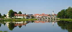
Waldsassen is a town in the district of Tirschenreuth in the Upper Palatinate region of Bavaria.

Waldsassen Abbey is a Cistercian nunnery, formerly a Cistercian monastery, located on the River Wondreb at Waldsassen near Tirschenreuth, Oberpfalz, in Bavaria, Germany, close to the border with the Czech Republic. In the Holy Roman Empire it was an Imperial Abbey.

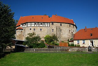
Bärnau is a town in the district of Tirschenreuth, Bavaria, Germany. It is situated near the border with the Czech Republic, 25 km northeast of Weiden in der Oberpfalz, and 26 km southwest of Mariánské Lázně. It obtained town privileges in 1343, making it the oldest town in the district.

Freyung is a town in Bavaria, Germany, capital of the Freyung-Grafenau district. It is situated in the Bavarian Forest mountain range, near the border with Austria and the Czech Republic.

Bad Kötzting is a town in the district of Cham, in Bavaria, Germany, near the Czech border. It is situated in the Bavarian Forest, 15 km (9.3 mi) southeast of Cham.

Schnaittenbach is a town in the Amberg-Sulzbach district, in Bavaria, Germany. It is situated 16 km northeast of Amberg.
Waldershof is a town in the district of Tirschenreuth, in Bavaria, Germany. It is situated 22 km northwest of Tirschenreuth, and 3 km southwest of Marktredwitz.

Waldmünchen, is a town in the district of Cham, in Bavaria, Germany. It is situated near the border with the Czech Republic, 18 km (11 mi) north of Cham, and 18 km (11 mi) southwest of Domažlice.

Konnersreuth is a municipality in the district of Tirschenreuth in Bavaria, Germany. It is situated in the northeast foothills of the Steinwald mountains between the Fichtel Mountains and the Upper Palatinate Forest, close to the Czech border. The village is best known as the home of the 20th-century Catholic stigmatist Therese Neumann.

Steingaden is a town and municipality in the Weilheim-Schongau district of Upper Bavaria, Germany. It is the site of the 12th-century Steingaden Abbey and the Wies Church, a UNESCO World Heritage Site.
Königswartha, in Sorbian Rakecy, is a municipality in the east of Saxony, Germany. It belongs to the district of Bautzen and lies 20 km north of the eponymous city.