
Flaming Gorge Reservoir is the largest reservoir in Wyoming, on the Green River, impounded behind the Flaming Gorge Dam. Construction on the dam began in 1958 and was completed in 1964. The reservoir stores 3,788,900 acre-feet (4.6735×10⁹ m3) of water when measured at an elevation of 6,040 feet (1,841 m) above sea-level (maximum).

The Payette River is an 82.7-mile-long (133.1 km) river in southwestern Idaho and is a major tributary of the Snake River.

Pathfinder Dam is a masonry dam, located on the North Platte River, approximately 47 miles (76 km) southwest of Casper, Wyoming. It was originally constructed between 1905 and 1909 as part of the North Platte Project and has been modified several times since then. It is included on the National Register of Historic Places. Construction of the dam created Pathfinder Reservoir which provides water storage for 226,000 acres (910 km2) of irrigation in Wyoming and Nebraska. The dam is named for General John Charles Fremont, who had explored the area in 1842 and was nicknamed the "Pathfinder of the West."

Flaming Gorge Dam is a concrete thin-arch dam on the Green River, a major tributary of the Colorado River, in northern Utah in the United States. Flaming Gorge Dam forms the Flaming Gorge Reservoir, which extends 91 miles (146 km) into southern Wyoming, submerging four distinct gorges of the Green River. The dam is a major component of the Colorado River Storage Project, which stores and distributes upper Colorado River Basin water.
Buffalo Bill State Park is a public recreation area surrounding the reservoir formed by the Buffalo Bill Dam, an impoundment of the Shoshone River, in Park County, Wyoming. The state park, reservoir and dam were named after William "Buffalo Bill" Cody, who founded the nearby town of Cody and who owned much of the land now occupied by the reservoir and park. The park offers camping, hiking, boating, fishing, and picnicking and is managed by Wyoming Division of State Parks and Historic Sites.

Navajo Dam is a dam on the San Juan River, a tributary of the Colorado River, in northwestern New Mexico in the United States. The 402-foot (123 m) high earthen dam is situated in the foothills of the San Juan Mountains about 44 miles (71 km) upstream and east of Farmington, New Mexico. It was built by the U.S. Bureau of Reclamation (Reclamation) in the 1960s to provide flood control, irrigation, domestic and industrial water supply, and storage for droughts. A small hydroelectric power plant was added in the 1980s.

Jackson Lake Dam is a concrete and earth-fill dam in the western United States, at the outlet of Jackson Lake in northwestern Wyoming. The lake and dam are situated within Grand Teton National Park in Teton County. The Snake River emerges from the dam and flows about eight hundred miles (1,300 km) through Wyoming, Idaho, Oregon, and Washington to its mouth on the Columbia River in eastern Washington.

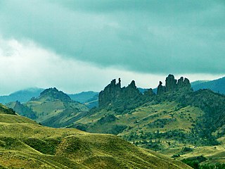
Yellowtail Dam is a dam across the Bighorn River in south central Montana in the United States. The mid-1960s era concrete arch dam serves to regulate the flow of the Bighorn for irrigation purposes and to generate hydroelectric power. The dam and its reservoir, Bighorn Lake, are owned by the U.S. Bureau of Reclamation.

Buffalo Bill Dam is a concrete arch-gravity dam on the Shoshone River in the U.S. state of Wyoming. It is named after the famous Wild West figure William "Buffalo Bill" Cody, who founded the nearby town of Cody and owned much of the land now covered by the reservoir formed by its construction. The dam is part of the Shoshone Project, successor to several visionary schemes promoted by Cody to irrigate the Bighorn Basin and turn it from a semi-arid sagebrush-covered plain to productive agricultural land. Known at the time of its construction as Shoshone Dam, it was renamed in 1946 to honor Cody.

The Colorado River Storage Project is a United States Bureau of Reclamation project designed to oversee the development of the upper Colorado River basin. The project provides hydroelectric power, flood control and water storage for participating states along the upper portion of the Colorado River and its major tributaries.

Hyrum State Park is a state park and reservoir in Cache County, Utah, United States.

The Rio Grande Project is a United States Bureau of Reclamation irrigation, hydroelectricity, flood control, and interbasin water transfer project serving the upper Rio Grande basin in the southwestern United States. The project irrigates 193,000 acres (780 km2) along the river in the states of New Mexico and Texas. Approximately 60 percent of this land is in New Mexico. Some water is also allotted to Mexico to irrigate some 25,000 acres (100 km2) on the south side of the river. The project was authorized in 1905, but its final features were not implemented until the early 1950s.

The Minidoka Project is a series of public works by the U.S. Bureau of Reclamation to control the flow of the Snake River in Wyoming and Idaho, supplying irrigation water to farmlands in Idaho. One of the oldest Bureau of Reclamation projects in the United States, the project involves a series of dams and canals intended to store, regulate and distribute the waters of the Snake, with electric power generation as a byproduct. The water irrigates more than a million acres (4,000 km²) of otherwise arid land, producing much of Idaho's potato crop. Other crops include alfalfa, fruit and sugar beets. The primary irrigation district lies between Ashton in eastern Idaho and Bliss in the southwestern corner of the state. Five main reservoirs collect water, distributing it through 1,600 miles (2,600 km) of canals and 4,000 miles (6,400 km) of lateral distribution ditches.

Caballo Dam is an earthen dam on the Rio Grande about 15 miles (24 km) downstream from Truth or Consequences, New Mexico, United States. In conjunction with Elephant Butte Dam, which lies about 25 miles (40 km) upstream, it regulates the discharge of the river in the lower Rio Grande Valley of New Mexico. Caballo serves as an afterbay for the Elephant Butte Reservoir, i.e. it stores water released from Elephant Butte for hydroelectricity generation purposes and discharges it in the dry season to provide for irrigation agriculture downstream. The dam is an important part of the Rio Grande Project. A secondary purpose of the dam was to compensate for lost capacity in Elephant Butte Lake due to sedimentation.

Webster Reservoir is a reservoir in Rooks County, Kansas, United States. Built and managed by the U.S. Bureau of Reclamation, it is used for flood control, irrigation, and recreation. Webster State Park is located on its shore.

Stampede Dam is a dam in Sierra County, California, impounding the Little Truckee River.
Meeks Cabin Dam is a dam on the Blacks Fork of the Green River, located in Uinta County, southwestern Wyoming. It impounds Meeks Cabin Reservoir, which is mostly in Wyoming, with a portion extending south over the state line into Utah.

Bonny Dam is a dam in Yuma County, Colorado, in the eastern part of the state.

Heron Dam is a storage dam Rio Arriba County, in northern New Mexico in the southwestern United States, just north of the El Vado Dam. It is owned and operated by the United States Bureau of Reclamation. The dam is about 9 miles west of the town of Tierra Amarilla.

