Annowo is a village in the administrative district of Gmina Gruta, within Grudziądz County, Kuyavian-Pomeranian Voivodeship, in north-central Poland.

Szczytno is a village in the administrative district of Gmina Choceń, within Włocławek County, Kuyavian-Pomeranian Voivodeship, in north-central Poland. It lies approximately 22 kilometres (14 mi) south of Włocławek and 67 km (42 mi) south of Toruń.
Halasy is a village in the administrative district of Gmina Międzyrzec Podlaski, within Biała Podlaska County, Lublin Voivodeship, in eastern Poland.
Stary Widok is a village in the administrative district of Gmina Kobiele Wielkie, within Radomsko County, Łódź Voivodeship, in central Poland.
Antonin is a village in the administrative district of Gmina Burzenin, within Sieradz County, Łódź Voivodeship, in central Poland. It lies approximately 2 kilometres (1 mi) north-east of Burzenin, 17 km (11 mi) south-east of Sieradz, and 56 km (35 mi) south-west of the regional capital Łódź.
Godzianów is a village in Skierniewice County, Łódź Voivodeship, in central Poland. It is the seat of the gmina called Gmina Godzianów. It lies approximately 10 kilometres (6 mi) south-west of Skierniewice and 42 km (26 mi) east of the regional capital Łódź.
Nadrybie-Wieś is a village in the administrative district of Gmina Puchaczów, within Łęczna County, Lublin Voivodeship, in eastern Poland.
Spławy is a village in the administrative district of Gmina Józefów nad Wisłą, within Opole Lubelskie County, Lublin Voivodeship, in eastern Poland. It lies approximately 6 kilometres (4 mi) east of Józefów nad Wisłą, 14 km (9 mi) south of Opole Lubelskie, and 52 km (32 mi) south-west of the regional capital Lublin.

Pilczyca is a village in the administrative district of Gmina Słupia Konecka, within Końskie County, Świętokrzyskie Voivodeship, in south-central Poland. It lies approximately 5 kilometres (3 mi) north-west of Słupia, 30 km (19 mi) south-west of Końskie, and 41 km (25 mi) north-west of the regional capital Kielce.
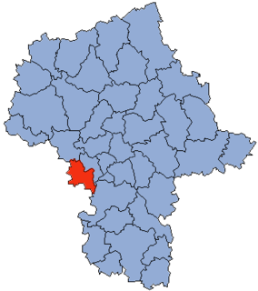
Kulany-Kolonia is a village in the administrative district of Gmina Wieczfnia Kościelna, within Mława County, Masovian Voivodeship, in east-central Poland.
Ostrówiec is a village in the administrative district of Gmina Karczew, within Otwock County, Masovian Voivodeship, in east-central Poland. It lies approximately 6 kilometres (4 mi) south of Karczew, 9 km (6 mi) south of Otwock, and 28 km (17 mi) south-east of Warsaw.
Zalesie is a village in the administrative district of Gmina Pionki, within Radom County, Masovian Voivodeship, in east-central Poland.
Kobylany-Skorupki is a village in the administrative district of Gmina Repki, within Sokołów County, Masovian Voivodeship, in east-central Poland.
Nowa Wieś is a village in the administrative district of Gmina Długosiodło, within Wyszków County, Masovian Voivodeship, in east-central Poland. It lies approximately 8 kilometres (5 mi) west of Długosiodło, 20 km (12 mi) north of Wyszków, and 70 km (43 mi) north-east of Warsaw.
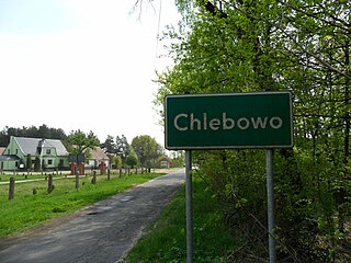
Chlebowo is a village in the administrative district of Gmina Gubin, within Krosno Odrzańskie County, Lubusz Voivodeship, in western Poland, close to the German border.
Kostkowo is a village in the administrative district of Gmina Gniewino, within Wejherowo County, Pomeranian Voivodeship, in northern Poland. It lies approximately 6 kilometres (4 mi) south of Gniewino, 16 km (10 mi) north-west of Wejherowo, and 52 km (32 mi) north-west of the regional capital Gdańsk.
Jadamowo is a village in the administrative district of Gmina Olsztynek, within Olsztyn County, Warmian-Masurian Voivodeship, in northern Poland.
Powalice is a village in the administrative district of Gmina Ińsko, within Stargard County, West Pomeranian Voivodeship, in north-western Poland. It lies approximately 6 kilometres (4 mi) west of Ińsko, 32 km (20 mi) east of Stargard, and 59 km (37 mi) east of the regional capital Szczecin.

The Crna Reka Monastery is a 13th-century Serbian Orthodox monastery located in Ribariće, in southwestern Serbia. The monastery is situated at the gorges of Ibarski Kolašin, on the Crna Reka, and includes the cave-church dedicated to Archangel Michael with 16th-century frescoes and relics of Saint Peter of Koriša. In the 16th century, Ottoman attacks forced the monks of Sopoćani to flee to the secluded Crna Reka Monastery.
Koshino is a village in Municipality of Dolneni, central Republic of Macedonia.