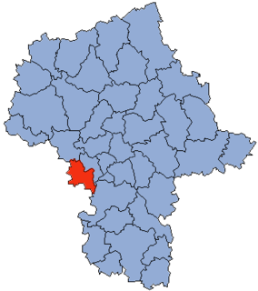
Little Grand Rapids is a community in east central Manitoba, Canada, near the Ontario border. It is located approximately 280 kilometers or 173 miles north-northeast from Winnipeg, Manitoba.

Teteven Glacier is a glacier on Greenwich Island in the South Shetland Islands, Antarctica situated east of Yakoruda Glacier, west of Quito Glacier, northwest of Traub Glacier and north of Murgash Glacier. It extends 6.5 km in east-west direction and 3.8 km in north-south direction, and drains the north slopes of Dryanovo Heights into the Drake Passage in Haskovo Cove and Skaptopara Cove between Miletich Point and the ice-free area at Agüedo Point.
Kituryki is a village in the administrative district of Gmina Michałowo, within Białystok County, Podlaskie Voivodeship, in north-eastern Poland, close to the border with Belarus.
Szyjki is a village in the administrative district of Gmina Radziłów, within Grajewo County, Podlaskie Voivodeship, in north-eastern Poland.
Białobłockie is a village in the administrative district of Gmina Kuźnica, within Sokółka County, Podlaskie Voivodeship, in north-eastern Poland, close to the border with Belarus.

Tolów is a village in the administrative district of Gmina Świnice Warckie, within Łęczyca County, Łódź Voivodeship, in central Poland. It lies approximately 4 kilometres (2 mi) south-west of Świnice Warckie, 22 km (14 mi) west of Łęczyca, and 47 km (29 mi) north-west of the regional capital Łódź.

Zofiów is a village in the administrative district of Gmina Biała Rawska, within Rawa County, Łódź Voivodeship, in central Poland. It lies approximately 4 kilometres (2 mi) south-west of Biała Rawska, 15 km (9 mi) east of Rawa Mazowiecka, and 69 km (43 mi) east of the regional capital Łódź.

Białynin-Południe is a village in the administrative district of Gmina Głuchów, within Skierniewice County, Łódź Voivodeship, in central Poland. It lies approximately 5 kilometres (3 mi) north-west of Głuchów, 20 km (12 mi) south-west of Skierniewice, and 38 km (24 mi) east of the regional capital Łódź.

Kawęczyn is a village in the administrative district of Gmina Godzianów, within Skierniewice County, Łódź Voivodeship, in central Poland. It lies approximately 2 kilometres (1 mi) west of Godzianów, 11 km (7 mi) south-west of Skierniewice, and 40 km (25 mi) east of the regional capital Łódź.

Kostki Małe is a village in the administrative district of Gmina Busko-Zdrój, within Busko County, Świętokrzyskie Voivodeship, in south-central Poland. It lies approximately 7 kilometres (4 mi) west of Busko-Zdrój and 47 km (29 mi) south of the regional capital Kielce.

Oleszki is a village in the administrative district of Gmina Busko-Zdrój, within Busko County, Świętokrzyskie Voivodeship, in south-central Poland. It lies approximately 5 kilometres (3 mi) west of Busko-Zdrój and 47 km (29 mi) south of the regional capital Kielce.
Humięcino-Klary is a village in the administrative district of Gmina Grudusk, within Ciechanów County, Masovian Voivodeship, in east-central Poland.
Narty is a village in the administrative district of Gmina Iłów, within Sochaczew County, Masovian Voivodeship, in east-central Poland.

Dzierżanów is a village in the administrative district of Gmina Jadów, within Wołomin County, Masovian Voivodeship, in east-central Poland.
Dębówiec is a village in the administrative district of Gmina Wilczyn, within Konin County, Greater Poland Voivodeship, in west-central Poland.
Bagna is a settlement in the administrative district of Gmina Czersk, within Chojnice County, Pomeranian Voivodeship, in northern Poland.
Ustronie is a settlement in the administrative district of Gmina Czersk, within Chojnice County, Pomeranian Voivodeship, in northern Poland.

Płęsy is a village in the administrative district of Gmina Dziemiany, within Kościerzyna County, Pomeranian Voivodeship, in northern Poland. It lies approximately 9 kilometres (6 mi) east of Dziemiany, 14 km (9 mi) south-west of Kościerzyna, and 63 km (39 mi) south-west of the regional capital Gdańsk.

Blucher is an unincorporated community in Saskatchewan.

Kamienica Łyszkiewicza w Warszawie is a museum, established 1967, in Warsaw New Town, Poland.


