Biestrzyków Wielki is a village in the administrative district of Gmina Kobiele Wielkie, within Radomsko County, Łódź Voivodeship, in central Poland. It lies approximately 7 kilometres (4 mi) north-east of Kobiele Wielkie, 17 km (11 mi) east of Radomsko, and 80 km (50 mi) south of the regional capital Łódź.
Dmenin is a village in the administrative district of Gmina Kodrąb, within Radomsko County, Łódź Voivodeship, in central Poland. It lies approximately 9 km (5.6 mi) east of Radomsko and 80 km (50 mi) south of the regional capital Łódź.
Feliksów is a village in the administrative district of Gmina Kodrąb, within Radomsko County, Łódź Voivodeship, in central Poland. It lies approximately 4 kilometres (2 mi) south-east of Kodrąb, 15 km (9 mi) east of Radomsko, and 80 km (50 mi) south of the regional capital Łódź.
Konradów is a village in the administrative district of Gmina Kodrąb, within Radomsko County, Łódź Voivodeship, in central Poland. It lies approximately 7 kilometres (4 mi) west of Kodrąb, 7 km (4 mi) north-east of Radomsko, and 77 km (48 mi) south of the regional capital Łódź.
Łagiewniki is a village in the administrative district of Gmina Kodrąb, within Radomsko County, Łódź Voivodeship, in central Poland. It lies approximately 9 kilometres (6 mi) east of Radomsko and 78 km (48 mi) south of the regional capital Łódź.
Rzejowice is a village in the administrative district of Gmina Kodrąb, within Radomsko County, Łódź Voivodeship, in central Poland. It lies approximately 18 kilometres (11 mi) east of Radomsko and 78 km (48 mi) south of the regional capital Łódź.
Smotryszów is a village in the administrative district of Gmina Kodrąb, within Radomsko County, Łódź Voivodeship, in central Poland. It lies approximately 11 kilometres (7 mi) east of Radomsko and 81 km (50 mi) south of the regional capital Łódź.
Teodorów Duży is a village in the administrative district of Gmina Kodrąb, within Radomsko County, Łódź Voivodeship, in central Poland. It lies approximately 11 kilometres (7 mi) east of Radomsko and 81 km (50 mi) south of the regional capital Łódź.
Teodorów Mały is a village in the administrative district of Gmina Kodrąb, within Radomsko County, Łódź Voivodeship, in central Poland. It lies approximately 12 kilometres (7 mi) east of Radomsko and 80 km (50 mi) south of the regional capital Łódź.
Wola Malowana is a village in the administrative district of Gmina Kodrąb, within Radomsko County, Łódź Voivodeship, in central Poland. It lies approximately 13 kilometres (8 mi) east of Radomsko and 81 km (50 mi) south of the regional capital Łódź.
Żencin is a village in the administrative district of Gmina Kodrąb, within Radomsko County, Łódź Voivodeship, in central Poland. It lies approximately 6 kilometres (4 mi) north-east of Kodrąb, 18 km (11 mi) north-east of Radomsko, and 72 km (45 mi) south of the regional capital Łódź.
Jaskółki is a village in the administrative district of Gmina Masłowice, within Radomsko County, Łódź Voivodeship, in central Poland. It lies approximately 27 kilometres (17 mi) east of Radomsko and 81 km (50 mi) south of the regional capital Łódź.
Wola Przedborska is a village in the administrative district of Gmina Przedbórz, within Radomsko County, Łódź Voivodeship, in central Poland. It lies approximately 2 kilometres (1 mi) north of Przedbórz, 31 km (19 mi) east of Radomsko, and 82 km (51 mi) south of the regional capital Łódź.
Zuzowy is a village in the administrative district of Gmina Przedbórz, within Radomsko County, Łódź Voivodeship, in central Poland. It lies approximately 9 kilometres (6 mi) north-east of Przedbórz, 37 km (23 mi) east of Radomsko, and 81 km (50 mi) south-east of the regional capital Łódź.
Dziepółć is a village in the administrative district of Gmina Radomsko, within Radomsko County, Łódź Voivodeship, in central Poland. It lies approximately 6 kilometres (4 mi) east of Radomsko and 81 km (50 mi) south of the regional capital Łódź.
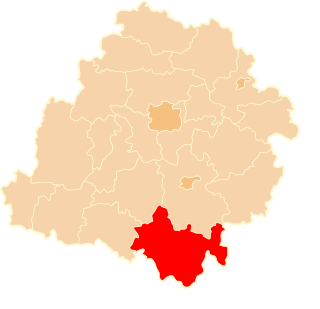
Grzebień is a village in the administrative district of Gmina Radomsko, within Radomsko County, Łódź Voivodeship, in central Poland. It lies approximately 6 kilometres (4 mi) south-east of Radomsko and 84 km (52 mi) south of the regional capital Łódź.
Okrajszów is a village in the administrative district of Gmina Radomsko, within Radomsko County, Łódź Voivodeship, in central Poland. It lies approximately 5 kilometres (3 mi) north-east of Radomsko and 76 km (47 mi) south of the regional capital Łódź.
Strzałków is a village in the administrative district of Gmina Radomsko, within Radomsko County, Łódź Voivodeship, in central Poland. It lies approximately 4 kilometres (2 mi) south-east of Radomsko and 82 km (51 mi) south of the regional capital Łódź.
Krzętów is a village in the administrative district of Gmina Wielgomłyny, within Radomsko County, Łódź Voivodeship, in central Poland. It lies approximately 6 kilometres (4 mi) south-east of Wielgomłyny, 29 km (18 mi) east of Radomsko, and 93 km (58 mi) south of the regional capital Łódź.
Sudzinek is a village in the administrative district of Gmina Żytno, within Radomsko County, Łódź Voivodeship, in central Poland. It lies approximately 15 kilometres (9 mi) east of Żytno, 31 km (19 mi) south-east of Radomsko, and 98 km (61 mi) south of the regional capital Łódź.