Kostrzyca, Pomeranian Voivodeship

Last updated
Kostrzyca
Settlement
Country Flag of Poland.svg Poland
Voivodeship Pomeranian
County Człuchów
Gmina Debrzno
Population 9

Kostrzyca [kɔsˈtʂɨt͡sa] is a settlement in the administrative district of Gmina Debrzno, within Człuchów County, Pomeranian Voivodeship, in northern Poland. [1]

Human settlement Community of any size, in which people live

In geography, statistics and archaeology, a settlement, locality or populated place is a community in which people live. The complexity of a settlement can range from a small number of dwellings grouped together to the largest of cities with surrounding urbanized areas. Settlements may include hamlets, villages, towns and cities. A settlement may have known historical properties such as the date or era in which it was first settled, or first settled by particular people.

Gmina Debrzno is an urban-rural gmina in Człuchów County, Pomeranian Voivodeship, in northern Poland. Its seat is the town of Debrzno, which lies approximately 16 kilometres (10 mi) south-west of Człuchów and 131 km (81 mi) south-west of the regional capital Gdańsk.

Człuchów County County in Pomeranian, Poland

Człuchów County is a unit of territorial administration and local government (powiat) in Pomeranian Voivodeship, northern Poland. It came into being on January 1, 1999, as a result of the Polish local government reforms passed in 1998. Its administrative seat and largest town is Człuchów, which lies 115 kilometres (71 mi) south-west of the regional capital Gdańsk. The county also contains the towns of Czarne, lying 28 km (17 mi) west of Człuchów, and Debrzno, 16 km (10 mi) south-west of Człuchów.

For details of the history of the region, see History of Pomerania .

History of Pomerania aspect of history

The history of Pomerania starts shortly before 1000 AD with ongoing conquests by newly arrived Polans rulers. Before that the area was recorded nearly 2000 years ago as Germania, and in modern-day times Pomerania is split between Germany and Poland. The name Pomerania comes from the Slavic po more, which means Land at the Sea.

The settlement has a population of 9.

Related Research Articles

Stade Auguste-Delaune football stadium

The Stade Auguste-Delaune is a multi-use stadium in Reims, France. It is used mostly for football matches and hosts the home matches of Stade Reims.

Kulturfinger

The Kulturfinger is the nickname of a steel-framed tower built during the days of the communist German Democratic Republic that is the tallest building in Neubrandenburg, Germany. It is part of the Haus der Kultur und Bildung or HKB, the city's cultural institution.

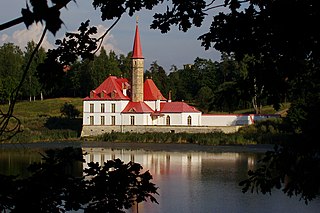
Priory Palace Palace in Gatchina, Leningrad Oblast, Russia.

Priory Palace is an original palace in Gatchina (Гатчина), Russia. It was built in 1799 by the architect N. A. Lvov on the shore of the Black Lake(Chyornoye ozero / Чёрное озеро). Constructed for the Russian Grand Priory of the Order of St John, it was presented to the Order by a decree of Paul I of Russia dated August 23, 1799.

Gruszów, Lower Silesian Voivodeship Village in Lower Silesian, Poland

Gruszów is a village in the administrative district of Gmina Marcinowice, within Świdnica County, Lower Silesian Voivodeship, in south-western Poland.

Sefiane Place in Batna, Algeria

Sefiane is a town in north-eastern Algeria.

Novo Celje Mansion

Novo Celje is a late Baroque mansion in the settlement of Novo Celje in the Municipality of Žalec west of Celje in the Styria region of Slovenia.

Popielarnia is a settlement in the administrative district of Gmina Potok Wielki, within Janów Lubelski County, Lublin Voivodeship, in eastern Poland.

Pomysk Wielki Village in Pomeranian, Poland

Pomysk Wielki is a village in the administrative district of Gmina Bytów, within Bytów County, Pomeranian Voivodeship, in northern Poland. It lies approximately 10 kilometres (6 mi) north-east of Bytów and 73 km (45 mi) west of the regional capital Gdańsk.

İkinci Mahmudlu Place in Fizuli, Azerbaijan

İkinci Mahmudlu is a village in the Fizuli Rayon of Azerbaijan. The village forms part of the municipality of Əhmədbəyli.

Zarat, Shamakhi Place in Shamakhi, Azerbaijan

Zarat is a village in the Shamakhi Rayon of Azerbaijan.

Jodłowno Village in Pomeranian, Poland

Jodłowno is a village in the administrative district of Gmina Przywidz, within Gdańsk County, Pomeranian Voivodeship, in northern Poland. It lies approximately 7 kilometres (4 mi) north-east of Przywidz, 17 km (11 mi) west of Pruszcz Gdański, and 21 km (13 mi) south-west of the regional capital Gdańsk.

Ząbrsko Górne Village in Pomeranian, Poland

Ząbrsko Górne is a village in the administrative district of Gmina Przywidz, within Gdańsk County, Pomeranian Voivodeship, in northern Poland. It lies approximately 6 kilometres (4 mi) north of Przywidz, 19 km (12 mi) west of Pruszcz Gdański, and 24 km (15 mi) south-west of the regional capital Gdańsk.

Siejkowo Settlement in Warmian-Masurian, Poland

Siejkowo is a settlement in the administrative district of Gmina Ryn, within Giżycko County, Warmian-Masurian Voivodeship, in northern Poland. It lies approximately 4 kilometres (2 mi) south of Ryn, 20 km (12 mi) south-west of Giżycko, and 71 km (44 mi) east of the regional capital Olsztyn.

Kania Mała Village in West Pomeranian, Poland

Kania Mała is a village in the administrative district of Gmina Chociwel, within Stargard County, West Pomeranian Voivodeship, in north-western Poland. It lies approximately 9 kilometres (6 mi) north-west of Chociwel, 26 km (16 mi) north-east of Stargard, and 46 km (29 mi) east of the regional capital Szczecin.

Yuman, California Former settlement in California, United States

Yuman is a former Maidu settlement in Butte County, California. It lay at an elevation of 171 feet. Its location is currently within the city limits of Oroville.

Midway, Alameda County, California Unincorporated community in California, United States

Midway is an unincorporated community in Alameda County, California, 6 miles (9.7 km) south-southeast of Altamont. It lies at an elevation of 358 feet. A post office operated in Midway from 1870 to 1918.

New Dover, Ohio Unincorporated community in Ohio, United States

New Dover is an unincorporated community in Dover Township, Union County, Ohio, United States. It is located at 40°14′48″N83°18′17″W, along U.S. Route 36, about three miles east of Marysville.

Čardaci Village in Federation of Bosnia and Herzegovina, Bosnia and Herzegovina

Čardaci is a village in the municipality of Bugojno, Bosnia and Herzegovina.

Schilleroper was a theatre in Hamburg, Germany.

Cherokee is an unincorporated community in Cherokee County, Kansas, in the United States. Cokedale is located at 37°14′48″N94°53′34″W.

References


Coordinates: 53°33′29″N17°14′48″E / 53.55806°N 17.24667°E / 53.55806; 17.24667

Geographic coordinate system Coordinate system

A geographic coordinate system is a coordinate system that enables every location on Earth to be specified by a set of numbers, letters or symbols. The coordinates are often chosen such that one of the numbers represents a vertical position and two or three of the numbers represent a horizontal position; alternatively, a geographic position may be expressed in a combined three-dimensional Cartesian vector. A common choice of coordinates is latitude, longitude and elevation. To specify a location on a plane requires a map projection.