The Spree is a river in Germany and the Czech Republic. With a length of approximately 400 kilometres (250 mi), it is the main tributary of the Havel River. The Spree is much longer than the Havel, which it flows into at Berlin-Spandau; the Havel then flows into the Elbe at Havelberg. The river rises in the Lusatian Highlands, in the Lusatian part of Saxony, where it has three sources: the historical one called Spreeborn in the village of Spreedorf, the water-richest one in Neugersdorf, and the highest elevated one in Eibau. The Spree then flows northwards through Upper and Lower Lusatia, where it crosses the border between Saxony and Brandenburg. After passing through Cottbus, it forms the Spree Forest, a large inland delta and biosphere reserve. It then flows through Lake Schwielochsee before entering Berlin, as Müggelspree(pronounced[ˈmʏɡl̩ˌʃpʁeː] ).

Lusatia is a historical region in Central Europe, territorially split between Germany and modern-day Poland. Lusatia stretches from the Bóbr and Kwisa rivers in the east to the Pulsnitz and Black Elster rivers in the west, and is located within the German states of Saxony and Brandenburg as well as in the Polish voivodeships of Lower Silesia and Lubusz. Major rivers of Lusatia are the Spree and the Lusatian Neisse, which defines the border between Germany and Poland. The Lusatian Mountains of the Western Sudetes separate Lusatia from Bohemia in the south. Lusatia is traditionally divided into Upper Lusatia, the hilly southern part, and Lower Lusatia, the flat northern part.

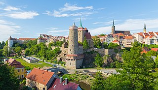
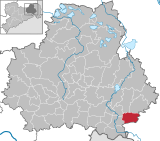
Bautzen or Budyšin, until 1868 Budissin in German, is a town in eastern Saxony, Germany, and the administrative centre of the district of Bautzen. It is located on the Spree river, is the eighth most populous town in Saxony, and is the seat of Saxony's largest district. Bautzen lies in the bilingual Sorbian settlement area of Lusatia, and is Lusatia's third-largest town after Cottbus and Görlitz, as well as the second-largest town in Upper Lusatia.

Herrnhut is a town of around 6,000 inhabitants in Upper Lusatia, in the district of Görlitz, in eastern Saxony, Germany. The town is mainly known as the place of origin of the community of the Moravian Church, and of the Moravian Stars.

Wehrsdorf (German) or Wernarjecy is a small village in a valley of the Lusatian Highlands in the region of Upper Lusatia (Oberlausitz) in Saxony, Germany. It has about 1,776 inhabitants and belongs to an administrative community of three different villages, with Sohland an der Spree and Taubenheim. This community is offícially called Sohland after the largest of these villages. Altogether, the community has about 7,700 inhabitants. The village is near the border to the Czech Republic.

Lower Lusatia is a historical region in Central Europe, stretching from the southeast of the German state of Brandenburg to the southwest of Lubusz Voivodeship in Poland. Like adjacent Upper Lusatia in the south, Lower Lusatia is a settlement area of the West Slavic Sorbs whose endangered Lower Sorbian language is related to Upper Sorbian and Polish.

Upper Lusatia is a historical region in Germany and Poland. Along with Lower Lusatia to the north, it makes up the region of Lusatia, named after the Slavic Lusici tribe. Both parts of Lusatia are home to the West Slavic minority group of the Sorbs.

Krásná Lípa is a town in Děčín District in the Ústí nad Labem Region of the Czech Republic. It has about 3,400 inhabitants.

The Lusatian Highlands or Lusatian Hills form a hilly region in Germany and the Czech Republic. A western extension of the Sudetes range, it is located on the border of the German state of Saxony with the Czech Bohemian region. It is one of the eight natural landscapes of Upper Lusatia.
The Lusatian Alliance, formerly the Wendish People's Party is a political party founded on 26 March 2005 in Cottbus to represent the Sorb/Wendish ethnic and linguistic minority in the German states of Saxony and Brandenburg in the region of Lusatia. At its third party congress of 26 April 2010 in Cottbus, the party changed its name to the Lusatian Alliance. The party is a full member of the European Free Alliance.

Cunewalde or Kumwałd is a municipality in the district of Bautzen in the east of the federal Free State of Saxony in Germany. It lies between the cities of Bautzen and Löbau in a valley between the hills of the Czorneboh, the Hochstein and the Bieleboh, all part of the northernmost mountain ranges of the Lusatian Highlands. It is one of the more populous villages in Upper Lusatia and the longest street village in all of Germany.

Großpostwitz (German) or Budestecy is a municipality in the east of Saxony, Germany. It belongs to Bautzen district and lies south of the town of Bautzen.

Guttau (German) or Hućina is a village in the east of Saxony, Germany. It is part of the municipality of Malschwitz in the district of Bautzen, and lies northeast of the town of Bautzen/Budyšin. The village is part of the bilingual Sorbian settlement area.

Malschwitz (German) or Malešecy is a municipality in the east of Saxony, Germany. It belongs to the district of Bautzen and lies 6 km northeast of the eponymous city.

Krauschwitz is a municipality in the Görlitz district of Saxony, Germany at the border with Poland. It is situated on the western banks of the Lusatian Neisse river, south of Bad Muskau. The municipality was established on 1 January 1994 by the merger of the villages Klein Priebus, Krauschwitz, Pechern, Podrosche, Sagar, Skerbersdorf, and Werdeck.
Görlitz district is a district (Kreis) in Saxony, and the easternmost in Germany. It is named after its capital Görlitz. It borders the district of Bautzen, the state of Brandenburg, Poland and the Czech Republic.

The Oder is a river in Central Europe. It is Poland's second-longest river and third-longest within its borders after the Vistula and its largest tributary the Warta. The Oder rises in the Czech Republic and flows 742 kilometres (461 mi) through western Poland, later forming 187 kilometres (116 mi) of the border between Poland and Germany as part of the Oder–Neisse line. The river ultimately flows into the Szczecin Lagoon north of Szczecin and then into three branches that empty into the Bay of Pomerania of the Baltic Sea.

Bieleboh is a mountain in the Lusatian Highlands, in the east of Saxony, Germany. Its summit is located on the grounds of Beiersdorf municipality.

Cunnersdorfer Wasser is a river of Saxony, Germany. Its source is at the foot of the Kottmar mountain. It is a right tributary of the Löbauer Wasser, which it joins near Löbau. It flows through Obercunnersdorf and Niedercunnersdorf.


