This article has multiple issues. Please help improve it or discuss these issues on the talk page . (Learn how and when to remove these messages)
|
| Kousika River |
|---|

Kousika River is a river that runs 52 km in the State of Tamil Nadu in India. [1]
This article has multiple issues. Please help improve it or discuss these issues on the talk page . (Learn how and when to remove these messages)
|
| Kousika River |
|---|
Kousika River is a river that runs 52 km in the State of Tamil Nadu in India. [1]
The Kousika River starts at Kurudi Hill, in Coimbatore. Mel Mudi (5,385 feet), Nadukandaan Poli (5600 feet), and Lambton's Peak (5080 feet) are the three mountain peaks of Guru Rishi Hill .
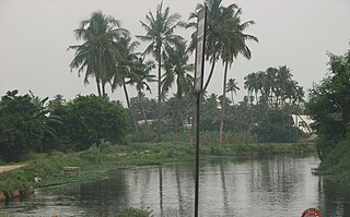
The Kousika River is 52 km in length. The Bhavani River (approx. 20 km) and the Noyyal River run north and south side of Kousika River in Coimbatore.
Kousika Lake is situated near Kulathupalayam in Coimbatore and Sengalaipalyam in Tirupur district. The village started to rejuvenate this lake in 2018 with the help of the Government of India via groundwater recharge. Nearly 20 villages, 500 acres of agricultural land and approximately 50,000 people benefit from this lake.
Sarkarsamakkulam Lake is situated near Kovilpalayam and Kurumbapalayam in Coimbatore. This lake covers nearly 150 acres. It is linked with the Kousika River and Kovilpalayam, known as "Sarkar Samakkulam" and "Kousika Puri."
Agrakarasamakulam Lake is situated near Idikarai, Vaiyampalayam. its outlet flows into the Kousika.
Aachan kulam situated near Neelambur is the largest lake ( more than 250 acres) which presently lies disconnected from Kausika river is the most prominent one.
This small storage between Idikarai and Periyanaickenpalayam (approx 20 acres) has been draining into Kausika river and also been a source of rich soil for local farmers.


The Kousika River starts from Kurudi Hill in Coimbatore It starts at Thekkupalayam, Narasimmanaikkanpalayam. It flows through NGGO colony, Sengalipalayam on one side and Poochiyur, Narashimhanaickenpalayam, Puduppalayam on 2nd side, straight from CRPF touching thekkupalayam all joining near Idikarai village, then through Athippalaiyam, Vayyampalayam, Kotaipalayam, Keeranam, Agragara Saamarkulam, Kurumbapalayam, Kovilpalayam, Thevenpalayam, Pethanaikanpalayam, Kallipalayam, Pachapalayam, Vadukapalayam, Saalaiyur, Sundamedu, Karichipalayam, Vagarayampalaym, Pappampatti, Kittampalayam, Kolathupalayam, and Thekkalur of Coimbatore District, Thimaniyampalayam, Puthunallur, Eripalayam, Moonukattipalayam, Puthupalayam, Kothapalayam, Smanthankottai, Govindapuram, Vanjipalayam, and finally joins in the Noyyal River at Kaniyampundi Village, Tiruppur.

The Thalamadal stream and the Thannasi stream of Kurudampalayam, Perumpallam passing through Ramakrishna Vidyalaya (in south border) in Coimbatore all join Kousika.
Arunagirinathar talked about "Kousika River" in his work Thiruppugazh (Tamil திருப்புகழ் tiruppukazh "Holy Praise" or "Divine Glory"), [2]
William Lambton surveyed InDIA to determine the shape of the Earth. To honor him, one peak was named Lambton's Peak. T
The name "Kousika" is derived from two sources. The first is that a sage called "Kousika Munivar" lived on the river's shore. The second is that king Kavanagan, who later became Kousikan, ruled this area. Kousika River is also called Vannathan Karai or Perumpallam.
Changes in the waterways and low rainfall affected the flow of the Kousika River. Along the river banks, groundwater sank 2 feet, affecting some 10 million people.
The panchayats of the affected towns agreed to reclaim Kousika River and include it in the Athikkadavu-Avinashi Groundwater Enrichment Scheme.
The Athikadavu Kousika River Development Association and Secretary P.K. Selvaraj is reclaiming the river via the Athikkadavu-Avinashi Groundwater Enrichment Scheme. [3] [4]

Coimbatore, sometimes shortened as Kovai, is one of the major metropolitan cities in the Indian state of Tamil Nadu. It is located on the banks of the Noyyal River and surrounded by the Western Ghats. Coimbatore is the second largest city in Tamil Nadu after Chennai in terms of population and the 16th largest urban agglomeration in India as per the census 2011. It is the administrative capital of Coimbatore District and is administered by the Coimbatore Municipal Corporation which was established in 1981.

The Noyyal River is a small river in Western Tamil Nadu, and a tributary of Kaveri River. It rises from the Vellingiri hills in the Western Ghats in Tamil Nadu, very closer in proximity to Kerala border, and flows through many villages and the cities of Coimbatore, and Tirupur. Then finally, the river drains into the Kaveri River at Noyyal, a village in Karur district named after the river itself. The river's basin is 180 km (110 mi) long and 25 km (16 mi) wide and covers a total area of 3,500 km2 (1,400 sq mi). Cultivated land in the basin amounts to 1,800 km2 (690 sq mi) while the population density is 120 people per km2 (311/mi2) in the countryside, and 1000 people per km2 (2590/mi2) in the cities. The area is known for its scanty rainfall and the development of the Noyyal River Tanks System to hold any overflow from the rains plus the water of the Northeast and Southwest monsoon season was ecologically important. Kausika river, which originates along the northern side of Coimbatore district in the Western Ghats along with its consequent streams, lake and pond systems is an important tributary of the river. The 173 km (107 mi) long tributary of the Kaveri River filled 32 tanks. These interconnecting tanks held the water flowing from the Noyyal.

TIDEL Park is an information technology (IT) park situated in the city of Chennai, India. The name TIDEL is a portmanteau of TIDCO and ELCOT. An ISO 9001/14001 company, In 2000, it was one of the largest IT parks in India. It was set up in 2000 to foster the growth of information technology in the state of Tamil Nadu by the TIDEL Park Ltd, a joint venture of TIDCO and ELCOT.

Coimbatore district is one of the 38 districts in the state of Tamil Nadu in India. Coimbatore is the administrative headquarters of the district. It is one of the most industrialized districts and a major textile, industrial, commercial, educational, information technology, healthcare and manufacturing hub of Tamil Nadu. The region is bounded by Tiruppur district in the east, Nilgiris district in the north, Erode district in the northeast, Palakkad district, Idukki district and small parts of Thrissur district and Ernakulam district of neighboring state of Kerala in the west and south respectively. As of 2011, Coimbatore district had a population of 3,458,045 with a sex ratio of 1,000 and literacy rate of 84%.

Perur is a major residential neighbourhood and cultural hub of the city of Coimbatore in Tamil Nadu, India. It is located on the banks of Noyyal River, which divides the settlement into equal halves.

Vellalore is a panchayat town in Coimbatore district in the Indian state of Tamil Nadu. It is a southern suburb of the city. It is at 12 km east of Townhall, the centre of the city Coimbatore. It is situated on the southern bank of Noyyal river.
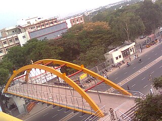
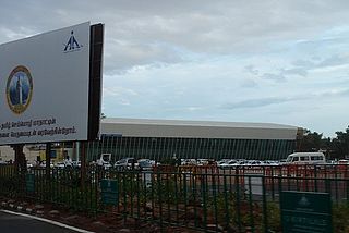
Peelamedu is a major commercial centre and residential locality in the Eastern part of the city of Coimbatore in Tamil Nadu, India. It is governed by Coimbatore City Municipal Corporation since 1981. The growth of Peelamedu during the last decade can be cited due to the growth of the IT sector in Coimbatore. The rapid growth of Peelamedu as a commercial and residential hub could be attributed to its geographical advantage in terms of the connectivity to other parts of the city. It acts as an important hub connecting the rapidly growing business class Information Technology corridor. The Peelamedu area stretches from Nava India to the Coimbatore International Airport near SITRA, encompassing major educational institutions, hospitals, and Industries.
Siruthuli is an NGO based in Coimbatore, India which works to rejuvenate the water sources in the city of Coimbatore. Siruthuli means a small drop in Tamil.

Tiruppur District is one of the 38 districts of the Indian state of Tamil Nadu, formed in 22 February 2009. Dharapuram was the largest taluk by area in the district. The district is well-developed and industrialized. The Tiruppur banian industry, the cotton market, Kangeyam bull and Uthukkuli butter, among other things, provide for a vibrant economy. The city of Tiruppur is the administrative headquarters for the district. As of 2011, the district had a population of 2,479,052 with a sex-ratio of 989 females for every 1,000 males.
Kalingarayan Canal is a 56.2-mile (90.5 km) long irrigation canal in the Erode district, Tamil Nadu, India. It was constructed by Kongu chieftain Kalingarayan. The canal's source is the Kalingarayan Anicut near Bhavani. The canal irrigates approximately 15,743 acres (6,371 ha) of agricultural land. The project including construction of the dam and canal started in 1271 and was completed in 1283.
Coimbatore is a city in the state of Tamil Nadu, India. Most transportation in the city and suburbs is by road. Coimbatore is well-connected to most cities and towns in India by road, rail, and air, but not through waterways. The city has successful transport infrastructure compared to other Indian cities, though road infrastructures are not well maintained and developed according to the growing needs of transport, making traffic congestion a major problem in the city. A comprehensive transport development plan has been made to address many traffic problems.

Coimbatore is the second largest city in the Indian state of Tamil Nadu. It is situated in the western corner of Tamil Nadu, a short distance from the border with the neighbouring state of Kerala, and is surrounded by the Western Ghats on all sides.
The Aathupalayam Dam is situated in Karvazhi Village near Thennilai of K. Paramathi Taluk in Karur District. The parched aycut area has not been receiving supplies as the Aathupalayam reservoir had become a storage tank for Orathuppalayam polluted water flowing down the River Noyyal over the past few years.
The Environmentalist Foundation of India (E.F.I) is an environmental conservation group based out of Chennai, Hyderabad, Puducherry, Bangalore, Trivandrum, Mumbai, Delhi, Kolkata and Coimbatore which focuses on wildlife conservation and habitat restoration. Started in 2007 and registered in 2011, the organisation is known for its work in cleaning and scientific restoration of lakes in India for biodiversity. The organisation and its efforts grew from one pond in Chennai to include over 167 water bodies in Andhra Pradesh, Chhattisgarh, Delhi, Gujarat, Jammu & Kashmir, Karnataka, Kerala, Madhya Pradesh, Maharashtra, Odisha, Puducherry, Rajasthan, Tamil Nadu, Telangana, Uttar Pradesh and West Bengal in the last 14 years.
The South India Textile Research Association, often known by acronym SITRA, is a textile research association established in 1956 at Coimbatore, India. SITRA is an Industry sponsored research institute supported by the Ministry of Textiles, Government of India. It is considered to be one of the best equipped textile research organisations in the world and its members apart from India include Indonesia, Iran, Nigeria, Thailand, Sri Lanka, Nepal and Bangladesh.

Mookaneri Lake, also called Kannankurichi Lake, is a lake in Kannankurichi, in the Salem Taluk of the Indian state of Tamil Nadu, that covers an area of 23.5 hectares. It is located to the south of the Shevaroy Hills and is a major body of water in Salem. The lake is fed by rainfall, including the hills surrounding Yercaud, which flow into the lake via the Puthu Yeri and Kothukaran Odai streams.
Singanallur is a major residential locality of the city of Coimbatore in Tamil Nadu, India. It is located on the banks of Noyyal river, which runs to the southern boundary of the locality. It is situated in the eastern part of the city, and is a major hub for the inter-city bus services towards Southern and Central districts of Tamilnadu from the city. It is one of the well developed neighborhoods in the city and has been part of Coimbatore Corporation since 1981. The East Zone Office of Coimbatore City Municipal Corporation is located at Singanallur.
The Avinashi Road Elevated Flyover is a 10.10-kilometre-long (6.28 mi), four-lane, flyover under construction in the city of Coimbatore, Tamil Nadu, India. The corridor begins near the Uppilipalayam Flyover and ends near the Goldwins junction over the Avinashi Road, the most important arterial road in the city, bypassing over 12 traffic intersections. Upon completion, this would be the longest elevated corridor in Tamil Nadu, and the second longest in India after the P. V. Narasimha Rao Expressway.
Selvapuram is a major residential locality of the city of Coimbatore in Tamil Nadu, India. It is located on the banks of Noyyal river, which runs to the northwestern boundary of the locality. It is situated in the northwestern part of the city, and is a major residential and industrial locality in the city. It is one of the well developed neighborhoods in the city and has been part of Coimbatore Corporation since 1866.